Map of Oak Lawn
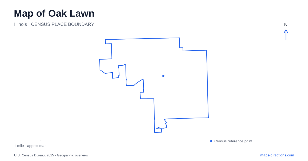
Street tiles load from OpenStreetMap when opened. The blue line shows the 2025 Census boundary.
- State
- Illinois
- Population · July 2025
- 56,450
- Land area
- 8.6 sq mi
- Water area
- 0.0 sq mi
Oak Lawn's central map is especially readable around 95th Street, where rail travel, cultural destinations, and nearby recreation facilities provide recognizable reference points. The commuter station district offers one starting place, while the public library supplies a second through its local history collection. Farther south, Stony Creek adds a green corridor to the street pattern. These places reveal a suburban landscape with several distinct centers of activity, each connected to a named street or a specific part of the transportation network.
A station district with a commemorative role
The Oak Lawn Patriot station name carries a story beyond its transportation function. Metra explains that the village added “Patriot” in 2012 to honor first responders who died following the September 11 attacks. A memorial beside the station incorporates beams from the Twin Towers. This makes the station surroundings a civic place as well as a point of departure, where a routine commute passes a site intended for remembrance.
The station's architectural project also reshaped how this part of 95th Street works. Its designers describe a mixed use development at 51st Avenue that replaced an older station and surface commuter parking. The resulting arrangement brought together the station, an art plaza, passenger drop-off space, and a multistory parking deck. On a map, the several symbols in this small area reflect a coordinated development rather than scattered unrelated facilities.
For a rail arrival, the relevant service is Metra's SouthWest Service, whose route connects Chicago Union Station and Manhattan. This places the village within a regional travel corridor while retaining a local district immediately around the platforms. The station area is therefore a useful base for a focused central visit rather than merely a place to change transportation modes.
Children's learning beside the commuter campus
The Children's Museum in Oak Lawn is at 5100 Museum Drive, close to the station. Its emphasis is on exploration through hands-on play: exhibits invite children to use movement, texture, sound, and imaginative activity. This gives the station district a family destination that has a different rhythm from the commute. A museum visit might occupy much of an outing even when the distance from the train is short.
Its parking instructions help explain the physical arrangement around the building. The museum directs weekday visitors to designated spaces on the roof of the garage and warns that the surface lots immediately outside its entrance do not belong to it. Numbered commuter spaces have separate payment requirements. That detail is useful here because the same compact development accommodates different users, and the most visible parking is not necessarily the museum's parking.
The museum also identifies bus stops on 95th Street, reinforcing that street's role as a local approach to the central district. When planning a family visit, it makes sense to organize the outing around the museum's address and operating day, then fit the train or bus journey around that plan.
Finding the village's documentary landscape
The public library at 9427 South Raymond Avenue offers another way to explore Oak Lawn. Its Local History Room, on the second floor, holds photographs, objects, maps, books, and other records of the community. This is a small museum within the library rather than a separate historic house elsewhere in the village.
For someone interested in how streets and neighborhoods changed, that collection adds depth to the present map. Old photographs can show a building's earlier surroundings, while maps and local records explain names that survive after the landscape around them has changed. The library's holdings include school yearbooks, oral histories, and materials connected to local police and fire departments. Those everyday sources help describe community life beyond the major landmarks visible in a navigation search.
Recreation along the numbered streets
Several park district facilities provide additional geographic reference points. Central Pool is on South Kenton near 95th Street, beside the administration building and ice arena. Centennial Park and its Community Pavilion combine outdoor fields and paths with indoor recreation. These concentrated recreation settings offer a different layout from a small neighborhood playground: multiple activities occupy a single campus or park.
Southward, Stony Creek Golf Course follows natural areas and the creek along 103rd Street. The district's master plan treats a bicycle connection toward Columbus Manor Park as a potential improvement, so it should not be assumed to be an established public route through the golf property. The distinction preserves the actual character of the landscape: a green corridor can contain different managed uses.
Taken together, these locations give Oak Lawn a practical sequence of reference points. The station district explains regional access, Museum Drive focuses a family outing, Raymond Avenue anchors local history, and the recreation sites extend the map beyond the central commercial corridor.
Map and statistics: U.S. Census Bureau, 2025 Gazetteer, January 2025 generalized place boundaries and Vintage 2025 population estimates. Local references: Metra; HKM Architects and Planners; Childrens Museum in Oak Lawn; Oak Lawn Public Library; Illinois Secretary of State; Oak Lawn Park District. Article prepared by Maps & Directions.