Map of North Richland Hills
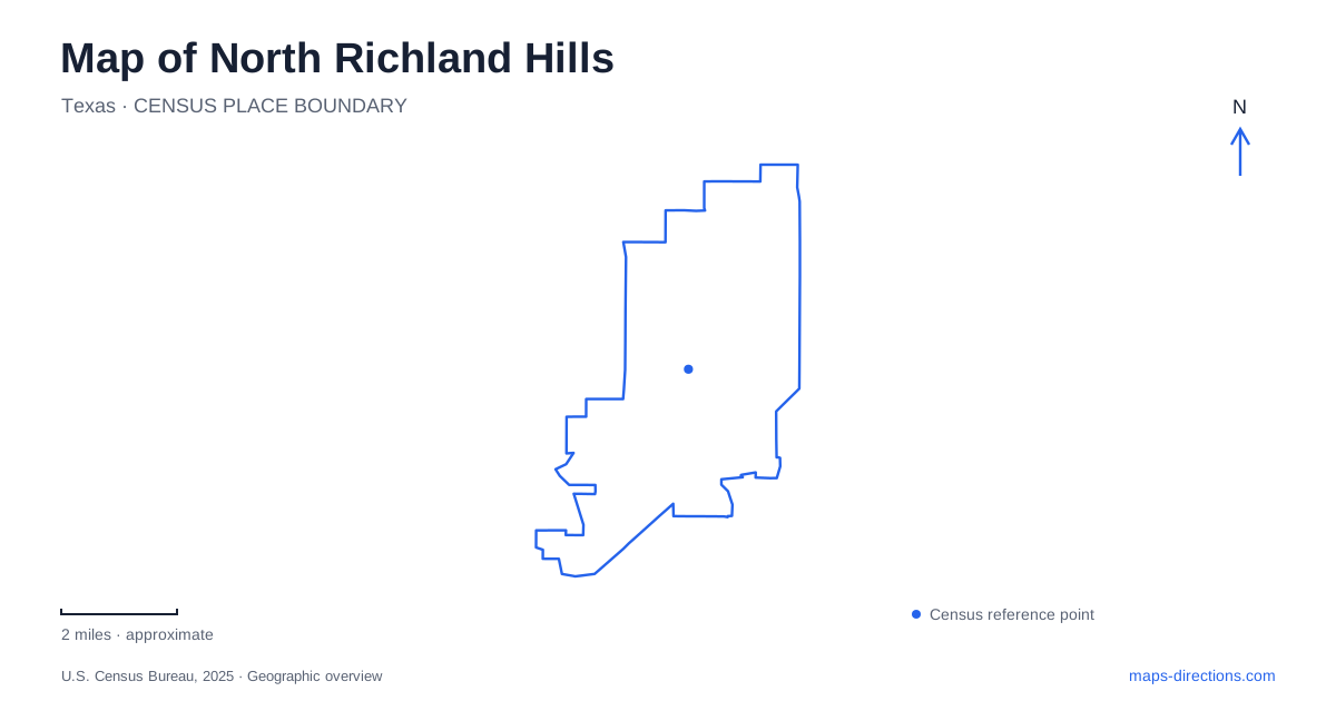
Street tiles load from OpenStreetMap when opened. The blue line shows the 2025 Census boundary.
- State
- Texas
- Population · July 2025
- 70,843
- Land area
- 18.2 sq mi
- Water area
- 0.0 sq mi
North Richland Hills has several overlapping ways to move through the community. TEXRail connects two local stations with Fort Worth and the airport, while the Cotton Belt Trail follows a railroad corridor on a separate paved route. Other trails branch toward neighborhoods and parks. Farther north, a historic plaza recalls a very different form of movement: the drag racing and road racing once associated with Green Valley Raceway. Together, these corridors and landmarks give the city a more specific identity than its position within the larger metropolitan area alone.
Two rail stations with different street approaches
The Iron Horse station is listed at 6351 Iron Horse Boulevard, while Smithfield station is at 6420 Smithfield Road. Both appear on Trinity Metro's TEXRail route between Fort Worth and DFW Airport Terminal B, with Grapevine among the other stops. Their names are useful geographic references because each belongs to a different local street setting.
For a North Richland Hills rail journey, choosing between the two stations begins with the neighborhood or destination at either end of the local trip. The regional train map explains the larger connection, but the street map explains how to reach the platform area. Trinity Metro also permits bicycles aboard and provides interior racks, making a rail-and-bike outing possible where the connecting street and trail route suits the rider.
The two stations should be considered part of a regional travel network rather than interchangeable labels for the entire city. Iron Horse Boulevard and Smithfield Road provide the detail needed to relate that network to local destinations.
The Cotton Belt as a trail corridor
The Cotton Belt Trail extends about four miles within the city alongside the railroad and continues east toward Grapevine. It connects locally with the John Barfield, Walker's Creek, and Calloway Branch trails. These junctions allow the corridor to function as a backbone for trips through several parts of the community.
The city identifies parking at Cambridge Trailhead, 6700 Cambridge Drive, and at Faram Park, 8344 Amundson Drive. These are useful starting references when planning an out-and-back ride or deciding where to join a longer route. A North Richland Hills trail map becomes much more informative when it shows those access points and branching paths rather than only the Cotton Belt's continuous line.
The paved trail and the railway remain separate facilities. Their parallel alignment explains the corridor's shape, but it does not turn the tracks into part of the recreation route. At junctions, the named trail connections provide the intended continuation through the network.
Where a racing landscape became a historic plaza
Green Valley Raceway Historic Plaza stands at 7904 North Tarrant Parkway, east of Smithfield Road. It can also be approached on foot from the John Barfield Trail. The plaza interprets a raceway that operated from 1960 to 1986, hosting drag racing, road racing, and karting.
Among its memorable events was Evel Knievel's motorcycle jump over eleven Mack trucks. The city's history also records the 1965 debut of the Mustang GT350 with Ken Miles driving for Carroll Shelby. These details give the location a significance that would not be obvious from today's neighborhood streets or trail corridor.
The North Richland Hills landscape has changed substantially since the raceway's operation. The plaza's photographs and historical interpretation allow visitors to connect the current place with its former use. Pairing a trail outing with this stop adds a concrete local story to a route that might otherwise be experienced only as exercise through residential surroundings.
Indoor recreation and the outdoor water park
The NRH Centre at 6000 Hawk Avenue combines an indoor pool, a double gymnasium, fitness equipment, an indoor walking track, and program rooms. The same facility includes the Grand Hall event space and senior center. Its range of uses explains why one address can appear in listings for swimming, fitness, meetings, or community programs.
NRH2O Family Water Park is a separate destination at 9001 Boulevard 26. The city's description places its water attractions on a seventeen-acre site. The similar names can obscure the geographic difference, so Hawk Avenue and Boulevard 26 are useful anchors when comparing a recreation-center visit with a water-park outing.
Reading the local connections
A North Richland Hills map works best when the major corridors are combined with these specific places. The rail stations explain regional access, the Cotton Belt and its branches explain movement within the community, and the raceway plaza introduces a preserved local story along a trail. Hawk Avenue and Boulevard 26 then distinguish two major recreation destinations. This combination shows a city organized around several kinds of travel and gathering, each with its own practical relationship to the surrounding streets.
Map and statistics: U.S. Census Bureau, 2025 Gazetteer, January 2025 generalized place boundaries and Vintage 2025 population estimates. Local references: Trinity Metro; City of North Richland Hills. Article prepared by Maps & Directions.