Map of North Port
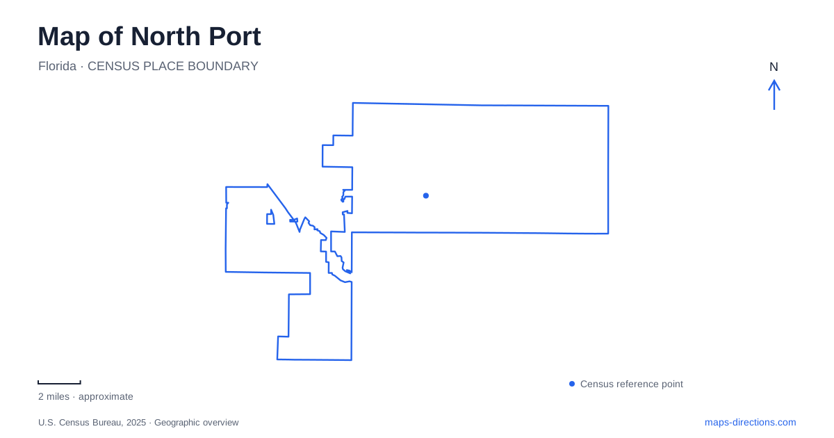
Street tiles load from OpenStreetMap when opened. The blue line shows the 2025 Census boundary.
- State
- Florida
- Population · July 2025
- 96,551
- Land area
- 99.4 sq mi
- Water area
- 4.8 sq mi
North Port's outdoor geography is organized around several different kinds of water. Warm Mineral Springs is a concentrated natural feature with archaeological significance. Myakkahatchee Creek runs through a wooded corridor, while named waterways connect neighborhood parks used for paddling and other recreation. Reading those features separately is more useful than treating every blue line or park symbol as the same kind of destination. The city's major roads then provide a framework for moving between them.
A spring with a protected past
Warm Mineral Springs Park is at 12200 San Servando Avenue. The city reports an average water temperature of about eighty-five degrees throughout the year. Its distinctive mineralized water and long history make it a different setting from a municipal swimming pool or a beach on open coastal water.
The spring is also an archaeological site. Exploratory work revealed prehistoric human remains and evidence of animals associated with much earlier environments. This significance explains the prohibition on diving and disturbing material in the spring. A recreational visit takes place within a protected historic resource, rather than a location where underwater exploration is freely available.
For North Port visitors, the site's buildings require a separate distinction from the water itself. Hurricane damage has affected the historic complex containing showers, restrooms, changing facilities and other services. Confirm the city's visitor arrangements for those facilities independently of water access. Photographs of the historic buildings explain the setting, but they cannot establish whether a particular interior, changing area or entrance is available for the visit you intend to make.
The spring's reputation has also produced many claims about health benefits. Its value as a distinctive natural and historic destination does not depend on treating those claims as established medical facts. The most useful map information is its San Servando Avenue location and the relationship between the spring, grounds, and visitor facilities.
The creek park lies north of the interstate
Myakkahatchee Creek Environmental Park occupies heavily wooded land north of Interstate 75, with its principal address at 6968 Reisterstown Road. The city identifies approximately 3.7 miles of trails and a connection to the Carlton Preserve. This places the park within a wider natural landscape rather than an isolated neighborhood recreation block.
Its paths accommodate walking, bicycle riding, and equestrian use. The park brochure describes rustic routes, footbridges, and oak canopy, with seasonal water possible on the trails. Those features create a shaded creek-side experience that differs from the maintained lawns and courts elsewhere in the city.
The larger creek corridor extends through North Port beyond this particular park. City visitor information identifies additional access to a narrow creek-side route near Butler Park and Oaks Park. These references should remain distinct from the Reisterstown Road destination: the creek is a long landscape feature, while the environmental park is one defined place along it.
Neighborhood parks connect to the Blueway
Blue Ridge Park at 2155 Ridgewood Drive sits beside the Blue Ridge Waterway. Its six acres include a playground, pavilion, and canoe-and-kayak launch. The city identifies it as one of five parks connected to the Blueway, a water-based trail system that gives paddlers a different perspective on local neighborhoods.
Dallas White Park lies close to US 41 along the Cocoplum Waterway. Its recreation facilities include tennis and volleyball courts, a softball field, a playground, and a large pavilion. Check the boat ramp's launching arrangements separately from the park's land-based recreation facilities. A restriction affecting a launch does not change the location or purpose of the surrounding recreation grounds.
These parks show how North Port's waterways and neighborhood facilities overlap. A family can use a playground without planning a paddle, while a paddler needs the specific launch and waterway rather than the general park name. Blue Ridge and Cocoplum identify different portions of that aquatic network.
Civic streets provide another set of reference points
City Hall stands at 4970 City Hall Boulevard. Behind the government building, a landscaped courtyard overlooks a canal, bringing the city's water-oriented geography into a civic setting. The municipality's photography guide also identifies a pedestrian bridge near Chipley Avenue, constructed in connection with Lamarque Elementary School.
Sumter Boulevard and Toledo Blade Boulevard provide additional recognizable corridors with sidewalks and landscaped stopping places. They offer a street-based frame for locating public destinations, while the creeks and canals reveal a less obvious pattern behind the road network.
A map of North Port is most informative when both patterns remain visible. San Servando Avenue leads to the spring, Reisterstown Road reaches the wooded environmental park, Ridgewood Drive identifies a neighborhood paddling stop, and City Hall Boulevard anchors civic activity. Their different settings explain the range of experiences spread across the city.
Map and statistics: U.S. Census Bureau, 2025 Gazetteer, January 2025 generalized place boundaries and Vintage 2025 population estimates. Local references: City of North Port. Article prepared by Maps & Directions.