Map of North Miami Beach
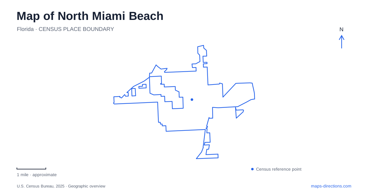
Street tiles load from OpenStreetMap when opened. The blue line shows the 2025 Census boundary.
- State
- Florida
- Population · July 2025
- 46,236
- Land area
- 4.8 sq mi
- Water area
- 0.5 sq mi
North Miami Beach has a landscape of numbered streets, established road names, canal-side public spaces, and parks shaped by the Oleta River. West Dixie Highway, Biscayne Boulevard, and Northeast 163rd Street supply useful reference lines, but the places along them have quite different histories. A former quarry became a county park, a Spanish monastery was reconstructed in a new setting, and a river that once supported farms and trade now anchors major recreation areas.
West Dixie Highway connects contrasting landmarks
Greynolds Park uses 17530 West Dixie Highway as its main address. The Ancient Spanish Monastery is at 16711 West Dixie Highway. Their shared road provides an easy way to relate two very different destinations without assuming that they form a single visitor complex.
The monastery's architecture originated in Sacramenia in Spain before being brought to its South Florida setting. Its European origins distinguish it from a building constructed locally during the same historical period. The present location is an example of transported and reconstructed heritage, which is part of what makes the destination unusual.
For a map of North Miami Beach, the two West Dixie addresses establish a useful sequence of places. The street connects them geographically, while the park landscape and monastery grounds offer separate kinds of visit. Keeping the destination name attached to the address preserves that distinction when arranging stops along the corridor.
Greynolds is more than one park location
The main park occupies land formerly used as a rock quarry and opened to the public in 1936. Miami-Dade County highlights its limestone structures associated with the Civilian Conservation Corps, linking the present landscape with Depression-era park building. Trails, playgrounds, and views of the Oleta River now occupy a setting whose earlier use was very different.
East Greynolds Park is a separate area, identified by the county at 16700 Biscayne Boulevard. Its facilities include a fishing dock, a canoe and kayak launch, and a dog park. The shared Greynolds name can obscure this separation in a quick search, particularly when someone is seeking one specific activity.
Camp Greynolds is another named component, with its own address on Northeast 22nd Avenue and a setting across the street from the main park's western entrance. The names describe related facilities, but a picnic in the main grounds, a dog-park outing, and a group camping visit should not all be routed as though they have the same arrival point.
The Oleta has an older name and a wider story
Florida State Parks records that the Oleta River was formerly called Big Snake Creek and received its present name in 1922. Its history includes Indigenous use, settlement, farms, and trade. By the late nineteenth century, pineapple and vegetable growing had developed along the waterway around Ojus.
That history helps explain why parks now follow the river. The waterway was a route and resource before it became a recreation attraction. Greynolds and Oleta River State Park are related through this river landscape, but they are separate managed destinations rather than two names for the same park.
When reading North Miami Beach's waterways, historical names should be treated as context rather than substituted casually for current map labels. Big Snake Creek in a river history and the present Snake Creek Canal references in municipal material belong to different uses of similar terminology. Retaining the modern destination name avoids turning a historical detail into a misleading direction.
Northeast 163rd Street and the state park
Oleta River State Park lists its entrance address as 3400 Northeast 163rd Street. Within it, the river, shoreline, and trail system support several kinds of outing. Florida State Parks describes paddling on the Oleta River and Biscayne Bay, along with cycling, hiking, and trail running on the land-based network.
The activity determines which internal map is most useful. A paddling map follows channels and shoreline relationships; a trail map follows the paths through the park. The street address gets a visitor to the park, but it cannot explain both experiences on its own.
For visitors based in North Miami Beach, this makes the state park a destination that merits its own plan rather than a quick generic beach stop. River access, land trails, and picnic facilities share a large setting while serving different purposes.
The canal also belongs to civic life
The city library is at 1601 Northeast 164th Street. Municipal redevelopment material connects the library plaza and nearby Margolis Amphitheater with the Snake Creek Trail, discussing improvements to how these public spaces relate to one another. This is a civic use of the waterfront landscape rather than the county or state park experience.
A map of North Miami Beach can therefore be organized around several distinct relationships: West Dixie Highway's landmarks, the separate Greynolds facilities, the Oleta's park landscape, and the canal-side civic area. Recognizing those relationships gives the road names and blue water lines meaning, making the map useful for choosing an outing as well as reaching an address.
Map and statistics: U.S. Census Bureau, 2025 Gazetteer, January 2025 generalized place boundaries and Vintage 2025 population estimates. Local references: Miami-Dade County; Greater Miami Convention and Visitors Bureau; Florida State Parks; City of North Miami Beach. Article prepared by Maps & Directions.