Map of North Little Rock
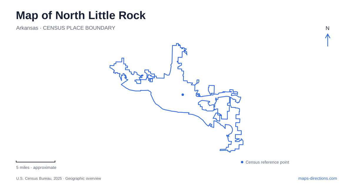
Street tiles load from OpenStreetMap when opened. The blue line shows the 2025 Census boundary.
- State
- Arkansas
- Population · July 2025
- 65,120
- Land area
- 53.0 sq mi
- Water area
- 3.2 sq mi
North Little Rock has a history of changing municipal names, a waterfront containing ocean-going naval vessels, and a celebrated mill that was built as a scenic re-creation. These details make its map more interesting than a simple collection of attractions. The Arkansas River links the city with its southern neighbor, while bluffs and inland neighborhoods create distinct settings beyond the central waterfront. Each area calls for attention to what survives, what was moved and what was deliberately designed.
Argenta is both a historic name and a present district
The Argenta name predates the modern city's identity. The community was annexed by Little Rock in 1890 and became its Eighth Ward. Subsequent political efforts separated the north-side community from that arrangement. The city adopted the name Argenta in 1906 and changed back to North Little Rock in 1917.
Those shifts explain why old documents can use different names for related places. Argenta now identifies a historic and arts district within the city, while earlier references may describe a municipal identity with a different extent. A district name on a current map should therefore not be projected backward as an unchanged boundary.
Preservation and revitalization efforts have made the older center an important cultural area. Its historical significance comes from the community and buildings that developed there, as well as the unusual sequence of annexation, separation and renaming. The name carries both a geographic and a political history.
The maritime museum brings distant events to the riverfront
The Arkansas Inland Maritime Museum occupies Riverfront Park along the Arkansas River. Its principal vessels are the submarine USS Razorback and the harbor tug USS Hoga. Their presence creates a naval-history destination far from the ocean waters where their wartime stories unfolded.
Razorback completed five combat patrols during World War II and was present in Tokyo Bay for the Japanese surrender. Hoga is associated with rescue and firefighting work during the attack on Pearl Harbor. The tug later served as a fireboat for Oakland, California, adding another chapter before its museum role.
For North Little Rock, the vessels are preserved objects brought into a new interpretive setting. The riverfront is their current home, not the site of the Pacific events they represent. This distinction is particularly useful on a map, where a museum label can otherwise obscure the difference between an original historic location and a place that preserves material from elsewhere.
The Old Mill is a work of scenic construction
The Old Mill in T. R. Pugh Memorial Park was created in 1933 as a re-creation of an older water-powered gristmill. Its weathered appearance was intentional. It should not be described as an industrial mill that simply survived from the pioneer period.
Mexican artist Dionicio Rodriguez created the reinforced-concrete sculptures during construction between 1931 and 1933. His work imitates natural materials, especially wood, producing bridges and other forms that appear organic despite their concrete structure. The setting is therefore both a landscape composition and an example of specialized sculptural craftsmanship.
The park lies within the Lakewood area, away from the downtown riverfront. Its historical value comes from the design and artistry of the 1930s project, rather than a claim that grain was once milled there. Understanding that origin allows the site to be appreciated on its own terms.
Emerald Park looks across a worked landscape
Emerald Park occupies bluffs above the river and offers elevated views. The nearby Big Rock Quarry landscape records extensive stone extraction, which altered the rock face over a long period. The city's destination guide connects the dramatic bluff setting with this quarrying history.
That relationship gives North Little Rock two useful perspectives on the same area: the high ground provides a view over the river, while the quarry below reveals how people reshaped the land. A natural rock formation and a worked quarry face are related features, but they are not identical in origin.
The map should distinguish the upper park approach from lower recreation areas around the quarry. A short horizontal distance between them does not erase the change in elevation. Here, the shape of the land is as important as the names of the destinations.
River crossings connect different parts of the region
The Big Dam Bridge opened in 2006 at Cook's Landing and serves pedestrians and cyclists. It crosses the Arkansas River at Murray Lock and Dam, adding a recreation connection associated with the river-trail system. This is a different function from a road bridge carrying ordinary vehicle traffic.
Its location also belongs to a wider river geography beyond the downtown museum and Argenta district. The city's waterfront is not one compact site: historic streets, moored vessels, bluffs, quarry land and recreation crossings occupy separate settings along the river.
Reading North Little Rock through these distinctions avoids several misleading impressions. Argenta's historical name is broader than a simple neighborhood label, the naval museum preserves vessels from distant waters, and the Old Mill is a designed re-creation. The bluffs and bridges then show how terrain and infrastructure connect those individual stories to the larger river landscape.
Map and statistics: U.S. Census Bureau, 2025 Gazetteer, January 2025 generalized place boundaries and Vintage 2025 population estimates. Local references: Argenta Arts District; City of North Little Rock; Library of Congress; North Little Rock Tourism; Little Rock Convention and Visitors Bureau. Article prepared by Maps & Directions.