Map of North Lauderdale
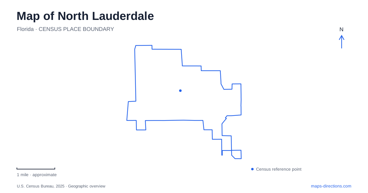
Street tiles load from OpenStreetMap when opened. The blue line shows the 2025 Census boundary.
- State
- Florida
- Population · July 2025
- 45,733
- Land area
- 4.6 sq mi
- Water area
- 0.1 sq mi
North Lauderdale is an inland residential community whose public places are spread among neighborhoods rather than concentrated on an oceanfront. Hampton Pines Park provides a substantial lakeside recreation setting, Kimberly Boulevard carries important community references, and Rock Island Road and McNab Road help organize movement through the developed area. These are more useful starting points for a local map than the broader regional association with beaches suggested by the city’s name.
Hampton Pines and its internal landscape
Hampton Pines Park is associated with Hampton Boulevard and contains a lake surrounded by recreation facilities. The county tourism bureau identifies fishing and boating, playgrounds, sand volleyball courts, a fitness and jogging trail, and lakeside picnic areas. The result is a park with several different activity zones rather than a single open lawn.
A municipal park plan shows the lake-related facilities alongside shelters, playgrounds, trails, and the office complex. Hampton Boulevard, Sussex Drive, and Avon Lane appear as surrounding street references. These names help place the park within its neighborhood, while the internal features explain how the grounds are arranged once someone reaches the area.
On a map of North Lauderdale, retain both levels of detail. The lake is the major visual feature, but a picnic pavilion and a playground represent different destinations around it. A meeting described only as “at Hampton Pines” leaves more uncertainty than one tied to a particular shelter or activity area. The useful local detail is the arrangement around the water, not simply the park’s outer boundary.
Kimberly Boulevard and community history
The Saraniero branch of Broward County Library is at 6901 Kimberly Boulevard. That address offers a community landmark independent of the recreation grounds. A library trip and an outing to the lake may both be local activities, but they belong to different parts of the street network and should remain distinct on a map.
Kimberly Boulevard also appears in the city’s municipal history. In 1971, City Hall moved to 6100 Kimberly Boulevard, a former country club building later known as the Samuel Miller Senior Center. The earlier municipal offices had occupied a small red brick house off State Road 7 on Anderson Road. These former locations show how public functions adapted existing buildings as the community developed.
North Lauderdale was incorporated in 1963, when the surrounding land still included pasture and vegetable farming. Early residential development included the area now called Kimberly Village Section One. Those details provide context for the neighborhood pattern: this is a community shaped substantially by twentieth-century residential development, with civic uses inserted and relocated as its needs changed.
The old City Hall address is a historical reference, not a substitute for a present municipal appointment location. Its value on a local map lies in showing how Kimberly Boulevard became associated with community life, alongside the library and surrounding residential streets.
Rock Island Road and McNab Road
The city’s economic-development mapping identifies McNab Road as a commercial corridor and Rock Island Road as a civic planning corridor. It places shopping centers, residential areas, Hampton Pines, and Woodville Dog Park within the broader McNab study area. This combination shows why the corridor serves more than through traffic: it also connects everyday shopping and neighborhood destinations.
A North Lauderdale map is easier to interpret when these main roads remain visible while smaller streets are explored. Hampton Boulevard gives the lake park a specific neighborhood reference, Kimberly Boulevard identifies the library area, and the Rock Island–McNab intersection provides a broader orientation point. These names are complementary rather than interchangeable.
The commercial planning map is useful for understanding land-use relationships, but proposed opportunity sites are not established attractions. Separate the existing street and shopping pattern from future redevelopment concepts. That approach preserves the useful geography without presenting a planning ambition as a completed destination.
A network of modest public places
County planning records distinguish the library complex, Hampton Pines, Bicentennial Park, Saraniero Park and Field, and other neighborhood recreation sites. Their different names indicate a distributed network of public places. Some serve outdoor recreation, some support community activities, and the library provides an indoor civic destination.
Read North Lauderdale through that neighborhood network. The lakeside park supplies a large recreational focus, Kimberly Boulevard carries a history of community institutions, and the main road corridors connect residential and commercial uses. Together these features describe the city’s everyday geography more accurately than a regional beach label or a list of anonymous green spaces.
Map and statistics: U.S. Census Bureau, 2025 Gazetteer, January 2025 generalized place boundaries and Vintage 2025 population estimates. Local references: Visit Lauderdale / Greater Fort Lauderdale Convention & Visitors Bureau; City of North Lauderdale; Broward County; Broward County Planning Council. Article prepared by Maps & Directions.