Map of North Las Vegas
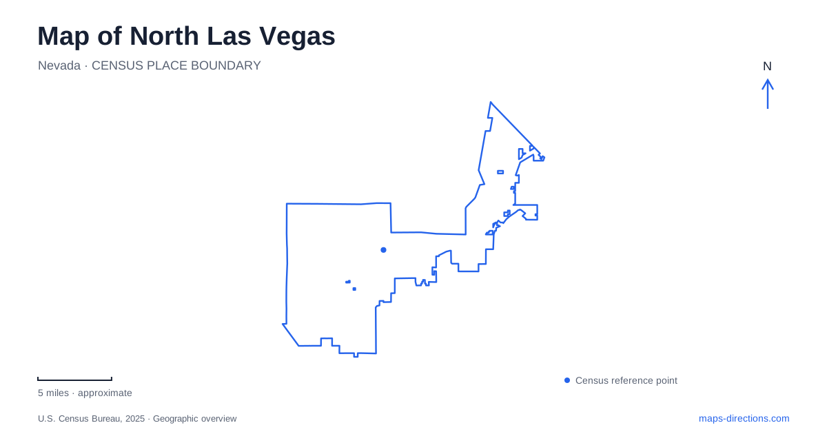
Street tiles load from OpenStreetMap when opened. The blue line shows the 2025 Census boundary.
- State
- Nevada
- Population · July 2025
- 296,653
- Land area
- 105.4 sq mi
- Water area
- 0.0 sq mi
North Las Vegas is a separate municipality incorporated in 1946, with a landscape that extends from established urban neighborhoods toward the northern valley's desert margin. Its parks provide an unusually useful way to understand that geography. A former golf course became a regional recreation space, a historic ranch preserves an artesian water source, and the fossil beds record a much older, wetter environment. These places connect everyday city life with changes in land use that reach far beyond the modern street network.
Craig Road and a transformed golf course
Craig Ranch Regional Park occupies about 170 acres at Craig Road and Commerce Street, with its listed address at 628 West Craig Road. The site was formerly a golf course. Its preservation as public space kept a large tract available for recreation instead of allowing it to be absorbed into surrounding development. That origin helps explain the generous scale of the grounds and their combination of open areas, ponds and established landscape features.
Today the park includes a 65,000-square-foot skate park, civic plazas, sports courts, community gardens and reservable shaded gathering spaces. The AMP provides a setting for concerts and other events within the wider park. For a map of North Las Vegas, Craig Ranch is therefore more than one recreation symbol: it is a substantial complex whose different facilities serve different activities. The Craig Road and Commerce Street intersection gives the grounds a clear position in the road network, while the internal park layout determines how a visit unfolds on foot.
Water and settlement at Kiel Ranch
Kiel Ranch Historic Park preserves a much earlier land-use story. Conrad Kiel established a substantial homestead in the late nineteenth century, on land with evidence of Indigenous Paiute presence before settlers. The remaining historic features include an adobe building, the Doll House cottage and an active artesian pond. National Register recognition dates to 1975.
The site's interest comes partly from the persistence of water in an otherwise dry regional setting. The pond, ranch structures and orchard history make it possible to consider settlement through the resources that sustained it. A park expansion completed in 2024 added an entrance from Commerce Street, paths connecting with the earlier park phase, interpretive signs and desert-adapted planting. Those additions improve the way the historic area connects with its urban surroundings. Kiel Ranch gives North Las Vegas a visible pre-city history that would be easy to overlook from the appearance of nearby modern streets.
Aliante's deliberately designed landscape
Aliante Nature Discovery Park at 2627 Nature Park Drive covers 20 acres and was established in 2003. Its lake and waterfall are man-made, forming the centerpiece of a designed neighborhood recreation landscape. Paths, picnic areas, courts and playing fields surround them, while a dinosaur-themed discovery area gives the park a distinctive identity for families.
This setting contrasts usefully with the artesian pond at Kiel Ranch. Both places include water, but their origins and purposes differ: one preserves an element of a historic ranch environment, while the other organizes a modern park around constructed features. The distinction also matters when interpreting the dinosaur theme. It is a play and discovery feature, whereas the fossil record at nearby Tule Springs concerns actual preserved evidence of much later prehistoric life. A thoughtful reading of North Las Vegas separates those stories while recognizing why both attract interest in the region's past.
Beyond the developed streets, an Ice Age record
Tule Springs Fossil Beds National Monument preserves sediments recording environmental change over roughly 570,000 years. Its fossil evidence includes mammoths, horses, camels and bison associated with earlier spring-fed landscapes. The present desert can therefore be misleading if treated as an unchanging backdrop. Water availability and animal communities differed substantially during the periods represented by the deposits.
The National Park Service identifies an access point at Aliante Parkway, with a parking area and interpretive kiosk. The surrounding terrain includes relatively flat desert scrub and views toward the Las Vegas and Sheep ranges. This is a different outing from a landscaped neighborhood park: the setting itself, its sediments and the history interpreted from them are the main attractions. Fossils must remain where they are found; a photograph and report to park staff preserve scientific context far better than removing an object.
An airport serving smaller aircraft
North Las Vegas Airport, identified by VGT, opened as Sky Haven Airport in December 1941 and was purchased by Clark County in 1987. It serves general aviation, including flight training, aircraft maintenance, sightseeing and public-service flights. Its role complements the region's large commercial airport by accommodating smaller aircraft.
The airport adds another layer to the city's development story. Aviation, urban recreation, ranch preservation and paleontology coexist within the broader valley, but each operates at a different scale. Using these specific places as reference points reveals a varied municipality whose identity extends well beyond its proximity to the famous resort corridor.
Map and statistics: U.S. Census Bureau, 2025 Gazetteer, January 2025 generalized place boundaries and Vintage 2025 population estimates. Local references: City of North Las Vegas; National Park Service; Clark County Department of Aviation. Article prepared by Maps & Directions.