Map of Noblesville
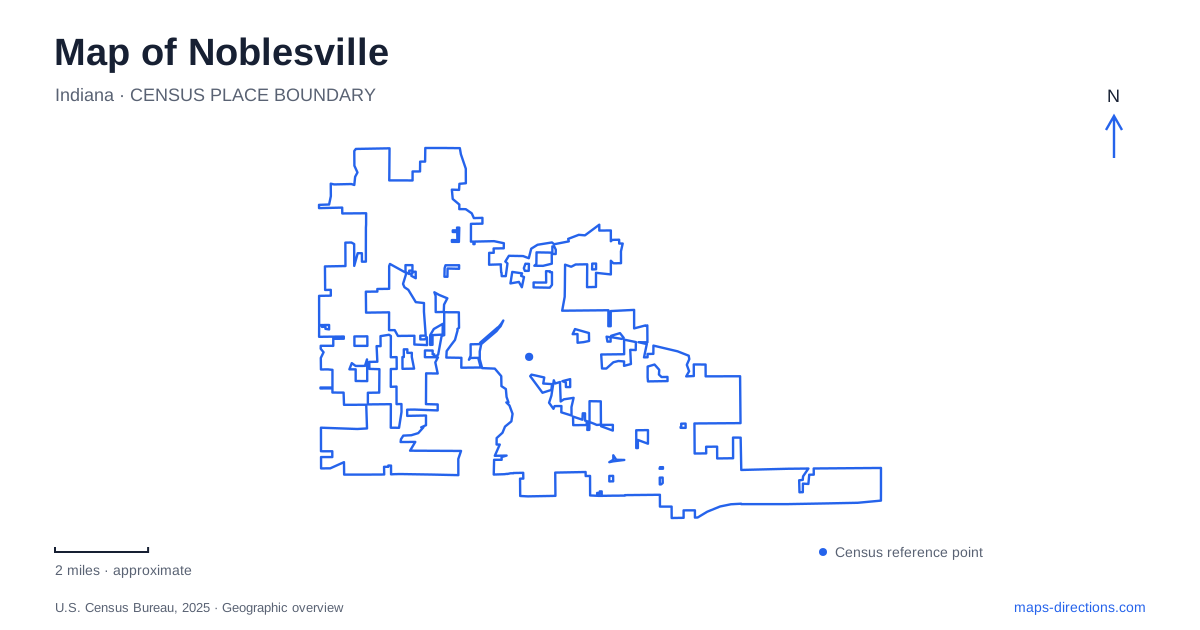
Street tiles load from OpenStreetMap when opened. The blue line shows the 2025 Census boundary.
- State
- Indiana
- Population · July 2025
- 76,111
- Land area
- 35.6 sq mi
- Water area
- 1.4 sq mi
Noblesville is easiest to understand by following the White River and then looking at how the courthouse square, parks, and railway relate to it. The river is more than scenery beside downtown: it connects places with very different histories, from a nineteenth-century covered crossing to a modern event lawn. The square supplies a compact civic center, while the greenway and northern parks stretch a visit into a longer landscape journey.
The courthouse square and the river edge
The Hamilton County Courthouse anchors the historic square, with shops, restaurants, and arts businesses around it. County tourism identifies the square as the center of the state-designated cultural arts district. That relationship is visible in the geography: the courthouse lawn gives the blocks a common reference point, while neighboring storefronts hold the everyday activity around it. A visitor can understand the center by circling this small area before following the riverwalk nearby.
Across the White River, Federal Hill Commons creates a different type of gathering place. Opened in 2017 at the northwest corner of State Roads 19 and 32, the 6.5-acre park has an amphitheater, events lawn, market plaza, and playground. Its published address is 175 Logan Street. The Green Room, an indoor venue with an attached overlook patio, belongs to this park setting. The square and the commons therefore form two complementary downtown spaces: one organized around the courthouse and streets, the other around a performance lawn.
A century of recreation at Forest Park
Forest Park gives the Noblesville map a substantial green area north of the center. Established in 1925, it occupies roughly 150 acres along State Road 19, with a general address of 701 Cicero Road. The name might suggest a place devoted solely to woodland walking, but the park has long combined trees and picnic areas with organized recreation. A nine-hole golf course, aquatic center, miniature golf, playgrounds, and athletic courts all contribute to that mix.
The historic inn and lodge add indoor gathering places, while paved and natural paths connect with the White River Greenway. This range of uses explains why Forest Park appears as several destinations within one boundary. A golf outing, a family swim, and a railway departure all use the same larger park landscape without sharing precisely the same arrival point or activity space.
Rails through the park
Hobbs Station sits inside Forest Park at 825 Forest Park Drive. The Nickel Plate Express operator places its boarding point just north of the three-way stop, with check-in in the station before passengers move to the platform. This is an excursion railway setting, where a particular booked experience determines the journey. It should not be read as a conventional commuter station connecting downtown to a daily rail network.
The operator also runs railbike experiences from Hobbs Station. Its Forest Park Rail Adventure follows the rails through woodland and farmland toward a turnaround south of Cicero. A shorter experience crosses the White River toward downtown. The coexistence of train rides, railbikes, and ordinary park trails makes the corridor distinctive, but these are different activities: rails used for an organized excursion are not simply another public walking path shown beside the greenway.
Potter's Bridge and the older crossing
The covered bridge northeast of central Noblesville preserves an earlier relationship with the river. Indiana's historical marker records a bridge at Potter's Ford commissioned in 1860, followed by the present Howe truss structure, approved in 1870 and completed in 1871. Its name recalls landowner William Potter. After a century of service, county commissioners voted to close it to road traffic in 1971.
The surrounding park, at 19401 Allisonville Road, turns the crossing into a destination for walking, river views, fishing, and paddling access. The White River Greenway links the park through Forest Park toward the historic square. That sequence helps explain why the covered bridge belongs on a Noblesville recreation map as well as a heritage map: it is both a preserved structure and a landmark within a longer riverside route.
Where the urban river trip becomes a county outing
Farther north, Strawtown Koteewi Park broadens the river story beyond Noblesville itself. The county describes woodland, prairie, wetland, and archaeological sites along the river's west fork. Its mapped destinations include the Taylor Center of Natural History, Koteewi Lake, archery facilities, and separate trail loops. The historical landscape includes evidence of an Oliver-phase village occupied between about 1250 and 1400, giving the river corridor a much longer human history than the courthouse or railway. This is a larger county park excursion, useful as an extension to a downtown visit when the emphasis shifts from compact streets to trails and landscape interpretation.
Map and statistics: U.S. Census Bureau, 2025 Gazetteer, January 2025 generalized place boundaries and Vintage 2025 population estimates. Local references: Hamilton County Tourism; City of Noblesville; Nickel Plate Express; Indiana Historical Bureau; Discover White River; Hamilton County. Article prepared by Maps & Directions.