Map of Newton
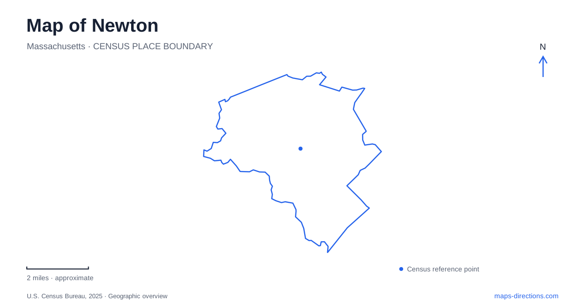
Street tiles load from OpenStreetMap when opened. The blue line shows the 2025 Census boundary.
- State
- Massachusetts
- Population · July 2025
- 90,741
- Land area
- 17.8 sq mi
- Water area
- 0.3 sq mi
Newton can be understood through places where ordinary-looking land holds several different histories. A family property became a refuge for people escaping slavery; a farmhouse became the center of a commercial nursery; riverbank woodland now offers views of a monumental bridge. These are specific destinations rather than interchangeable suburban attractions. Locating the Jackson Homestead, Durant-Kenrick House, Hemlock Gorge and Crystal Lake gives a visitor several different ways to interpret the city's landscape.
The Jackson Homestead and its difficult inheritance
The Jackson Homestead on Washington Street is the Federal-style house built by Timothy Jackson in 1809. The property's history is older than that building, and the distinction matters. Earlier generations of the family enslaved people on the site, while later family members became abolitionists. William Jackson offered the house as a station on the Underground Railroad, helping people seeking freedom.
The house remained in family ownership until Frances Middendorf gave it to the city in 1949. It opened as a museum in 1950. That sequence separates a long period of domestic occupation from the public institution visible on a modern map. The museum's meaning comes from the people and choices associated with the property, not simply the age or appearance of the building.
The homestead's interpretation examines how Newton has been shaped by Indigenous stewardship, colonization, migration, activism and daily decisions. Its approach deliberately includes contrasting experiences within the same place. For a visit, this makes the homestead an introduction to the wider city rather than a period room detached from the surrounding community. The address identifies a preserved house; the interpretation reaches well beyond its walls.
The nursery landscape behind a second museum
The Durant-Kenrick House and Grounds occupies a separate property at 286 Waverley Avenue. The Georgian farmhouse dates approximately to 1734. Its spacious rooms and surviving decorative details reflect the ambitions of the Durant family, whose holdings included orchards, pasture and woodland. The museum also addresses slavery, the Revolutionary era and later preservation, so the household story is not confined to its most prosperous residents.
John Kenrick purchased the property in 1790 and established a commercial nursery. Fruit varieties, flowering shrubs and ornamental trees tied this ground to a much wider horticultural trade. The nursery history gives Newton's residential landscape an unexpected agricultural dimension: plants now associated with gardens once formed part of a substantial business here. Kenrick was also an early abolitionist, publishing an antislavery work in 1817.
In the twentieth century, Arthur and Frances Dewing preserved the house. Their stewardship helped retain the building for its later museum role. Today period rooms, interactive exhibits, gardens and a modern educational space occupy the site together. The Waverley Avenue museum and Washington Street homestead share an operating organization, but they are not two names for one attraction. Each has its own building, grounds and historical emphasis.
A gorge along the Charles
Hemlock Gorge Reservation brings a different scale of landscape into a Newton itinerary. The state-managed area covers about 23 acres along the Charles River. Its wooded terrain and Echo Bridge provide a river-focused outing distinct from either house museum. The viewing platform beneath the bridge is associated with the echo that gives the structure its name.
The state lists a small parking area at Hamilton Place and Central Avenue in neighboring Needham. That is a useful reminder that the most practical entrance to a regional landscape may sit across a municipal boundary. A city outline alone cannot explain where a visitor should begin. The reservation's actual approach, paths and viewpoints make more useful planning details than a generalized pin over the river.
Crystal Lake has more than one shoreline use
Crystal Lake supplies Newton with a seasonal swimming destination at 30 Rogers Street. Entry to the beach is through the bathhouse, and swimming is confined to the buoyed area. The lake's visible outline is therefore much larger than the authorized swimming zone. The municipal beach operates seasonally; a water feature on the map does not imply year-round supervised swimming.
Fishing is a separate use with different arrangements. The city identifies a fishing platform at Levingston Cove and prohibits fishing from the swimming beach and docks. Someone planning to fish should not select the bathhouse merely because it is the best-known lake address. These distinctions make the shoreline easier to use without assuming every access point serves every activity.
Together, the two museums, river gorge and lake reveal a city built from several overlapping landscapes. Domestic history, horticultural enterprise, conservation and managed recreation each require a different map reading. Choosing a specific property or access point first makes those differences visible and produces a more coherent visit than trying to treat the municipal center as the starting point for everything.
Map and statistics: U.S. Census Bureau, 2025 Gazetteer, January 2025 generalized place boundaries and Vintage 2025 population estimates. Local references: City of Newton; Massachusetts Department of Conservation and Recreation. Article prepared by Maps & Directions.