Map of Newport News
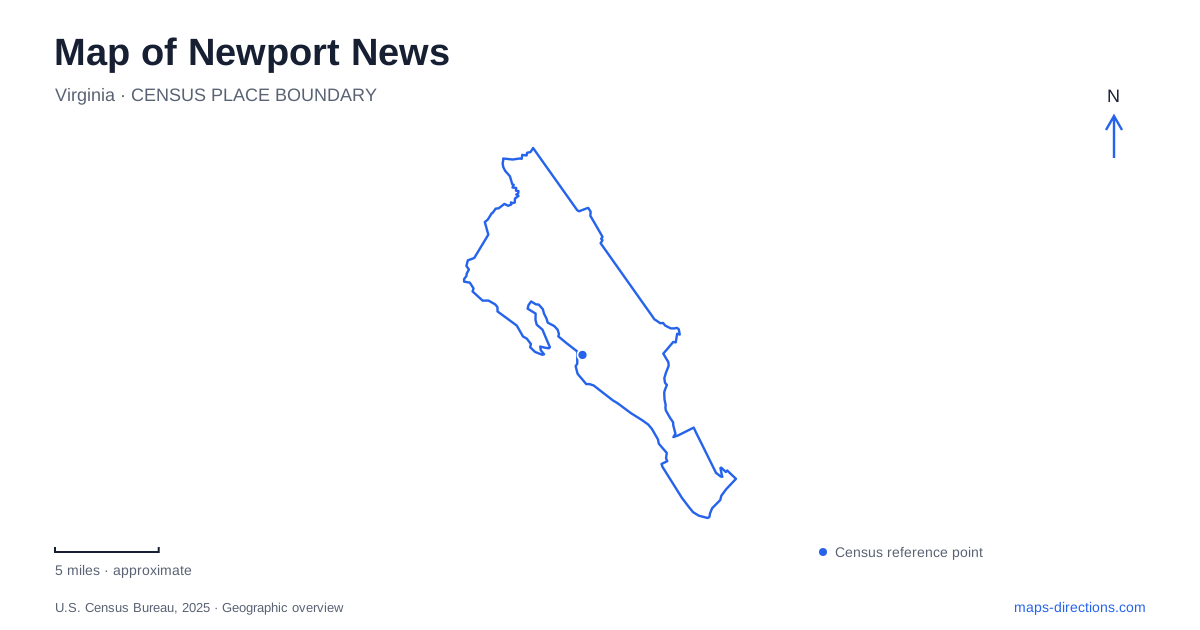
Street tiles load from OpenStreetMap when opened. The blue line shows the 2025 Census boundary.
- State
- Virginia
- Population · July 2025
- 183,230
- Land area
- 69.0 sq mi
- Water area
- 50.6 sq mi
Newport News extends through several distinct landscapes, from a shipbuilding waterfront to wooded parkland and an older railway village. Its history is not confined to one downtown square. The James River provides a strong geographical reference, but local destinations also reach inland around a freshwater lake and north into the Lee Hall area. A map becomes more useful when these clusters remain distinct: the working waterfront explains one period of growth, wartime housing another, and the northern historic sites reveal connections that predate many of the city's modern commercial areas.
The working river and the downtown memorial
Downtown lies beside the James River within sight of the shipyard. The Yard District name acknowledges that industrial relationship. Victory Landing Park offers a public setting for river views, while the shipyard remains a working facility rather than a general visitor attraction. This difference matters because the waterfront's historical importance comes from ongoing industry as well as preserved monuments.
At 25th Street and West Avenue, the Victory Arch commemorates military service and the return of troops after the First World War. The first arch was erected in 1919, and soldiers arriving by ship marched beneath it. The present structure dates to a 1962 reconstruction; an eternal flame was added in 1969. Those separate dates describe a memorial whose physical form changed while its purpose continued.
The arch and riverfront give Newport News a downtown story tied directly to arrival by water. They also explain why the city's historical center is situated beside an industrial shoreline. It was a place of employment, embarkation, and homecoming, rather than a waterfront developed solely for sightseeing.
Hilton Village and the shipbuilders' neighborhood
Following Warwick Boulevard northwest brings a different expression of the same maritime economy into view. Hilton Village began in 1918 as housing for shipbuilders during the First World War. The federally sponsored wartime project produced about 500 homes, subsequently sold to individual owners after the war.
The significance of the district lies in the neighborhood as a whole. Houses, local streets, and commercial premises preserve the relationship between industrial employment and domestic life. The Peninsula Community Theatre and the James River setting add present-day destinations to a place whose original purpose was residential. It is a useful counterpoint to the shipyard: one landscape represents where vessels were made, while the other records where workers and their families lived.
A map of Newport News should therefore give Hilton Village its own place in the sequence along Warwick Boulevard. Combining every historic destination under a downtown heading obscures the separate neighborhood and the particular wartime circumstances that created it.
Freshwater paths within the maritime landscape
The Mariners' Museum and Park introduces an inland body of water into this river-oriented setting. Mariners' Lake covers 167 acres within a 550-acre park. The five-mile Noland Trail encircles the lake through wooded terrain, using numerous bridges to cross its irregular shoreline. Dedicated in 1991, the trail revived a tradition of paths around the water dating to the park's earlier decades.
This is not simply a flat promenade. The trail has changing grades, and the museum notes roots and graded steps along portions of the route. Holly Tree Overlook has accessible parking and a paved approach, while the multipurpose trail parallel to Warwick Boulevard provides another option. Those differences are more informative than treating every line around the lake as an equivalent walking surface.
At Lions Bridge, views connect the lake landscape with the James River. Inside the museum, the USS Monitor Center and maritime collections provide another way to explore the importance of water to Newport News. Together the galleries, lake, and woodland make a substantial destination cluster with several different kinds of activity.
Lee Hall and the northern parkland
Farther north, Lee Hall developed as a Chesapeake and Ohio Railway community. Warwick Boulevard and Yorktown Road supported its businesses, while the surviving depot anchors the historic village. Some early twentieth-century houses remain, although many of the former commercial buildings have disappeared. The surrounding historic landscape also includes Lee Hall Mansion and Endview.
The city's 2023 Lee Hall Area Plan defines this northern area using the York County and James City County boundaries, with Fort Eustis Boulevard and Dozier Road along its southern side. These references help locate the district within the larger peninsula rather than treating Lee Hall as a single building.
Newport News Park, at 13560 Jefferson Avenue, occupies 7,711 acres of woods, meadows, and lakes. Camping, hiking, fishing, and other outdoor facilities give this northern landscape a scale very different from the downtown riverfront. Reading the city from the arch through Hilton Village and the museum park to Lee Hall reveals a series of connected histories: maritime industry, workers' housing, preservation, railway settlement, and extensive public open space.
Map and statistics: U.S. Census Bureau, 2025 Gazetteer, January 2025 generalized place boundaries and Vintage 2025 population estimates. Local references: Newport News Tourism; Virginia Tourism Corporation; The Mariners Museum and Park; National Park Service; City of Newport News. Article prepared by Maps & Directions.