Map of Newport Beach
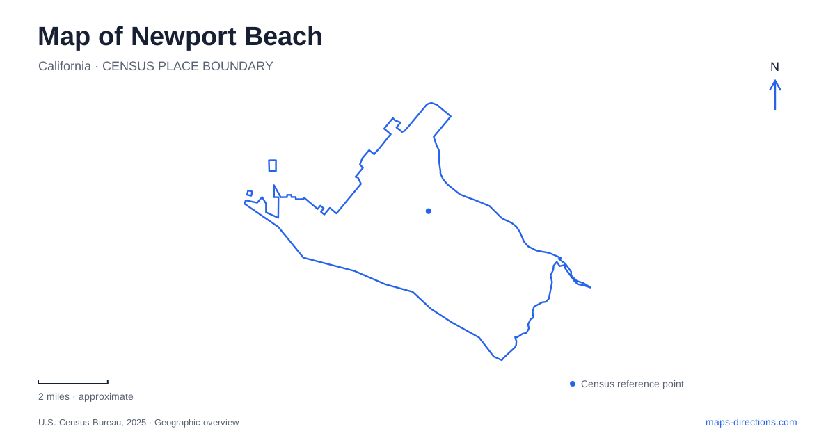
Street tiles load from OpenStreetMap when opened. The blue line shows the 2025 Census boundary.
- State
- California
- Population · July 2025
- 81,977
- Land area
- 23.8 sq mi
- Water area
- 2.2 sq mi
Newport Beach is best read as a collection of shorelines rather than a single beach destination. The Balboa Peninsula separates ocean water from harbor water, islands create additional waterfront neighborhoods, and Upper Newport Bay extends inland into an estuary. Farther along the coast, bluffs and coves introduce a different kind of beach access. These differences explain why two places with similar coastal descriptions can require entirely different approaches.
Two piers on one peninsula
The city describes the Balboa Peninsula as a three-mile strip between Newport Harbor and the Pacific Ocean. That narrow shape gives the peninsula two distinct edges. Ocean Front Walk belongs to the ocean side; the harbor's channels, landings, and islands occupy the other side. An ocean-facing pier and a harbor boarding point are therefore different destinations even within the same village.
Newport Pier is associated with McFadden Square. Balboa Pier belongs to the Balboa village area, alongside the Fun Zone and historic Pavilion. Keeping the pier names separate is one of the most useful first steps in understanding Newport Beach. A meeting arranged simply at “the pier” leaves two plausible oceanfront locations.
The names also preserve different parts of local history. Municipal historical research connects the earlier McFadden Wharf with commercial shipping, while the Pavilion and Balboa Pier were completed in 1906 as the peninsula developed as a resort destination. Reading those places together reveals a transition from working waterfront to seaside recreation, rather than two interchangeable structures projecting into the ocean.
Islands and the ferry crossing
Balboa Island and the peninsula face one another across harbor water. The city harbor department identifies the auto ferry crossing between them as an active interruption in the main channel. For a land-based traveler, the ferry is a particular connection across water; for a vessel, the same location is a crossing to recognize while following the channel.
This matters when comparing routes around Newport Beach. A line across the harbor may represent a ferry leg rather than an ordinary road. The island's street destination and the peninsula's destination remain separate even where their waterfronts appear close together. A route that includes the crossing should be understood in those terms before comparing it with an approach around the harbor.
Lido Marina Village and Lido Isle form another useful distinction. The city's community description places the residential island across a bridge from the shopping and waterfront dining district. Similar names indicate a relationship, but they do not identify the same piece of land. This is a recurring feature of the harbor map: villages, islands, and water passages are closely associated while retaining separate street patterns.
The estuary beyond the harbor bridge
The harbor department identifies the channel beneath the Coast Highway Bridge as the boundary between the lower harbor and the upper, or Back Bay, portion. This gives the highway crossing a geographic role beyond carrying road traffic. It marks a transition between the developed harbor landscape and the inland bay landscape.
The Peter and Mary Muth Interpretive Center stands at 2301 University Drive. Newport Bay Conservancy describes its focus as life in and around an estuary. On a map of Newport Beach, this address is a useful northern educational reference, distinct from the harbor's island shops and ocean piers.
The municipal Back Bay Loop description lists several places around the bay, including Upper Castaways Park, Big Canyon, and the Back Bay Science Center on Shellmaker Island. These are separate points along a broader landscape. Choosing a named stop gives a visit a clear focus: an interpretive center, a canyon-side setting, or an island science facility each directs attention to a different part of the estuary.
Bluffs, coves, and the highway
Crystal Cove State Park lies along Pacific Coast Highway between Corona del Mar and Laguna Beach. Its geography differs from the peninsula: coastal bluffs stand above beaches, while inland ridges and canyons extend away from the water. A bluff-top walk and a visit to the sand therefore involve different elevations and access choices.
California State Parks identifies Los Trancos as the principal parking area for the Historic District, on the inland side of the highway. Pelican Point and Reef Point provide separate day-use approaches to the coastal bluff trail. The distinction is concrete: a destination among the historic cottages is not the same as a starting point for a bluff-top outing.
Newport Beach becomes easier to navigate when these shoreline forms stay separate. The peninsula organizes ocean and harbor sides; bridges and ferries connect particular islands; the Coast Highway crossing marks the upper bay transition; and the coastal parks use named entrances above or across from their beaches. Together they explain the city's coastal geography more clearly than a single generalized waterfront label.
Map and statistics: U.S. Census Bureau, 2025 Gazetteer, January 2025 generalized place boundaries and Vintage 2025 population estimates. Local references: City of Newport Beach; Newport Bay Conservancy; California State Parks. Article prepared by Maps & Directions.