Map of Newnan
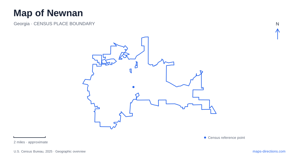
Street tiles load from OpenStreetMap when opened. The blue line shows the 2025 Census boundary.
- State
- Georgia
- Population · July 2025
- 45,867
- Land area
- 19.9 sq mi
- Water area
- 0.4 sq mi
Newnan has a recognizable center: a courthouse square surrounded by an older street grid. Beyond it, the map records several different patterns of growth, including residential avenues, an industrial neighborhood beside the railway, and newer paths connecting recreation sites. Reading those patterns together is more revealing than treating the entire historic area as one uniform district. The courthouse is the central landmark, but the streets and neighborhood boundaries explain how the town developed around it.
A square that organizes the center
Downtown was laid out in 1828, and its historic district comprises a nine-square-block plan with a public square and wide avenues. The present Coweta County Courthouse dates to 1904. Its dome rises more than 100 feet above the square, with clocks facing four directions, giving the building a presence that extends beyond its immediate parcel.
The courthouse address is 200 Court Square. On a map of Newnan, begin with that central space and then examine the surrounding blocks. The useful distinction is between the square itself and the streets serving the businesses around it. A destination described as being “on the square” may occupy a neighboring frontage rather than the courthouse grounds.
The building’s symmetrical architecture reinforces its role as a center viewed from several directions. This makes the square a useful reference when comparing downtown destinations: the relationship between two nearby businesses is easier to understand in terms of their sides of the square than by treating each address as an unrelated point.
Greenville Street Park at a change in townscape
Greenville Street Park occupies two acres between Greenville Street, LaGrange Street, and Salbide Avenue. Its position at the edge of the historic commercial and residential areas gives it a particular role in the downtown landscape. It marks a transition between the business district and the streets of older houses, rather than functioning as a large outlying recreation ground.
The park’s colonnaded entrance, terraced lawn, stage, brick plazas, pavilion, and paths fit several forms of public gathering into a compact site. Its address, 51 Greenville Street South, anchors it to the surrounding street pattern. Looking at all three bounding streets makes the grounds easier to understand than looking only at the entrance address.
For a short exploration of Newnan, the square and this park provide two contrasting public spaces. One is organized around the county’s landmark building; the other provides open ground where the commercial center meets a residential setting. Their different shapes and functions help explain the change in character without requiring a long journey across town.
Neighborhoods shaped by different histories
The historic districts extend beyond the central square. College-Temple reflects a planned neighborhood with educational sites, while Cole Town developed around the R.D. Cole Company. The Greenville-LaGrange district follows older principal streets and later infill streets. These are different development stories, not simply alternative names for downtown.
The former cotton mill and its village have a particularly readable industrial geography. The mill was established beside the railroad on East Washington Street in 1888. The associated village lies between the railway and Farmer Street, with Washington Street to the south and Wilcoxen Street to the north. Those boundaries connect the residential area directly to the industry that shaped it.
A detailed Newnan map can therefore show more than architectural attractions. The railway, street edges, and neighborhood names explain why houses and workplaces occupy particular positions. Keeping those relationships visible gives the historic districts meaning beyond the age or appearance of individual buildings.
Recreation connected by the LINC
C.J. Smith Park lies between Farmer and Murray Streets, with a municipal address of 92 Farmer Street. Its recreation facilities include a playground, bike pump track, skate area, and splash pad. The park also connects with the LINC, the city’s multiuse path system, placing active recreation within the wider network of pedestrian and bicycle movement.
The completed Greison Trail bridge connected eastern and western LINC sections in December 2022. That crossing is an important feature to recognize when studying the path network: a bridge provides continuity that a line drawn toward a road cannot establish by itself. The LINC’s long-term vision is larger than its completed routes, so planned extensions should remain distinct from established connections.
Read Newnan as a combination of a formal civic center, historically different neighborhoods, and a developing network of public paths. Court Square explains the downtown focus, Greenville Street Park marks a transition in the streetscape, and the mill area and LINC reveal other ways the city’s places connect.
Map and statistics: U.S. Census Bureau, 2025 Gazetteer, January 2025 generalized place boundaries and Vintage 2025 population estimates. Local references: City of Newnan; Explore Georgia; Friends of LINC. Article prepared by Maps & Directions.