Map of Newark
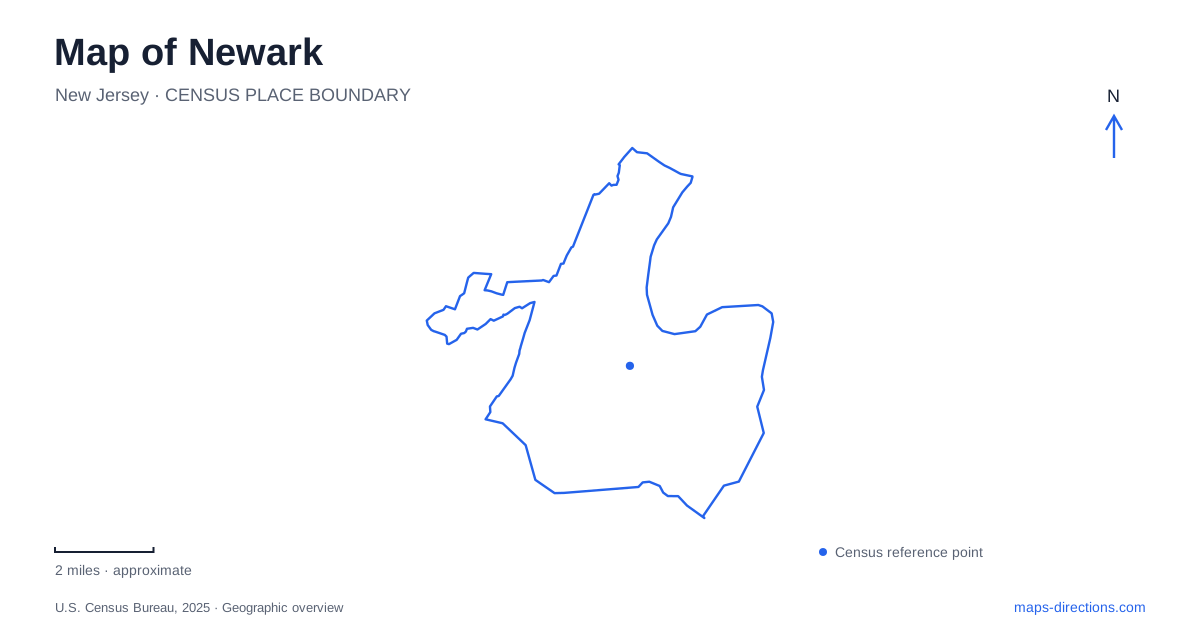
Street tiles load from OpenStreetMap when opened. The blue line shows the 2025 Census boundary.
- State
- New Jersey
- Population · July 2025
- 323,808
- Land area
- 24.1 sq mi
- Water area
- 1.7 sq mi
Newark's railways, riverfront, and long park landscapes give its neighborhoods a more varied structure than a quick view of the downtown skyline suggests. Penn Station and Broad Street Station serve different rail corridors, Ferry Street provides a commercial focus in the Ironbound, and the cultural buildings around Washington and Center streets create another group of destinations. Farther north, Branch Brook Park stretches toward Belleville. These features offer a useful framework for understanding the city at both street and regional scales.
Two main stations with different connections
Newark Penn Station receives NJ TRANSIT's Northeast Corridor, North Jersey Coast, and Raritan Valley services. Broad Street Station receives the Morris & Essex and Montclair-Boonton lines. The distinction matters before arrival because the two stations occupy separate parts of downtown and connect with different regional routes.
The light rail links them, with an additional route continuing through the central and northern neighborhoods. The Broad Street extension opened in July 2006, adding a roughly one-mile connection between the mainline stations. Its stops also serve downtown destinations, so it performs a local circulation role as well as transferring passengers between rail lines.
Broad Street Station stands near University Avenue and Route 280. Penn Station supplies a different orientation point closer to the Ferry Street approach. A map that shows both stations and the light rail makes the city easier to understand as a connected network. It also avoids the ambiguity of asking for directions to a station without specifying which regional service is involved.
Ferry Street and the Ironbound's commercial life
Ferry Street carries a sequence of small shops and businesses from the Penn Station end of the Ironbound toward Routes 1 and 9. Its boutiques, food businesses, and neighborhood services give the street a sustained commercial role rather than concentrating activity in one enclosed destination.
Portuguese, Brazilian, and Spanish culinary traditions are particularly prominent in the district. Restaurants and shops reflect those community connections, while cultural celebrations bring additional activity onto the street. The neighborhood's identity therefore comes from a collection of businesses and institutions, not solely from its reputation as a place to eat.
On a Newark map, Ferry Street is a practical organizing line for this part of the city. Following its sequence of intersections reveals the district's extent more clearly than selecting one restaurant and assuming the surrounding blocks have all been covered. The street's relationship to the station also helps explain its accessibility within the wider metropolitan transport network.
Cultural buildings around Washington and Center streets
The Museum of Art stands at 49 Washington Street and incorporates the Ballantine House. Built in 1885 for Jeannette and John Holme Ballantine, the mansion originally contained 27 rooms. It became part of the museum in 1937 and received National Historic Landmark designation in 1985.
The house connects art interpretation with the history of a prominent brewing family and the craftspeople who constructed and furnished its home. Its survival within a museum complex preserves a domestic scale of architecture amid a more institutional downtown setting. That relationship is visible on the ground even before entering the galleries.
The New Jersey Performing Arts Center, or NJPAC, occupies 1 Center Street. Its own directions connect Penn Station with Raymond Boulevard and Mulberry Street, while the NJPAC/Center Street light rail stop offers another approach. Military Park provides an additional nearby reference. These named streets and landmarks give Newark's cultural destinations a more precise arrangement than the broad label of downtown.
Public access along the Passaic
Riverfront planning has restored opportunities to approach the Passaic River from the city. The orange boardwalk became a particularly visible feature of that effort. Municipal planning material identifies an approximately 800-foot boardwalk, river overlooks, educational interpretation, and a boat dock within one of the developed park segments.
The riverfront's linear form explains why its public spaces differ from an enclosed neighborhood square. Views and movement follow the water's edge, while roads and the surrounding urban fabric shape access from inland blocks. It is a landscape where recreation and the history of a working river meet.
A county park extending across the city line
Branch Brook Park covers 360 acres between the Forest Hill and Roseville neighborhoods, with part of the grounds continuing into Belleville. The park extends nearly three and a half miles and combines waterways, bridges, lawns, athletic facilities, and flowering cherry trees. Its Olmsted-designed landscape and early role in the county park system give it significance beyond seasonal blossom viewing.
The Cherry Blossom Welcome Center marks the northern end, while Prudential Concert Grove provides a southern reference. Those widely separated landmarks make the park's length tangible. Including both ends on a Newark map reveals a substantial green corridor whose paths and recreational spaces continue beyond a single neighborhood and even beyond the municipal boundary.
Map and statistics: U.S. Census Bureau, 2025 Gazetteer, January 2025 generalized place boundaries and Vintage 2025 population estimates. Local references: NJ TRANSIT; Greater Newark Convention and Visitors Bureau; Newark Museum of Art; NJPAC; City of Newark / NJ DEP; Essex County Parks; Branch Brook Park Alliance. Article prepared by Maps & Directions.