Map of New Orleans
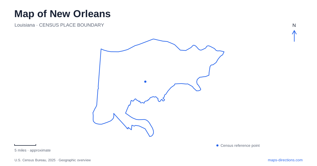
Street tiles load from OpenStreetMap when opened. The blue line shows the 2025 Census boundary.
- State
- Louisiana
- Population · July 2025
- 362,154
- Land area
- 169.6 sq mi
- Water area
- 180.3 sq mi
New Orleans takes much of its shape from the Mississippi River's bends and the land between the river and Lake Pontchartrain. Local references to riverside, lakeside, Uptown, and Downtown reflect that setting. A compass remains useful, but the water provides another practical frame for understanding how neighborhoods and routes relate. The French Quarter's compact grid, the avenues leading inland, and the crossings toward Algiers each reveal a different part of the city's geography.
The original grid faces the Mississippi
In 1722, French military engineer Adrien de Pauger laid out the street grid that became the Vieux Carré, or French Quarter. The location served the strategic purpose of controlling movement along the Mississippi Valley. The river was central to the settlement's existence, not simply a scenic edge added to its streets.
Jackson Square, originally the Place d'Armes, preserves the public-square element of that plan. The space served ceremonial and military gatherings and faces the riverfront. Decatur Street and the streets around the square help locate it within the neighborhood rather than at the geographic center of the modern city.
The Quarter's ordered blocks meet a much less regular river. That contrast is one of the clearest features on a New Orleans map: a compact planned district follows the edge of a powerful curving waterway. Later neighborhoods expanded beyond it without erasing the original arrangement.
Esplanade connects the river with City Park
Esplanade Avenue begins near the Mississippi levee and continues to the entrance of City Park. Its inland course recalls an older portage connection associated with trade between Bayou St. John and the river. The avenue provides a direct geographic relationship between two landscapes that otherwise appear as separate visitor areas.
At the park approach, North Carrollton Avenue and Wisner Boulevard meet the end of Esplanade. The park then opens into a much larger system of gardens, water, recreation grounds, and wooded space. The Besthoff Sculpture Garden, Big Lake, Storyland, and Couturie Forest occupy different parts of that landscape.
Lakeview lies beside City Park toward the lakefront, with Harrison Avenue serving as a neighborhood shopping and dining corridor. Beyond it, marinas and the shore of Lake Pontchartrain introduce an expansive water setting quite different from the working Mississippi riverfront. This sequence gives New Orleans an inland-to-lake progression as well as a river-oriented one.
Streetcar names describe branching corridors
The St. Charles line follows a route through St. Charles Avenue and Carrollton Avenue, with stops including Jackson, Napoleon, Broadway, Willow, and Claiborne. Those names trace a long corridor through the urban area rather than a loop around the French Quarter.
The Canal routes have two distinct destinations. Route 47 is identified with the cemeteries, while Route 48 serves City Park and the Museum of Art. Their shared Canal Street section can make them look similar at first, but the branch destination is part of the route's identity.
The network also includes Rampart/Loyola and Riverfront services. Together, these lines provide several ways to relate central districts to the river and inland avenues. The RTA route map is particularly useful for seeing where the corridors overlap and where they separate. Temporary service changes around parades or construction are a separate layer from this underlying geography.
Downriver neighborhoods regain waterfront space
Marigny and Bywater lie downriver from the historic center. Crescent Park follows the Mississippi beside these neighborhoods, with walking and cycling space along a former working waterfront setting.
Railroad tracks remain part of the landscape between neighborhood streets and the water. Bridges over those tracks connect the park with nearby blocks, showing how new public access has been fitted around existing transport infrastructure. The riverfront is therefore reached through designed connections rather than by extending every street directly to the shore.
The Lafitte Greenway offers a different example of reused infrastructure within New Orleans. It follows a former railroad and canal corridor from the Basin and St. Louis streets area toward North Alexander Street in Mid-City. This inland route contrasts with Crescent Park's waterfront alignment, while both add recreational movement outside the ordinary street grid.
Algiers is connected across the bend
The Canal Street–Algiers Point ferry crosses the Mississippi to a neighborhood on the opposite bank. The route's history dates to 1827, making it a longstanding connection within the city.
Current Canal–Algiers boats serve pedestrians, and the terminal's former vehicle-ferry arrangement has shaped its redevelopment. The distinction explains why a ferry line on a map does not imply a car crossing. From Algiers Point, the view back across the water also makes the river's role in New Orleans especially clear: it connects neighborhoods through transport while giving each bank a different urban setting.
Map and statistics: U.S. Census Bureau, 2025 Gazetteer, January 2025 generalized place boundaries and Vintage 2025 population estimates. Local references: New Orleans & Company; National Park Service; City of New Orleans; City Park Conservancy; Regional Transit Authority. Article prepared by Maps & Directions.