Map of New Haven
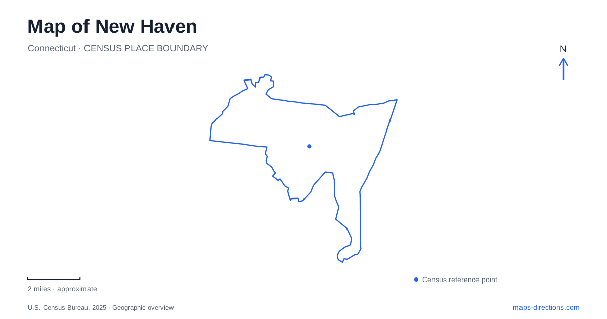
Street tiles load from OpenStreetMap when opened. The blue line shows the 2025 Census boundary.
- State
- Connecticut
- Population · July 2025
- 138,774
- Land area
- 18.7 sq mi
- Water area
- 1.4 sq mi
New Haven has a compact planned center framed by much larger natural landmarks. Its original nine-square street arrangement supplies a clear starting point, while the harbor and the two prominent traprock ridges explain the wider landscape. University buildings, churches, shops and museums occupy parts of this framework rather than forming one isolated campus. Reading the center first and then following the streets outward reveals how a seventeenth-century settlement became a place of overlapping civic, educational and industrial activity.
The central square and its public history
The New Haven Green occupies the middle parcel of the nine-square plan laid out in 1638. That central position gives the open space a stronger organizing role than a small neighborhood park. Streets divide surrounding blocks into a recognizable pattern, and the Green remains a reference point even where later development has made the city less regular. The historic commons also has an unusual ownership history: the Proprietors, a private body, have maintained its ownership rather than simply transferring the whole parcel into ordinary municipal park administration.
Three churches erected between 1812 and 1816 give the open ground its distinctive architectural grouping. Center Church and United Church represent the Federal period, while Trinity Church introduces an early Gothic Revival form. Their proximity makes differences in shape and architectural vocabulary visible within one short stretch of landscape. The buildings belong to separate congregations, despite appearing together as a familiar civic ensemble.
The Green also carries history that a conventional sightseeing map can easily obscure. The Amistad captives were held in a jail on its east side during 1839 and 1840 and exercised on the commons. Supporters gathered nearby. Understanding that episode changes the meaning of the space: lawns and church fronts also mark a setting in a major struggle over enslavement and freedom.
Chapel Street's two art institutions
Chapel Street connects everyday commercial frontage with major university collections. In New Haven, this combination makes the arts district part of the street itself, with museum visits interwoven with the surrounding blocks. The Yale University Art Gallery stands at 1111 Chapel Street, at York Street. Its architectural history includes Louis Kahn's 1953 building, an important landmark in the university's development of modern museum space.
The Yale Center for British Art has a separate address at 1080 Chapel Street and a different collection and institutional identity. Kahn also designed its building, which grew from Paul Mellon's gift and opened in the 1970s. A major conservation project concluded with the center's reopening in March 2025. Preserving the architect's treatment of materials and daylight was part of that work. The two museums therefore offer an unusually close comparison of one architect's ideas across different commissions, rather than two interchangeable names for the same attraction.
Whitney Avenue and natural history
The Peabody Museum at 170 Whitney Avenue extends the museum geography beyond Chapel Street. Its major renovation began in 2020 and was completed in 2024, reshaping a longstanding institution rather than creating an entirely new museum. The building's position along Whitney provides another way to understand the university: academic and cultural destinations continue along corridors beyond the most familiar central courtyards.
Nearby, the Environmental Science Center at 21 Sachem Street contains laboratories, classrooms, collections and administrative functions. That relationship between public exhibition and research space is significant. A museum symbol on a map identifies the visitor destination, while adjacent academic buildings explain the larger setting in which specimens are studied and cared for. They are not all equivalent public galleries.
East Rock and the Mill River landscape
East Rock rises above the Mill River valley at the border with Hamden. For New Haven, the ridge is both a skyline landmark and evidence of the region's geological structure. Resistant traprock remained prominent as surrounding softer rock eroded, leaving steep faces that contrast sharply with the relatively level central street grid. The rock reaches roughly 350 feet above the valley, so its visual prominence exceeds what a small map symbol suggests.
The municipal park encompasses about 425 acres. College Woods and the ranger station near Cold Spring and Orange streets belong to its lower landscape, while the ridge creates a different, elevated setting. The park's paved roads and walking trails also serve distinct purposes: the city limits bicycles to paved roads. The wooded slopes should not be interpreted as a continuation of the downtown cycling network simply because paths appear on the map.
West Rock's long ridge
West Rock Ridge State Park has a more elongated form, following a ridge for about six miles toward Bethany. Its South Overlook offers views across the harbor, Long Island Sound and surrounding landmarks. Baldwin Drive, built through the Works Progress Administration in the 1930s, now provides a car-free corridor for walking and cycling. The blue-blazed Regicides Trail follows a different recreational line along the ridge.
Judges Cave adds another historical layer. Edward Whalley and William Goffe, wanted for their involvement in the execution of Charles I, hid here in the seventeenth century. The name connects a rocky shelter with political events far beyond Connecticut. Taken together, the Green, museum streets and two ridges make New Haven legible at several scales: a planned center, an expanding university setting and a landscape shaped by resistant rock and river valleys.
Map and statistics: U.S. Census Bureau, 2025 Gazetteer, January 2025 generalized place boundaries and Vintage 2025 population estimates. Local references: National Park Service; Yale Center for British Art; Yale University Art Gallery; Yale Peabody Museum; City of New Haven; Connecticut State Parks. Article prepared by Maps & Directions.