Map of New Brunswick
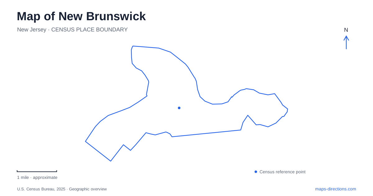
Street tiles load from OpenStreetMap when opened. The blue line shows the 2025 Census boundary.
- State
- New Jersey
- Population · July 2025
- 57,133
- Land area
- 5.2 sq mi
- Water area
- 0.5 sq mi
New Brunswick brings a university, a downtown rail hub and a historic riverfront into a relatively compact urban setting. Albany Street and George Street are useful downtown references, while College Avenue identifies one part of Rutgers. Cook and Douglass form a different campus setting, with gardens, farm activity and performance spaces. The Raritan River creates a major geographic division across the wider university community, which extends into Piscataway. Understanding these separate areas is essential: a university destination may lie well beyond the downtown streets suggested by its institutional name.
Arriving around Albany Street
New Brunswick Station serves NJ Transit's Northeast Corridor at French and Albany streets, between Easton Avenue and George Street. This location places rail travel directly into the downtown street network. The station's different platforms and street-level facilities make it a point of transition between a regional journey and the smaller scale of walking through city blocks.
The rail station and Rutgers should not be treated as one destination. An arrival near Albany Street may be convenient for part of the university, but the institution spans several campus centers. A building name and campus designation are therefore more useful than simply asking for directions to the university. Rutgers publishes separate maps for College Avenue, Cook/Douglass, Busch, Livingston and downtown facilities, reflecting those real geographic distinctions.
George Street is another useful reference because it appears in approaches to both downtown and university destinations. Keeping Albany Street, George Street and the campus name together gives an arriving visitor a workable orientation without assuming that every academic building lies within the same cluster.
College Avenue and the arts downtown
The College Avenue area holds the oldest Rutgers campus setting in New Brunswick. The university identifies it with the historical Old Queens campus. Nearby, the Zimmerli Art Museum stands at 71 Hamilton Street and offers public admission, giving visitors a cultural destination that does not depend on being a student.
Hamilton Street is worth retaining as the museum's specific address. A university art museum belongs to the academic community, but its entrance and visiting arrangements are those of an individual institution. Its gallery schedule can also differ from the rhythm of lectures or administrative offices elsewhere on campus.
State Theatre New Jersey supplies another major arts address at 15 Livingston Avenue. The theater describes the rail station as only a few blocks away and identifies several public parking decks within walking distance. This creates a different kind of outing from a campus tour: a performance can be organized around the downtown streets, a meal and the walk between a deck or station and the theater. The museum and theater enrich the same city center while occupying distinct addresses and schedules.
Cook and Douglass beyond the central blocks
Cook and Douglass give New Brunswick a more open university landscape. Cook's environmental and biological sciences identity is expressed through research fields, farm activity and its relationship with Rutgers Gardens. Douglass combines residential college life with historic buildings and arts facilities.
Passion Puddle is a recognizable landscape feature within this area, while the Ravine Bridge, often called the Kissing Bridge, spans a wooded gorge near the performing arts facilities. Those features make campus geography more varied than a sequence of classroom buildings. Water, slopes and green space help organize movement and create landmarks that remain useful even when individual academic destinations are unfamiliar.
George Street and Nichol Avenue are important approach references in the university's directions for this area. The Cook/Douglass map then distinguishes smaller roads such as Dudley Road, Lipman Drive and College Farm Road. A visitor attending a recital, finding a student center or exploring agricultural spaces will use different parts of that network. The campus designation gets the journey into the right area; the named building and internal road identify the final destination.
Boyd Park and the canal edge
Boyd Park opens New Brunswick toward the Raritan River and preserves another transport story. Its riverfront landscape includes the historic Delaware and Raritan Canal edge, outlet locks and a swing bridge. The park's redevelopment restored these elements and added interpretation explaining the waterway's history.
The canal and river should be understood together. The river supplied the broader natural corridor, while the engineered canal created a controlled route for movement and commerce. At the park, surviving structures make that relationship visible in a way that a modern road map alone cannot convey.
A towpath walk here offers a different perspective from the downtown buildings or university grounds. The city skyline becomes a backdrop, while the water and old transport infrastructure occupy the foreground. Combining a riverfront visit with the arts or a campus stop reveals several versions of the same urban place: a rail-connected center, a university community and a former canal gateway.
Map and statistics: U.S. Census Bureau, 2025 Gazetteer, January 2025 generalized place boundaries and Vintage 2025 population estimates. Local references: NJ Transit; Rutgers University; Zimmerli Art Museum; State Theatre New Jersey; New Brunswick City Market. Article prepared by Maps & Directions.