Map of New Britain
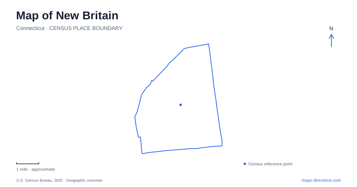
Street tiles load from OpenStreetMap when opened. The blue line shows the 2025 Census boundary.
- State
- Connecticut
- Population · July 2025
- 76,286
- Land area
- 13.4 sq mi
- Water area
- 0.1 sq mi
New Britain is particularly interesting on a map because its cultural destinations occupy very different kinds of urban space. An art museum meets the edge of a landscaped hill park, an industrial collection has moved among downtown buildings, and a dedicated bus corridor connects the center with Hartford. Reading those places together reveals more than a list of attractions: it shows how public landscape, manufacturing memory, and regional transportation fit into a compact Connecticut city.
A hill and a common west of downtown
Walnut Hill Park has two landscape personalities. Its elevated ground provides the dramatic feature, while the lower meadow creates a broad, open common encircled by paths. The National Park Service describes the 1870 commission given to Olmsted, Vaux & Co. and explains that the lower portion follows the designers' intentions more closely than the summit. The proposed winding ascent and overlook were never completed as envisioned. A ninety-foot obelisk erected in 1930 occupies the high point instead.
That distinction gives a park walk a useful structure. The perimeter of the open lawn and the ascent toward the monument represent different experiences within the same green space. The municipal directory identifies a one-mile walking loop, rose garden, view pavilions, and Darius Miller Concert Shell, alongside playing fields and tennis courts. This is a designed civic landscape with active recreation woven into it, rather than an undeveloped woodland preserve. West Main Street provides the park's published general address, while individual attractions also appear under more specific locations.
American art beside the park
The New Britain Museum of American Art stands at 56 Lexington Street. Its relationship to Walnut Hill Park makes the museum and the outdoor landscape a natural geographical pairing. The institution describes a collection spanning more than three centuries, with strengths including colonial portraits, Hudson River School painting, American Impressionism, and the Ash Can School. Thomas Hart Benton's mural series, The Arts of Life in America, gives the collection another distinctive reference point.
Lexington Street is therefore more than a convenient museum address: it marks the meeting of an indoor cultural destination and the park's outdoor setting. The museum identifies parking on its own property, additional space toward Park Place, and street parking along the park side. Its accessible entrance ramp sits to the right of the main parking area. Those details explain why the museum's arrival pattern differs from simply choosing the nearest point inside the large green park polygon.
Industrial history with a changed downtown address
The industrial museum preserves another side of New Britain, collecting objects associated with more than two centuries of invention and manufacturing. Its relocation is a real cartographic trap. The institution identifies 30 High Street as its new home, behind the public library, and explicitly warns that navigation systems may still return its previous addresses at 59 West Main Street or 185 Main Street.
These addresses represent successive museum locations, not three branches. Confirm the museum's visitor address and public access arrangements before planning a collection-focused visit. Even without assuming an opening date, the move is useful context for reading older visitor material: a downtown heritage map can remain geographically plausible while pointing to a building the organization has left.
A bus corridor with three different local stations
CTfastrak adds a strong regional line to the New Britain map. The system uses a dedicated 9.1-mile busway toward Hartford; it should be understood as bus rapid transit even where station platforms and the separated corridor resemble rail infrastructure. Downtown station is at Main Street and Columbus Boulevard. East Main Street station lies between Wilson and Harvard streets, while East Street station is at 1299 East Street. The similar names describe separate places along the corridor.
The parallel multi-use trail offers another way to understand this transportation spine. Its approximately five-mile paved route runs from downtown to Newington Junction. A fence separates it from bus operations, and an East Street detour negotiates a constrained underpass before the trail rejoins the corridor. Consequently, the walking and cycling line is related to the busway without being an exact uninterrupted trace beside it.
Separate parks for separate activities
The wider New Britain park network provides useful contrasts to Walnut Hill. Stanley Quarter Park, at 451 Blake Road, combines a pond, a short walking circuit, a skate park, and sports facilities. A.W. Stanley Park is a separate destination at 2159 Stanley Street, with its own pond, nature trail, picnic areas, and pools. Willow Brook Park on South Main Street concentrates major athletic facilities, including distinct baseball and multipurpose stadium spaces. These names describe a distributed recreation system: landscape history, neighborhood recreation, and large sporting venues each occupy their own setting.
Map and statistics: U.S. Census Bureau, 2025 Gazetteer, January 2025 generalized place boundaries and Vintage 2025 population estimates. Local references: National Park Service; City of New Britain; New Britain Museum of American Art; New Britain Industrial Museum; CTtransit. Article prepared by Maps & Directions.