Map of National City
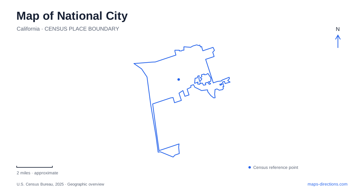
Street tiles load from OpenStreetMap when opened. The blue line shows the 2025 Census boundary.
- State
- California
- Population · July 2025
- 57,807
- Land area
- 7.3 sq mi
- Water area
- 2.0 sq mi
National City has a waterfront shaped by working maritime facilities as well as recreation. Inland, numbered streets and lettered avenues help locate older civic and residential landmarks. Between these settings, rail corridors connect a nineteenth-century depot story with present-day Trolley travel. A useful first view of the map therefore includes three places: the A Avenue historic area, the West 23rd Street depot and the marina district beside Pepper Park. Each reveals a different part of how the community developed.
Brick Row and the older townscape
At 909 A Avenue, Brick Row is one of the most distinctive historic addresses in National City. Frank Kimball built its ten row houses in 1887 for Santa Fe Railroad executives. Architect R. C. Ball used an eastern row-house form associated with cities such as Philadelphia, bringing an unfamiliar architectural pattern into the local landscape.
The long wooden porch and continuous brick frontage make the building read as a single composition, although its units are individually owned. Its preserved exterior is part of Heritage Square. For a visitor, this is best understood as a historic residential streetscape rather than a large public institution with unrestricted interiors. The relationship between one long facade and several separate homes is central to what makes the site interesting.
Nearby historic addresses carry the same early development story into other uses. St. Matthews Episcopal Church stands at 521 East 8th Street on land donated by the Kimball brothers. The city's historic inventory identifies the church's English countryside inspiration. Together, the houses and church show that the railroad-era settlement involved domestic and community buildings as well as industrial infrastructure.
The railroad district around West 23rd Street
The Santa Fe Rail Depot at 922 West 23rd Street dates to 1882. Its location provides a second historical focus in National City, apart from the A Avenue buildings. The restored depot functions as a railroad museum and community meeting place. Nearby, the railcar display at 840 West 24th Street preserves an 1887 passenger car associated with the old Motor Cannon Ball service.
These addresses are close in street numbering, but the depot building and railcar display are separate historic objects. Seeing them together makes the passenger railway story easier to grasp: one represents the station where journeys were organized, while the other shows the vehicle in which people traveled. They also help explain why rail infrastructure remains such a strong feature of the western side of the city.
Modern rail travel uses the UC San Diego Blue Line. MTS lists the 8th Street station at 555 West 8th Street and the 24th Street station's parking address at 506 West 22nd Street. That second address is a useful local wrinkle: the station name and the street used for its listed parking approach are different. The historic depot is also distinct from both modern Trolley stops, so a museum visit and a rail commute should be planned with separate destination names.
Pepper Park and the working bayfront
Pepper Park places National City visitors beside the marina landscape. The Port of San Diego describes the approximately 5.2-acre park as adjacent to Pier 32 Marina, with a boat launch, fishing pier, floating dock, picnic facilities and an aquatic center. Recreation here shares the wider bayfront with marine terminal activity; it is a pocket of public waterfront within a larger working coastal district.
The park's first phase of improvements was completed in spring 2026. Added features include a splash pad, pirate-themed playground, hillside play area, overlook terrace and a perched beach. Development plans also describe a separate expansion of roughly 2.5 acres. Keeping the phase boundaries distinct helps explain project drawings, while the park's facility information establishes the grounds and entrances available for a visit.
A portion of the Bayshore Bikeway also belongs to the broader bayfront setting. For a waterfront outing, the marina, aquatic center and park offer several different reasons to use this part of the city. Boating access, a fishing visit and children's play are concentrated near one another, while the surrounding maritime land uses remain important to the area's character.
Civic recreation around East 12th Street
Kimball Park supplies National City with a central recreation setting inland from the bayfront. The city identifies the park along East 12th Street, with the 12th Street and D Avenue area serving as a familiar location reference. The public library lies nearby on the main boulevard, and civic and community facilities cluster around the park rather than beside the marina.
This creates a useful division for a day of exploration. The A Avenue historic buildings and the East 12th Street civic area belong to the older urban streetscape; the depot and railcar tell the transport story farther west; Pepper Park opens onto the bayfront. Moving between them follows the city's actual layers of development, from homes and public institutions to railway infrastructure and the water that helped give the settlement its regional role.
Map and statistics: U.S. Census Bureau, 2025 Gazetteer, January 2025 generalized place boundaries and Vintage 2025 population estimates. Local references: City of National City; San Diego Metropolitan Transit System; Port of San Diego; San Diego Electric Railway Association. Article prepared by Maps & Directions.