Map of Nashua
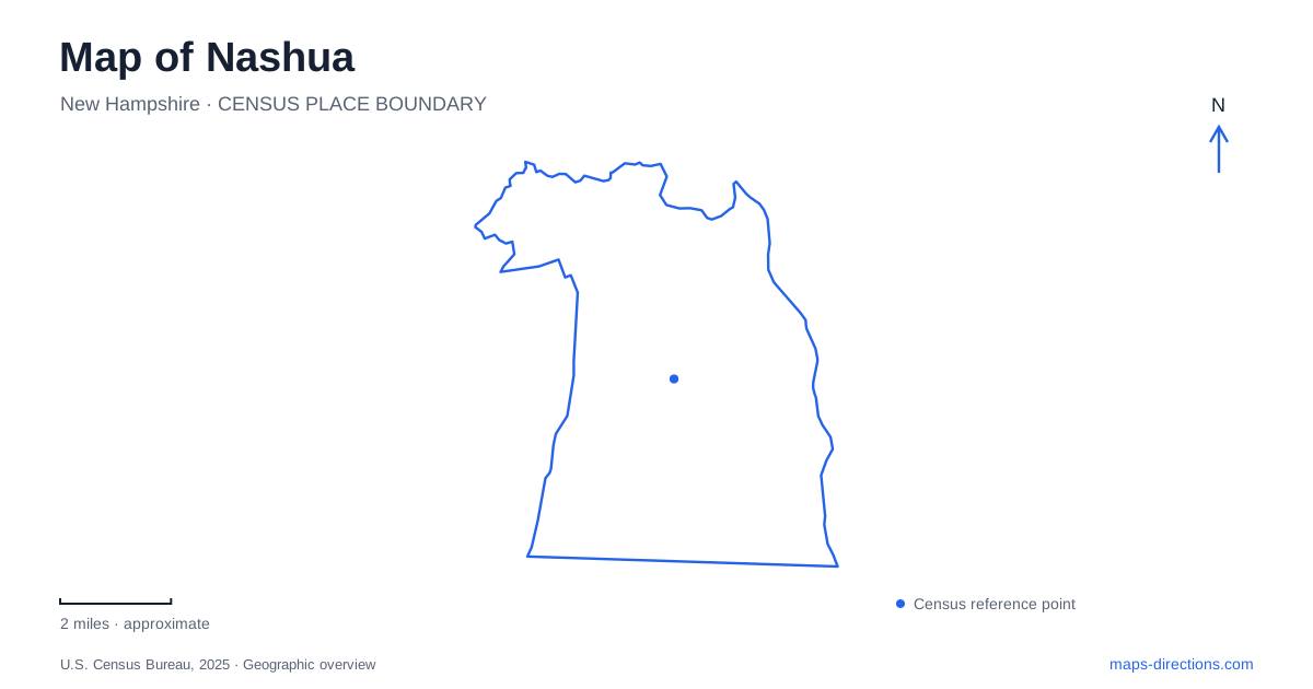
Street tiles load from OpenStreetMap when opened. The blue line shows the 2025 Census boundary.
- State
- New Hampshire
- Population · July 2025
- 92,435
- Land area
- 30.8 sq mi
- Water area
- 0.9 sq mi
Nashua grew around moving water, and its map still makes that relationship unusually clear. The city's namesake river meets the Merrimack, while a historic canal follows a separate course through a broad recreational landscape. Downtown streets, former industrial land, park trails, and baseball history occupy different parts of this setting. Following the waterways first helps explain why the city has both a compact Main Street corridor and an extensive wooded park near its center.
A river and canal with different jobs
Mine Falls Park covers 325 acres between the river on its northern side and the Mill Pond canal system to the south. Woods, wetlands, open fields, and sports facilities share the site. The canal was an industrial undertaking: workers using shovels and mules excavated a three-mile channel that delivered a 36-foot water drop to the mills. This engineered route helps explain the shape of a landscape that can otherwise look simply like a large patch of woodland.
The gatehouse near the falls dates to 1886, replacing earlier gates first built in 1826. It still directs river water toward Mill Pond. A hydroelectric plant added in 1984 extends the site's relationship with waterpower into a later period. The canal and former manufacturing district entered the National Register of Historic Places in 1987, recognizing the connected industrial landscape rather than one isolated building.
A Nashua outing here can therefore combine natural and industrial history. Water, banks, channels, and surviving structures describe how energy once reached the mills. The park's modern recreational role adds another chapter without erasing that underlying arrangement.
Choosing a route through Mine Falls
The city's trail map marks Whipple Street, Lincoln Park, the high-school grounds, Mill Pond, and the gatehouse as reference points around the trail system. It distinguishes bridges, stairways, fishing access, and marked routes. Those details are more useful for planning a walk than the park's overall acreage because the canal and river create long edges with particular crossing opportunities.
The published map also distinguishes prominent trails from secondary paths and warns that some secondary routes may not suit strollers or small children. For a family walk, a bridge-and-path route can be chosen before entering the woods. A visit centered on the gatehouse has a different purpose from an outing to the sports fields along Whipple Street, even though both fall within the same park landscape.
Main Street's performance and civic blocks
The Nashua Center for the Arts stands at 201 Main Street. Its visitor directions identify Elm Street Garage at 19 Elm Street as the closest parking option and also list Spring Street Lot and the High Street and School Street garages. This makes the surrounding side streets part of the arrival experience for a Main Street performance.
Parking access deserves particular attention when choosing between downtown garages. A nearby space is not necessarily the best choice for someone who needs an elevator or a step-free route to the theater. High Street Garage, its stairways and its elevator are separate parts of the arrival plan. Use the city's parking and accessibility information to confirm a suitable approach, and respect coned-off areas instead of treating a short map distance as proof of an accessible walk.
The downtown parking map shows the river crossing, Canal Street, library area, Main Street, West Pearl Street, and City Hall within one connected district. It also separates street spaces from garages and surface lots. This finer view is useful when combining an evening performance with another downtown stop.
Concord Street and the park landscape
Greeley Park occupies a different setting along Concord Street. Its bandshell at 100 Concord Street hosts many municipal SummerFun events, while the park also includes playing fields, tennis, picnic areas, a playground, and trails. The wading pool is intended for small children, distinguishing it from the city's larger swimming facilities.
The municipal Route 1 bus serves Greeley Park as well as Concord Street, Manchester Street, French Hill, Canal Street, and the Main Street Bridge. Its service pattern connects the park with surrounding neighborhoods and the transit center at 30 Elm Street. For a Nashua map reader, that route provides a useful picture of how the northern park corridor relates to downtown streets.
Baseball history on Amherst Street
Holman Stadium occupies the community recreation property at 67 Amherst Street. Built in 1937 with support from Charles Frank Holman and New Deal funding, it was designed by local architect Philip S. Avery. Roy Campanella and Don Newcombe played there for the local Dodgers affiliate in 1946, making the stadium an important place in baseball's integration history.
The site brings a different kind of historical evidence to Nashua: a working sports setting associated with consequential players and events. Seen alongside the canal, Main Street performance venue, and Concord Street park, it broadens the map beyond either a shopping corridor or a single riverfront attraction.
Map and statistics: U.S. Census Bureau, 2025 Gazetteer, January 2025 generalized place boundaries and Vintage 2025 population estimates. Local references: City of Nashua; Nashua Center for the Arts. Article prepared by Maps & Directions.