Map of Nampa
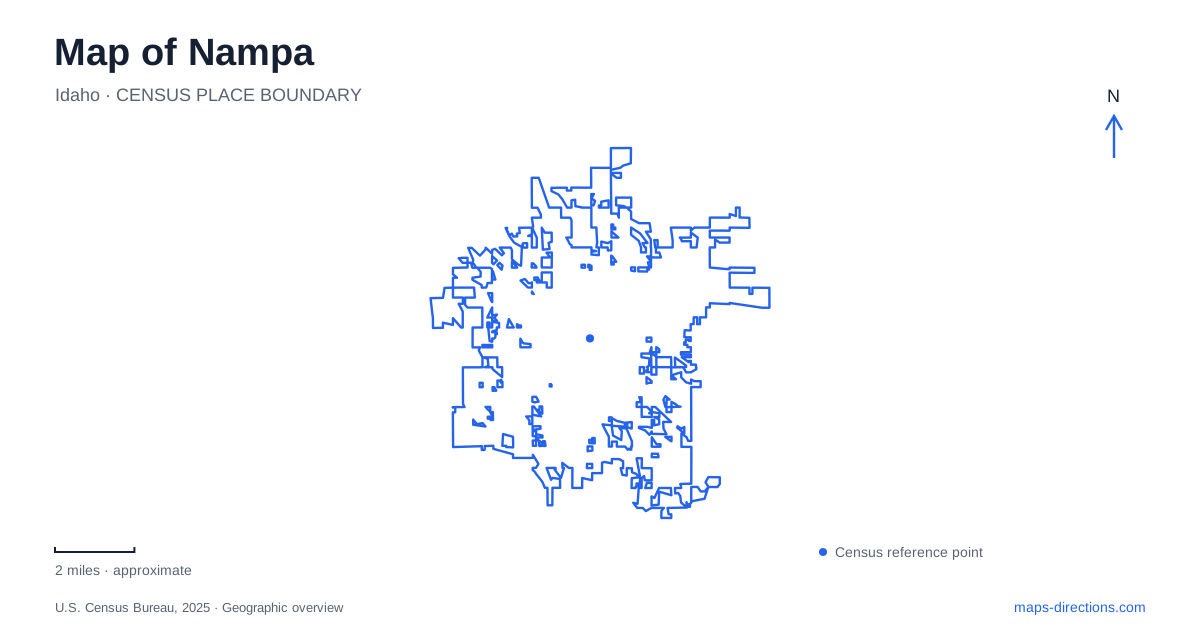
Street tiles load from OpenStreetMap when opened. The blue line shows the 2025 Census boundary.
- State
- Idaho
- Population · July 2025
- 120,384
- Land area
- 36.1 sq mi
- Water area
- 0.2 sq mi
Nampa has a railroad-centered downtown and several outdoor destinations whose similar names can conceal different locations. The historic commercial blocks, Lakeview Park, Wilson Creek, Wilson Springs, and Lake Lowell each need their own place on the map. The most useful starting point is the relationship between a named destination and its street or landscape, rather than a general search for downtown, a lake, or a greenway. That approach reveals both the city's development history and the different scales of its recreation areas.
Railroad history is written into the downtown blocks
The city's historic district description centers on First Street South between Twelfth and Fourteenth avenues. This is a compact commercial area associated with building activity in the early twentieth century. It provides a specific starting window for a downtown map, rather than requiring a visitor to infer the historic center from whichever business happens to appear first in a search.
The railroad depot is another important reference in Nampa. The city's history identifies the 1903 passenger station as the building now associated with the county historical society and museum. The downtown map also marks Front Street, the numbered avenues, an Eleventh Avenue underpass, and a Sixteenth Avenue overpass. Those crossings help explain movement across the railway setting rather than treating the tracks as an invisible line beneath the street network.
A major fire in 1909 destroyed the block between Twelfth and Thirteenth avenues and First and Front streets. Knowing that particular block gives the rebuilding story a geographic location. It also explains why the age and appearance of the commercial buildings need not correspond to the city's earliest settlement period.
The modern downtown description identifies Library Square, Lloyd Square Park, and the depot museum as landmarks. Together they offer several different reasons to spend time within the urban core. A library visit, a park gathering, and a historical walk can use the same small street network while remaining distinct destinations.
Lakeview is a city park, not Lake Lowell
Lakeview Park occupies the Garrity Boulevard and Sixteenth Avenue setting. The city lists a pond, rose garden, amphitheater, sports facilities, playground, and swimming pool among its features. This is a developed urban park with several recreation uses, not an access point to the much larger reservoir outside the downtown area.
On a Nampa map, keeping Lakeview and Lake Lowell separate resolves an easy naming confusion. One search leads to a neighborhood-scale collection of facilities near Garrity; the other leads toward a broad lake and wildlife refuge landscape. The word lake in a destination name does not identify the same water body or the same kind of outing.
For Lakeview, the relevant detail is the particular facility within the park. The rose garden and pool belong to one park setting, but a gathering organized around either still benefits from that specific name. The surrounding road intersection gives the larger orientation.
Wilson Creek and Wilson Springs serve different visits
Wilson Creek Park is at 2608 South Juniper Street. The city describes it as a neighborhood park with play areas, a walking trail, and access to the Wilson Creek Greenway Trail. That combination makes it useful for a local park visit or as a point of entry to a longer greenway outing.
Wilson Springs, by contrast, is a fishing pond complex reached from South Powerline Road. Idaho Fish and Game identifies paved pathways to fishing areas as well as unimproved shoreline paths. Trophy Pond is one named water within the complex. A Nampa itinerary that abbreviates either destination to Wilson loses the distinction between a neighborhood greenway park and a fishing-focused pond area.
Retaining Juniper or Powerline alongside the destination name makes the difference clear. It also avoids assuming that a route through one Wilson site automatically continues into the other. Their shared name is less useful for navigation than their separately documented roads and facilities.
Lake Lowell requires a refuge-scale map
Deer Flat National Wildlife Refuge encompasses the Lake Lowell setting. The federal visitor directions approach its visitor center using Karcher Road, Lake Avenue, Roosevelt Avenue, and the entrance at Indiana Avenue. This sequence establishes a particular visitor-center approach rather than suggesting that any road reaching the reservoir leads to the same facilities.
The refuge identifies the East Dike Trail and the Swallow Nest Trail across the Upper Dam as distinct options for exploring the landscape. It also distinguishes the Lake Lowell unit from its Snake River Islands unit. These names belong to a larger regional geography than the city's urban parks.
For a trip beginning in Nampa, choose whether the goal is the visitor center, a named refuge trail, or another permitted lake activity. That decision determines which part of the reservoir map matters. Combined with the downtown blocks and the separate city parks, it produces an itinerary grounded in actual places rather than a list of similarly named water and recreation destinations.
Map and statistics: U.S. Census Bureau, 2025 Gazetteer, January 2025 generalized place boundaries and Vintage 2025 population estimates. Local references: City of Nampa; Idaho Fish and Game; U.S. Fish and Wildlife Service. Article prepared by Maps & Directions.