Map of Murfreesboro
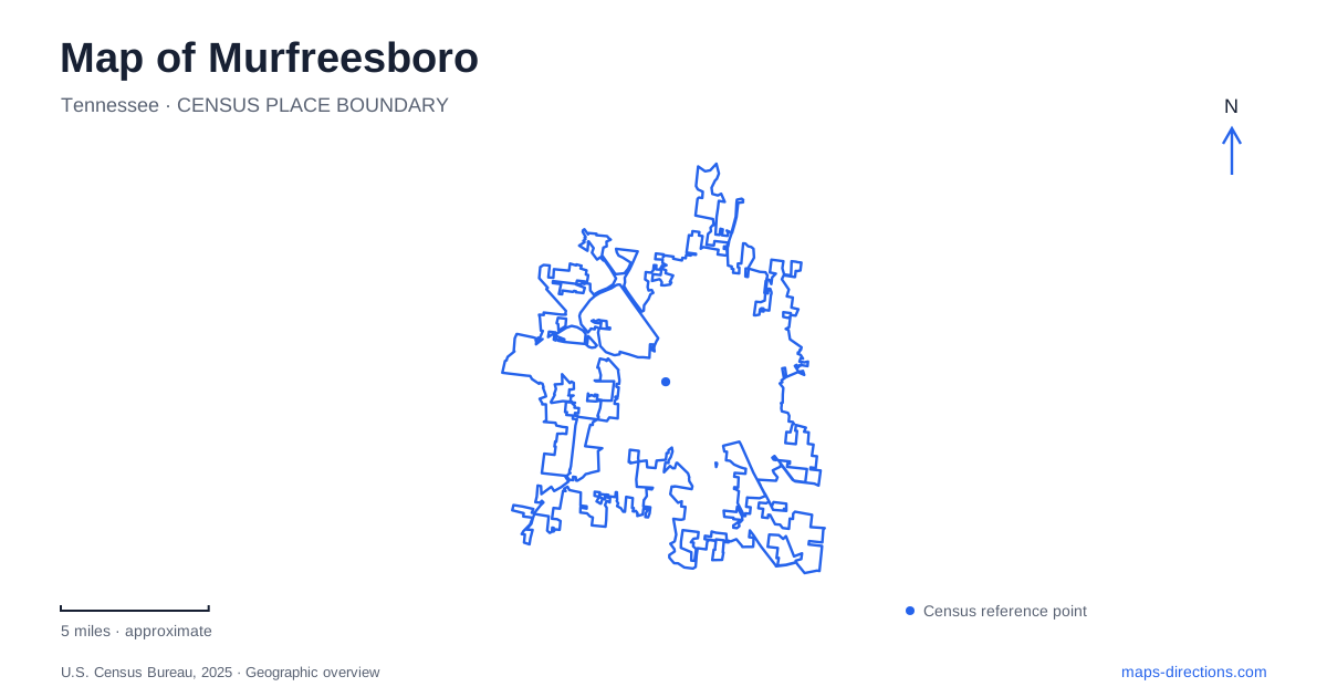
Street tiles load from OpenStreetMap when opened. The blue line shows the 2025 Census boundary.
- State
- Tennessee
- Population · July 2025
- 171,178
- Land area
- 64.8 sq mi
- Water area
- 0.1 sq mi
Murfreesboro brings together a courthouse-centered downtown, a major Civil War landscape, and a university that began as a teacher-training school. The Stones River and Lytle Creek provide another framework, carrying greenways between historic places and modern neighborhoods. These elements are related without occupying one continuous historic district. A useful map separates the courthouse square from the battlefield parcels, then shows how paths and waterways connect parts of the broader landscape. That approach explains both the city's civic center and the dispersed places where important events unfolded.
The courthouse as a downtown reference
The Rutherford County Courthouse was completed in 1859. It stands at the center of the public square, continuing a civic arrangement established when land was reserved for county government. The square provides a clear urban reference point: surrounding streets and businesses face an institutional center rather than a river landing or a university lawn.
The courthouse museum connects the building with local historical interpretation through a partnership involving county archives and Middle Tennessee State University's Center for Historic Preservation. This makes the square a place to consider the county's documentary history as well as its architecture.
For Murfreesboro, the courthouse is one layer of a larger civic story. Its location and age help orient downtown, but they do not mean that all of the city's most important historical sites lie immediately around the square. Military sites and educational institutions developed according to different needs and occupy their own settings.
A battlefield preserved in separate pieces
The Battle of Stones River took place from December 31, 1862, through January 2, 1863. The national battlefield preserves only part of the much larger area over which the fighting occurred. Its lands include separate parcels, a crucial point when interpreting a map of the park.
The visitor center at 3501 Old Nashville Highway provides the principal orientation point. Completed in 1964 as part of the National Park Service's Mission 66 improvements, it represents a later period of public interpretation layered onto the wartime landscape. The national cemetery contains more than 6,100 Union soldiers, including many whose names remain unknown.
This combination of battlefield ground, cemetery, and visitor facilities gives Murfreesboro a landscape of conflict and commemoration extending beyond one attraction symbol. The preserved boundary does not reproduce the entire historical battlefield. Understanding that distinction helps make sense of interpretive stops separated by modern development and roads.
The fortress belongs to the battle's aftermath
Fortress Rosecrans was constructed by the Army of the Cumberland after the battle. Designed by James St. Clair Morton, the earthen defenses enclosed more than 200 acres and protected warehouses and the railroad. The installation's importance lay in supplying later Union campaigns, including the advance toward Chattanooga.
Only portions survive. The National Park Service preserves Lunettes Palmer and Thomas, Curtain Wall No. 2, and Redoubt Brannan. A remnant of another curtain wall lies on city property beside the Lytle Creek Greenway. These scattered remains explain why the fortress cannot be understood as a complete standing enclosure.
The earthworks add a logistical dimension to the history of Murfreesboro. The battlefield records combat; the fortress records the effort to hold and supply an army afterward. Native grasses help stabilize surviving earth, and paved paths and boardwalks allow visitors to examine the remains without walking on the defensive structures themselves.
Waterways connect historical and everyday places
The city's greenway system includes more than 17 miles of trails, bridges, and boardwalks. Stones River and Lytle Creek corridors link parks, neighborhoods, businesses, and historic resources. Named sections include the Fortress Rosecrans Loop, Murfree Spring Trail, and West College Street Spur, making the system a network with several purposes rather than one uninterrupted scenic circuit.
Cannonsburgh Village at 312 South Front Street offers a different form of historical interpretation near the downtown area. It represents Tennessee life from the 1830s through the 1930s, gathering a broad span of domestic and community history into one visitor setting. That interpretive range differs from the tightly focused wartime sites.
A university with teacher-training roots
Middle Tennessee State University opened in 1911 as a normal school with a two-year teacher-training program. It became a four-year teachers college in 1925 and a state college in 1943, reflecting the expansion of its academic mission. The original campus occupied 100 acres before growing into a much larger educational landscape.
These origins explain another major component of Murfreesboro beyond the courthouse and military history. The city contains places shaped by county administration, conflict, historical interpretation, and public education. Showing those settings alongside the river and creek corridors produces a map that is useful both for finding destinations and for understanding why they developed where they did.
Map and statistics: U.S. Census Bureau, 2025 Gazetteer, January 2025 generalized place boundaries and Vintage 2025 population estimates. Local references: Rutherford County Historical Society; Rutherford County Tourism; National Park Service; City of Murfreesboro; Middle Tennessee State University. Article prepared by Maps & Directions.