Map of Mount Pleasant
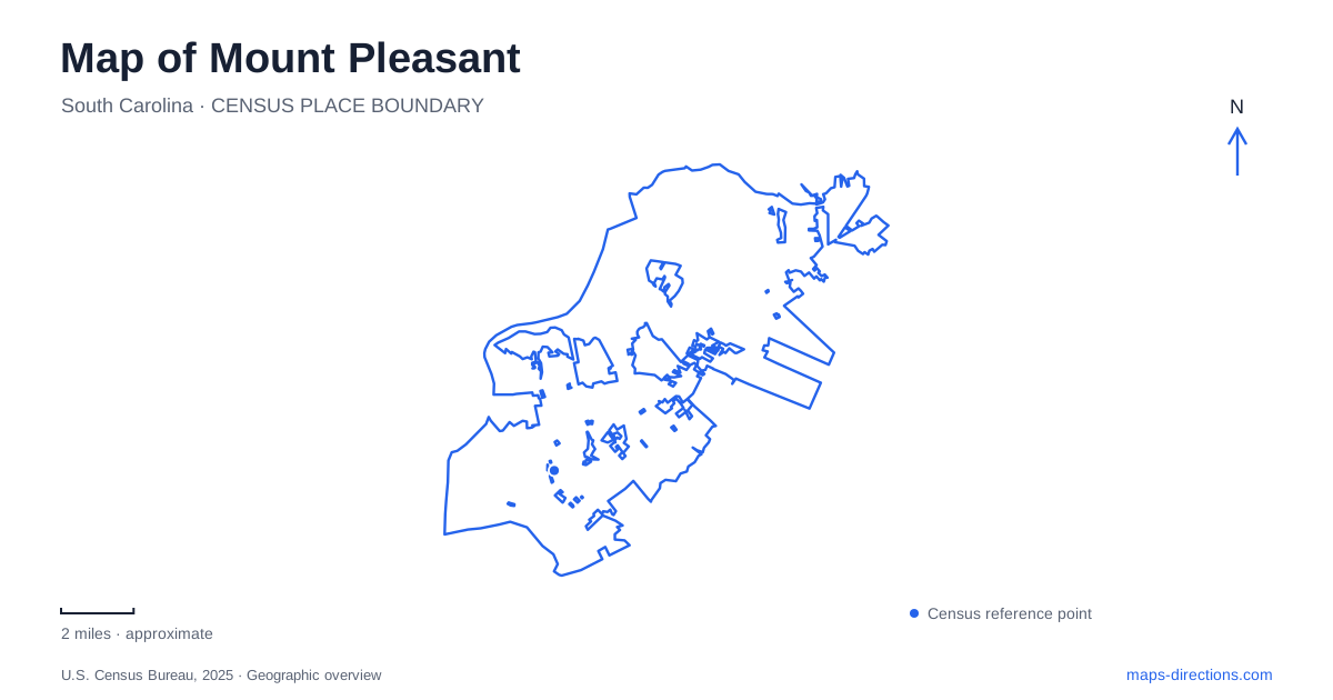
Street tiles load from OpenStreetMap when opened. The blue line shows the 2025 Census boundary.
- State
- South Carolina
- Population · July 2025
- 95,469
- Land area
- 49.8 sq mi
- Water area
- 8.9 sq mi
Mount Pleasant’s waterways create several distinct waterfronts. The Cooper River, Shem Creek, and the marshes around the Old Village each offer a different relationship between land and water. A map that treats them as one continuous waterfront misses the roads, bridge approaches, and tidal channels separating them. Coleman Boulevard provides an especially useful reference through the creek district, while the Ravenel Bridge marks the larger river crossing toward Charleston.
Coleman Boulevard and the creek district
Shem Creek meets Charleston Harbor, bringing boats, waterfront businesses, and public walking spaces into a relatively compact district. Coleman Boulevard crosses the creek and supplies its principal road corridor. Mill Street and Simmons Street help orient the boat-launch side of the area: the county-maintained landing is at their intersection. These smaller streets connect the waterfront’s practical maritime uses with the main road.
The public boardwalk has its own history of connections. An expansion arranged with the Simmons, Toler, and Fitch families brought access across previously private waterfront property. A pedestrian bridge over Jones Creek joined the extension to the original park, making a continuous path toward Coleman Boulevard. This is a useful detail when interpreting the smaller channels on a map. Jones Creek is part of the walking route’s geography, even when the larger Shem Creek name dominates the view.
The boardwalk reaches toward the creek mouth, with outlooks toward Crab Bank Island, Fort Sumter, and downtown Charleston. Information stations describe local history and ecology. The experience follows tidal water and marsh rather than a conventional street promenade, so the boardwalk’s bends and crossings are as important as its starting point.
A road crossing that now carries a longer cycling connection
A change to Mount Pleasant’s street network concerns the Coleman Boulevard bridge. The town completed marked bicycle lanes across Shem Creek between Pelzer Drive and Mill Street in 2025. The project filled a gap in more than a mile and a half of continuous bicycle lanes between Houston Northcutt Boulevard and Pherigo Street.
Those endpoints show the wider significance of a relatively short bridge project. The crossing ties together sections of a longer corridor; it is not simply a recreational loop around the creek. Someone comparing walking and cycling routes can therefore distinguish the boardwalk beside the water from the bicycle lanes following Coleman Boulevard. Both serve the same district, but they organize movement along different lines.
Pitt Street and the former island connection
Within the Old Village Historic District, Pitt Street Bridge preserves the alignment of a former trolley connection to Sullivan’s Island. It now serves recreation, with walking space and fishing access. The remaining bridge landscape makes the old transportation relationship visible even though it no longer functions as that through route.
For Mount Pleasant visitors, this is a particularly clear example of a map feature whose purpose has changed. The long approach through the coastal setting reflects a historical crossing, while its present use invites an out-and-back walk and time beside the marsh. Palmettos and open views distinguish it from the more commercial atmosphere along Shem Creek. The Old Village and the creek district can both be waterfront destinations without offering the same kind of outing.
Public space beside the Ravenel Bridge
Memorial Waterfront Park occupies the Cooper River setting beside the Arthur Ravenel Jr. Bridge. The pier’s county-listed address is 71 Harry Hallman Boulevard, while the visitor center is at 99 Harry M. Hallman Jr. Boulevard. These neighboring addresses place the riverfront facilities within the same larger park setting.
The Sweetgrass Cultural Arts Pavilion adds a cultural purpose to Mount Pleasant’s waterfront. Opened in 2009, it recognizes the region’s basket-making tradition. The town subsequently made its space available without charge to basket makers from east of the Cooper River. That role gives the pavilion meaning beyond its architectural appearance: it supports the continuation and presentation of a local craft.
The pier has its own operating rules within the larger park. Pets other than service animals are not permitted on it, and swimming beneath or around the structure is prohibited. The river-facing destination is therefore a pier and public gathering landscape, rather than a swimming beach.
Wetlands around Needlerush Parkway
Palmetto Islands County Park, at 444 Needlerush Parkway, introduces another water landscape. County property records show that wetlands account for most of its roughly 950 acres. Boone Hall Creek runs beside park infrastructure, including the Peninsula Center deck and boating facilities. The distinction between upland and wetland explains why the park’s broad mapped area contains a more selective network of trails and developed spaces.
This setting reveals Mount Pleasant’s geography at a smaller scale than the river bridge. Tidal creeks, wooded gathering areas, and marsh occupy adjoining parts of the park. Following marked paths keeps a walk within that designed access network while allowing the surrounding wetland landscape to remain the defining feature.
Map and statistics: U.S. Census Bureau, 2025 Gazetteer, January 2025 generalized place boundaries and Vintage 2025 population estimates. Local references: Town of Mount Pleasant; Experience Mount Pleasant; Charleston County Parks; Lowcountry Park Venues. Article prepared by Maps & Directions.