Map of Mount Juliet
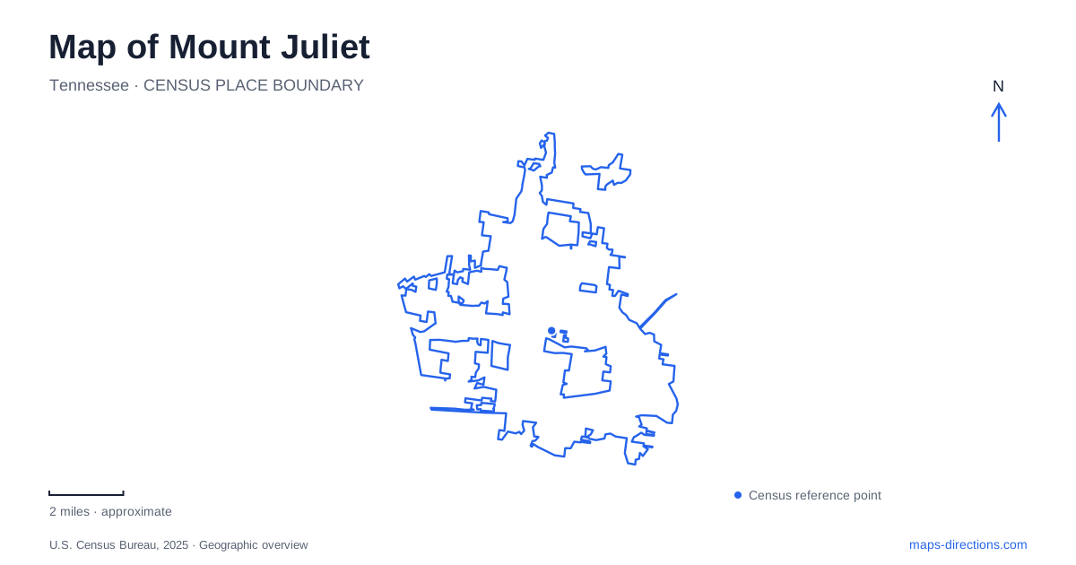
Street tiles load from OpenStreetMap when opened. The blue line shows the 2025 Census boundary.
- State
- Tennessee
- Population · July 2025
- 45,172
- Land area
- 26.9 sq mi
- Water area
- 0.3 sq mi
Mount Juliet developed through a change in transportation geography. Its early settlement was associated with the old road between Nashville and Lebanon; the arrival of the railway drew the community toward a new location. Today, a commuter station, major road corridors, municipal parks, and nearby lake recreation areas each contribute a different layer to the map. Understanding those layers helps explain why the city's destinations are spread among several corridors rather than gathered around one historic square.
An early settlement followed the railway
The city's land-use history places the original community along the old Nashville and Lebanon road, now identified as Old Lebanon Dirt Road. Travelers encountered Stoner's Creek and rising ground along that route. Railway construction north of the original village in the late 1860s prompted a shift toward the tracks, and the community became known as a station settlement.
This is a useful starting point for reading Mount Juliet. The earliest road-based location and the railway-oriented center belong to successive periods of development. A historic place name therefore does not always refer to an unchanged point on the map. The transportation system altered which properties were central, where businesses could receive goods, and how people connected with neighboring communities.
The town remained unincorporated for many years, finally incorporating in 1972. That long interval also matters: a later municipal boundary does not mean that the settlement or its road network began at the same time.
Division Street retains the rail connection
The WeGo Star station is at 22 East Division Street, with parking access from Division Street. It belongs to the regional rail service connecting the Lebanon corridor with Nashville. The city's transportation timeline records the start of the Music City Star service in 2006, the earlier name associated with this commuter system.
For a Mount Juliet rail trip, the station is the practical focal point. It is a specific stop with a timetable, rather than a general indication that trains are available from anywhere along the track. The continued use of the corridor also connects modern travel with the reason the earlier village moved. Rail infrastructure has served different equipment and travel needs over time while retaining a recognizable place in the local geography. Check the day's service pattern when planning the outward journey and the return together.
Charlie Daniels Park and the creek path
Charlie Daniels Park is on Charlie Daniels Parkway. Its walking track connects with Cedar Creek Greenway, linking a developed recreation area with a route along the creek corridor. The park includes Planet Playground, a separate toddler play area with a tricycle track, courts, an amphitheater, and a skate park.
The relationship between the track and greenway is more useful than simply counting facilities. A short circuit within the park and a walk onto the greenway can begin in the same recreation setting but produce different outings. The amphitheater and play areas support gathering and activity, while the connecting route extends the experience beyond those concentrated facilities.
In Mount Juliet, this is an example of a park functioning as part of a wider pedestrian network. It also requires care with planning documents: proposals for future greenway phases should not be treated as confirmation that every illustrated connection is open. Use the established park connection and the current trail map to choose the portion of the system you intend to follow.
Road names and route numbers describe another layer
South Mt. Juliet Road is also State Route 171, while Central Pike is State Route 265. Those paired names can help reconcile a local address with a regional road map. The city also identifies Interstate 40's Exit 226 with the main city road and Exit 229 with Golden Bear Gateway and Beckwith Road.
These corridors explain a different kind of access from the railway station or greenway. They distribute traffic among larger development areas and interstate approaches. Retaining both the street name and route number in a trip note can be particularly useful when moving between a regional view and a detailed local view, where the same road may be labeled differently.
Cedar Creek at Old Hickory Lake
Cedar Creek Campground and its day-use recreation area are associated with Old Hickory Lake, a reservoir supplied primarily by the Cumberland River. The Corps of Engineers identifies Cedar Creek as one of the lake's designated swimming areas, and the recreation site includes camping and boating facilities.
A lake visit from Mount Juliet has a different scale from a walk on the municipal Cedar Creek Greenway. The shared creek name does not establish a continuous visitor route between them. The reservoir's shoreline, campground, and launch facilities require their own approach and operating information. Choose the lake facility according to whether the outing involves camping, launching a boat, or day use, then consult that facility's access details rather than using the waterbody's central map label as the destination.
Map and statistics: U.S. Census Bureau, 2025 Gazetteer, January 2025 generalized place boundaries and Vintage 2025 population estimates. Local references: City of Mt. Juliet; WeGo Public Transit; Recreation.gov / U.S. Army Corps of Engineers; U.S. Army Corps of Engineers. Article prepared by Maps & Directions.