Map of Morgan Hill
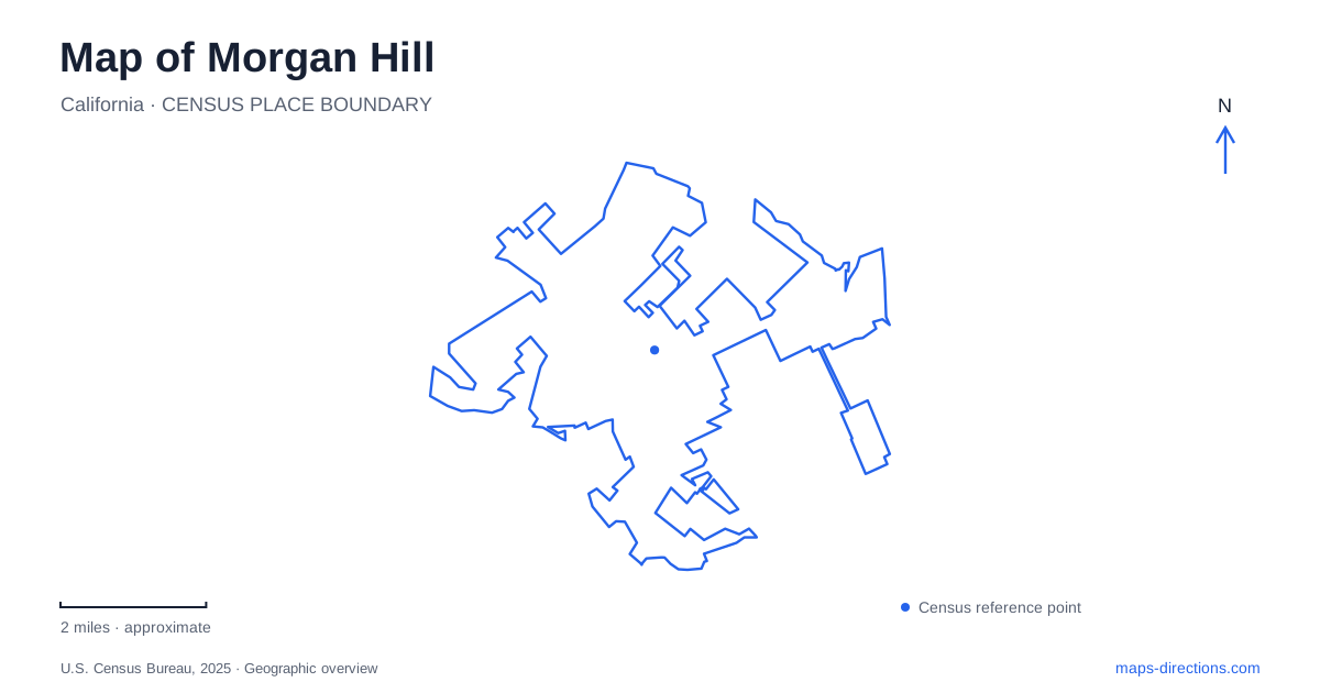
Street tiles load from OpenStreetMap when opened. The blue line shows the 2025 Census boundary.
- State
- California
- Population · July 2025
- 45,625
- Land area
- 12.9 sq mi
- Water area
- 0.0 sq mi
Morgan Hill occupies a landscape where a historic estate, a railway corridor, neighborhood creeks, and nearby mountain country remain closely connected. Monterey Road provides a strong reference through the older developed area, while East Dunne Avenue leads toward a markedly different setting in the hills. El Toro is a prominent local landmark, but its importance is cultural as well as visual: the mountain helped give the city’s best-known historic estate its name.
Villa Mira Monte and the view of El Toro
Villa Mira Monte stands at 17860 Monterey Road, north of downtown. The estate’s name refers to its mountain view, especially the peak now called El Toro and formerly known as Murphy’s Peak. The house was built between 1884 and 1886 on land inherited by Diana Murphy Hill. Its Queen Anne and Eastlake Stick architectural elements distinguish it from the later development around it.
The Hiram Morgan Hill House became a preservation project after the property was deeded to the historical society in 1993. A five-year rehabilitation led to its reopening in 1998. The estate’s present role therefore combines an original residential setting with a later effort to make local history accessible to the community.
The Acton House adds another chapter. This former farmhouse first moved to a city-owned site near City Hall in 1983, then moved again to Villa Mira Monte in 2005 when library development required its relocation. After renovation, the history museum opened there in 2010. The buildings share the modern history-park grounds, although their paths to that location were different.
Monterey Road and the agricultural town
Local historical records describe orchards and vineyards spreading across the valley during the late nineteenth and early twentieth centuries. Prunes, apricots, and wine grapes were important crops, and packing and transport facilities formed part of the town’s economy. The Farmers’ Union Packinghouse opened at Fourth Street and Depot Avenue in 1915, placing agricultural activity alongside the railway district.
Morgan Hill’s downtown history can be read through these street relationships. Monterey Road carried civic and commercial destinations, while the Depot corridor linked the town with rail transport. The first library occupied a store at Second Street and Monterey Road, and the original Granada Theater opened between Second and Third streets on Monterey in 1923. These locations describe an evolving center with education, entertainment, and agricultural commerce close together.
Railroad Park’s train-themed playground near the depot now gives the transport corridor a different community use. Its name recalls the setting directly, while the surviving street pattern helps place older accounts of packinghouses and downtown businesses within the present city.
Creek paths through the developed landscape
The municipal trail system includes the Edmundson Creek Trail, West Little Llagas Creek Trail, and Madrone Channel Trail. The city identifies these as routes through or beside developed neighborhoods, with paved paths available on the Edmundson and Madrone corridors. Their creek and channel names preserve the drainage geography beneath the suburban pattern.
For Morgan Hill, these local routes form a different outdoor setting from the regional hill parks. The Coyote Creek Visitor Center at 19245 Malaguerra Avenue provides another reference, connecting environmental education with the Coyote Creek Parkway. Its location is useful when exploring the creek landscape without assuming that every feature around Anderson Lake remains accessible.
The Anderson Dam seismic retrofit affects substantial portions of the reservoir recreation area. County notices identify closures involving boating, fishing, shoreline access, and several nearby trails and picnic facilities. Historic brochures showing a fully functioning lake recreation area therefore describe opportunities that cannot simply be assumed available during the project.
East Dunne Avenue into the Diablo Range
East Dunne Avenue continues beyond Anderson Lake toward the Coe Ranch entrance of Henry W. Coe State Park. State Parks describes approximately ten miles of narrow, winding road beyond the lake before the headquarters area. The approach leaves the valley’s developed street pattern for the hills and ridges of the Diablo Range.
El Toro presents a separate access question. The city describes a proposed public trail developed in partnership with the Open Space Authority, with property acquisition and planning still part of the process. The mountain’s visual prominence does not establish an unrestricted summit route.
Morgan Hill’s geography is best understood through these actual relationships: a historic estate facing El Toro, an agricultural downtown beside the railway, neighborhood drainage paths, and an eastern road that climbs toward Coe Ranch. The contrasts between them explain how a compact town center belongs to a much wider landscape of farms, watercourses, and mountain terrain.
Map and statistics: U.S. Census Bureau, 2025 Gazetteer, January 2025 generalized place boundaries and Vintage 2025 population estimates. Local references: Morgan Hill Historical Society; City of Morgan Hill; Santa Clara County Parks; California State Parks. Article prepared by Maps & Directions.