Map of Moreno Valley
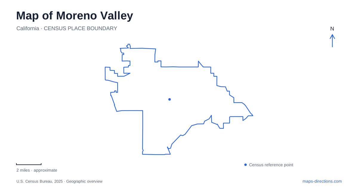
Street tiles load from OpenStreetMap when opened. The blue line shows the 2025 Census boundary.
- State
- California
- Population · July 2025
- 214,263
- Land area
- 51.4 sq mi
- Water area
- 0.1 sq mi
Moreno Valley combines the street networks of three older communities with a landscape framed by hills, a major airfield and the recreation lands around Lake Perris. Edgemont, Sunnymead and Moreno joined through incorporation in December 1984, but their names and development patterns remain visible. The broad valley setting can look uniform at first glance. Closer reading reveals older commercial blocks, large institutional properties and open slopes that interrupt and shape the newer urban fabric.
The older communities within the modern city
Edgemont occupies the southwestern area near the junction of State Route 60 and Interstate 215. Sunnymead Boulevard provides another important historical reference, with smaller blocks and parcels than many later developments. Municipal planning documents describe a central area stretching east from Heacock Street toward Lasselle Street and north of Alessandro Boulevard. These named roads give the older community pattern a practical geographic framework.
The history of Moreno Valley includes periods of farming, military development and rapid housing growth. Sunnymead Boulevard was paved in 1936, while Edgemont's development began around 1940. Later expansion connected places that had previously been distinct rural communities. Their boundaries are not always sharply expressed in the continuous modern street network, but their names still explain differences in block size and the location of established commercial activity.
The site of the former Riverside International Raceway adds another layer. City planning records identify the present mall area with the former motorsports property. This large-scale reuse helps explain why some parts of the map contain extensive commercial parcels rather than the fine-grained pattern of the older boulevard. The current land use conceals an earlier landscape organized around a road-racing circuit.
Aviation on the southwestern edge
March Field originated as a military flying-training installation in 1918. The air museum's history describes how the agricultural plain was rapidly developed with hangars, barracks, workshops and other facilities. That transformation brought a very different scale of land use into the valley, one organized around aircraft operations rather than farm plots or town blocks.
March Field Air Museum is at 22550 Van Buren Boulevard, with access from Interstate 215. Its published address uses Riverside, and it sits adjacent to the reserve base. For a visitor exploring Moreno Valley, this is a nearby regional attraction with a specific public entrance, distinct from the operational military installation.
The museum itself began in 1979 inside the base's former theater, with displays documenting aviation and the installation's history. Its evolution into a separate visitor destination parallels the wider valley's growth. The airfield remains a major geographic reference, while the museum provides a place to interpret that history without treating the whole military property as public recreation space.
Box Springs above the urban streets
Box Springs Mountain Reserve protects about 3,400 acres overlooking the valley and neighboring Riverside. The mountain rises above 3,000 feet, giving the northwest landscape a strong vertical contrast with the developed floor below. The reserve's multi-use trails vary in difficulty, and its upper and Hidden Springs access areas serve different portions of the terrain.
Riverside County notes that the reserve once supported dense coastal sage scrub, while fires have allowed nonnative grasses to spread in some areas. This vegetation history explains why the hills should not be imagined as a uniform forested mountain park. Open grass, scrub and rocky terrain are part of the setting encountered from the trails. The reserve is a conservation landscape as well as a viewpoint over Moreno Valley, with habitat protection influencing how recreation is managed.
The reservoir and its cultural landscape
Lake Perris State Recreation Area opened in 1973 and provides a broad area of water, rugged hills and open space south of the developed valley. Its park map distinguishes the Moreno gate, Perris gate, campgrounds, marina and beach areas. Via del Lago and Moreno Beach Drive form part of the approach from the city side. The separate gates and internal roads reflect the size and variety of the recreation area.
The Ya'i Heki' Regional Indian Museum adds a cultural dimension to the lake landscape. Its Cahuilla name means Home of the Wind. California State Parks describes its purpose as preserving and presenting the history, culture and contemporary achievements of the region's Native communities. The museum has undergone building upgrades and is developing renewed exhibits, so its interpretation is an evolving project rather than a fixed collection described by an old brochure.
These places give Moreno Valley several distinct edges: historic communities within the street grid, aviation facilities along the freeway corridor, protected mountain slopes and a large reservoir park. The differences are substantial enough to organize a visit around the landscape itself, with each area explaining a separate part of the valley's development.
Map and statistics: U.S. Census Bureau, 2025 Gazetteer, January 2025 generalized place boundaries and Vintage 2025 population estimates. Local references: City of Moreno Valley; March Field Air Museum; Riverside County Parks; California State Parks. Article prepared by Maps & Directions.