Map of Moorhead
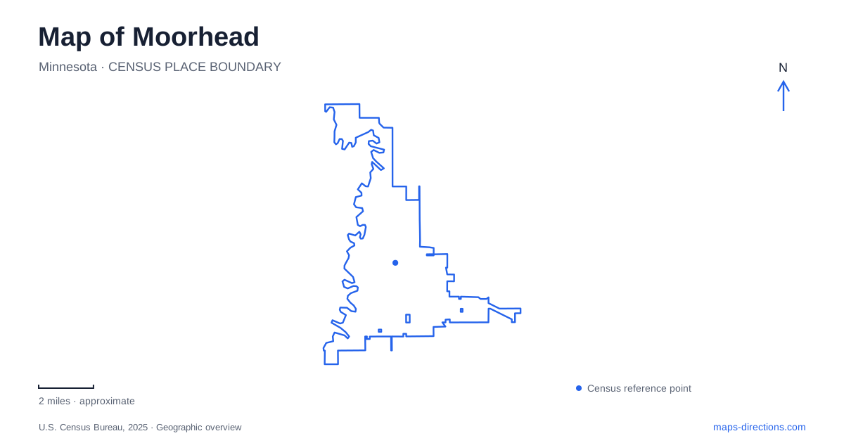
Street tiles load from OpenStreetMap when opened. The blue line shows the 2025 Census boundary.
- State
- Minnesota
- Population · July 2025
- 46,533
- Land area
- 22.3 sq mi
- Water area
- 0.0 sq mi
Moorhead stands on the Minnesota side of a river that is both a state boundary and a shared urban landscape. Across the Red River is Fargo, North Dakota; along its banks are trails, parkland, and places to get onto the water. The river is therefore more than the edge of a street map. It helps explain the relationship between the two cities, the shape of local recreation, and why some land beside established neighborhoods has become public open space.
Read the river before the street grid
A regional map can make the two communities look like one continuous built-up area. The Red River provides a clear dividing feature within that larger picture. A destination across the water involves a change of state as well as a crossing, even when it appears close to another destination on the opposite bank.
For an urban walk, the bank matters as much as the straight-line distance. For a paddling outing, the same line on the map becomes the route itself. This reversal is a useful way to understand the waterfront: what separates street networks can connect a journey on the water. The Minnesota Department of Natural Resources includes this reach in its Red River State Water Trail mapping, placing the local riverfront within a much longer waterway.
A corridor shaped by flood history
The public river landscape in Moorhead has an important flood-management history. After major floods in 2009, 2010, and 2011, the city undertook flood mitigation work and acquired flood-prone properties. Land that had been privately owned became part of a larger public corridor. Green space beside the river is thus not simply land that development happened to leave behind.
The city's corridor planning brought recreation, transportation, flood management, property boundaries, and habitat restoration into the same discussion. That combination helps explain why an urban waterfront may contain open stretches as well as conventional parks. A recreational map shows where people can spend time; a floodplain map explains another reason that land is managed as it is. Neither layer alone tells the whole story.
Flood projects reduce risk rather than removing it altogether. Riverfront plans should consequently be read as a relationship between a city and a changing river, not a promise that every low-lying path remains usable under every condition.
Follow the long trail without treating it as one short walk
The Red River Corridor Trail runs for about 16 miles between Oakport and Bluestem Amphitheater. This gives Moorhead a long recreational spine, rather than a waterfront confined to a single central park. The named endpoints are useful because they reveal the scale of the route before an outing is chosen.
Within the corridor, the Red River Discovery Walk uses signs and artwork to interpret local and natural history. Someone interested in a short interpretive outing has a different purpose from someone trying to cover a substantial part of the full trail. The map can accommodate both, but the 16-mile description refers to the larger corridor, not the distance required to see every nearby display.
It is helpful to choose a section by its landscape or destination, then view how that section belongs to the wider riverfront. This gives an individual walk a clear focus while preserving the sense of a connected corridor extending beyond it.
Hjemkomst Landing and the park setting
Hjemkomst Landing is associated with Viking Ship Park at 202 First Avenue North. Municipal recreation information identifies it as a place for canoeing and kayaking, with River Keepers involved in the city's paddling program. The landing is the useful reference for a water outing, while the park and Hjemkomst Center identify the broader setting.
These names describe connected interests without being identical destinations. A visitor looking for the center is orienting around a building; a paddler is orienting around river access. Gooseberry Park, listed at 100 22nd Avenue South, supplies another named riverfront recreation reference. Using these specific names makes a map of Moorhead more informative than placing a single marker labeled waterfront and expecting it to represent every activity along the bank.
The prairie excursion east of the city
Buffalo River State Park belongs to the wider regional picture, not the urban Red River corridor. The Minnesota DNR locates it near Glyndon, roughly 14 miles east of the city and south of US 10. Including it in a day out means leaving the city for a different river landscape.
There, floodplain forest meets prairie, and the Buffalo River has cut into the old bed of glacial Lake Agassiz. The state park, adjoining prairie lands, and the regional science center form a landscape context quite different from an urban trail beside developed neighborhoods. This distinction is worth preserving when searching for parks: the shared word river does not make the two settings interchangeable.
A map of Moorhead is most revealing when it holds those scales together. The Red River defines the immediate cross-border relationship, the public corridor explains a local transformation, and the trip toward Glyndon introduces the surrounding prairie country. Each is a separate layer of the same regional story.
Map and statistics: U.S. Census Bureau, 2025 Gazetteer, January 2025 generalized place boundaries and Vintage 2025 population estimates. Local references: City of Moorhead; Minnesota Department of Natural Resources. Article prepared by Maps & Directions.