Map of Monroe
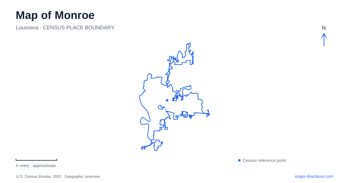
Street tiles load from OpenStreetMap when opened. The blue line shows the 2025 Census boundary.
- State
- Louisiana
- Population · July 2025
- 46,860
- Land area
- 29.9 sq mi
- Water area
- 3.6 sq mi
Monroe is easier to understand when its water features are kept separate. The Ouachita River organizes the downtown riverfront, Bayou DeSiard runs through the university campus, and Black Bayou Lake anchors a wildlife refuge to the north. These are three different settings rather than interchangeable versions of a single waterfront destination. Their relationships to roads, buildings and public open space give the city much of its geographic character.
The Ouachita connects two downtown settings
Across the river, West Monroe has its own downtown. The regional tourism organization identifies Campbell's Landing and Lazarre Park on that side, while the RiverMarket and Forsythe Boat Dock belong to the opposite city's riverfront experience. The river connects these places visually, but moving between banks is a separate transportation decision from moving along one bank.
This is a useful distinction when comparing restaurants, events or public spaces described as “on the river.” Two waterfront destinations may look close on the screen while facing each other across the Ouachita. Establish the bank and the relevant bridge connection before grouping stops into a walking itinerary. A riverfront label describes the view or setting; it does not establish that all venues form one continuous pedestrian district.
A port landscape becomes an urban cultural area
The city describes downtown's history in terms of a river port, a fort and a center for commerce and the arts. That history explains why the Ouachita remains a strong organizing feature rather than simply a natural boundary behind the buildings. RiverMarket continues to place public activity beside the water, while other riverfront destinations offer different settings for recreation or dining.
A map of Monroe can therefore be read from the river inward. First locate the riverfront destination, then identify the surrounding downtown streets and the connection to the broader road network. This approach preserves the historic relationship between commerce and the river without implying that every former port function remains active. It also distinguishes a downtown event setting from a boat-access area farther along the bank.
Bayou DeSiard shapes the university campus
At the University of Louisiana Monroe, Bayou DeSiard passes through the campus itself. The university describes this waterway as a central landscape feature, and its planning material maps the bayou alongside campus buildings, wooded areas, athletic grounds and nearby drainage features. Unlike the Ouachita's role between two downtowns, the bayou is woven into the internal arrangement of an educational campus.
The university's arrival information uses DeSiard Street, or US Highway 80, and Bayou Drive as practical street references. This provides a connection between the regional highway system and a campus-scale destination. Once within the campus, a building or event location matters more than the broad university label. The institution also identifies the College of Pharmacy's Bienville Building as a separate site at 1800 Bienville Drive, illustrating why not every university appointment belongs to the same campus arrival.
Black Bayou Lake is a refuge landscape
Black Bayou Lake National Wildlife Refuge is located off Highway 165 in the northern part of the city. The U.S. Fish and Wildlife Service describes a landscape combining bottomland hardwood forest, cypress swamp and open lake. The refuge's visitor information concentrates many recreational opportunities around the visitor center and Conservation Learning Center, with a nature-trail boardwalk and a wildlife pier extending the experience toward the water.
This is a different scale and purpose from a downtown riverfront stop. A refuge map has to distinguish habitat, designated visitor routes and areas managed for wildlife. The lake's open surface does not mean that every wooded edge offers the same access. Likewise, a boardwalk through bottomland habitat and a paddling route use different parts of the setting. The refuge provides its own maps and activity regulations because those distinctions are central to managing the site.
Roads organize a journey among the water features
Highway 165 appears in both the university's regional arrival information and the refuge's visitor directions, while Highway 80 serves the campus approach along DeSiard Street. Interstate 20 provides the broader east–west regional connection identified by the university. These routes help place the three water landscapes within one city-scale journey without collapsing their individual geography.
For Monroe, the most useful overview therefore includes the Ouachita downtown corridor, the campus bayou and the northern refuge together. Choose the activity first—an urban riverfront visit, a campus appointment or a wetland outing—then use the appropriate local map for that setting. The larger pattern explains how the places relate; the site map explains the part of the landscape intended for the particular visit.
Map and statistics: U.S. Census Bureau, 2025 Gazetteer, January 2025 generalized place boundaries and Vintage 2025 population estimates. Local references: Discover Monroe West Monroe; City of Monroe; University of Louisiana Monroe; US Fish and Wildlife Service. Article prepared by Maps & Directions.