Map of Moline
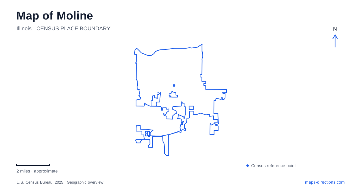
Street tiles load from OpenStreetMap when opened. The blue line shows the 2025 Census boundary.
- State
- Illinois
- Population · July 2025
- 42,362
- Land area
- 16.8 sq mi
- Water area
- 0.2 sq mi
Moline occupies an unusual position between two river corridors: the Mississippi on the north and the Rock River on the south. That arrangement is the strongest starting point for understanding its map. The industrial downtown developed around Mississippi water power, while southern open spaces belong to the Rock River landscape. Inland, Prospect Park records a third force in the city's growth: the street railway and its ability to connect residential development with leisure destinations.
Water power established the northern center
David Sears arrived in 1836 and developed mills powered by the Mississippi's rapids. A town was platted in 1843 and incorporated in 1848, the same year John Deere moved here. Water power and transportation access made the riverbank valuable to manufacturers. The city's mill-derived name reflects that early economy rather than a later promotional identity.
For Moline, the riverfront was consequently a workplace before its modern recreational and visitor roles developed. A map showing downtown beside the water preserves that basic relationship even where individual factories have vanished or changed use. The arrival of the railroad in 1854 further reinforced the industrial location. Instead of reading the commercial center as an arbitrary collection of blocks near the river, it helps to see it as the urban area supported by milling, manufacturing and the movement of goods.
Deere locations tell different stories
The John Deere Pavilion on River Drive interprets the company through equipment and exhibits. It belongs to the downtown visitor landscape, while the company's World Headquarters has the separate address of One John Deere Place. The headquarters architecture was designed by Eero Saarinen and is noted for its self-weathering steel. These two places present different aspects of the same industrial legacy: machinery and public interpretation at the Pavilion, corporate architecture at the headquarters.
The original John Deere Historic Site is farther away in Grand Detour, Illinois, where the company's founder developed his early plow. Keeping that distinction in mind prevents a regional history from being compressed into one downtown destination. A map of Moline can explain the local manufacturing story while acknowledging that the founder's earlier blacksmithing history belongs to another community.
Following and crossing the Mississippi
Ben Butterworth Parkway provides a way to follow the northern waterfront. The city's park map shows the bike path along River Drive, with several parking areas and supporting facilities distributed along the corridor. Its linear arrangement makes it useful for seeing a sequence of river views rather than concentrating on one compact park lawn.
The I-74 bridge provides another perspective by carrying a dedicated bicycle and pedestrian path across the Mississippi to Bettendorf. The two-state crossing changes a riverfront journey into a regional one. The official opening announcement in 2022 confirmed the path's completion; it should not be confused with older city project pages that still describe the bridge in future tense. The river remains the boundary between states, but the walking and cycling connection makes the opposite bank part of an accessible regional route.
Sylvan Island offers a smaller-scale river setting at 111 First Avenue. The city lists roughly 37 acres, fishing areas, a picnic shelter and 1.24 miles of gravel or natural trails. Those surfaces and the island setting differ from the parkway's linear bike-path experience. Including both reveals that the Mississippi waterfront supports several types of outdoor space rather than one uniform promenade.
A park built to attract trolley riders
Prospect Park's history begins with a railway company's 1889 purchase of land for a subdivision and a park at Frick's Grove. An artesian well supplied the new lake, and the pavilion opened in July 1891. Located at the end of the trolley line, the recreation grounds were intended to encourage people to use the street railway.
This relationship gives inland Moline a distinctive historical geography. Residential lots, public recreation and transportation were promoted together. The surviving pavilion at 1580 34th Avenue is therefore evidence of more than Victorian recreation; it helps explain why a substantial park developed at this particular location. Comparing it with the mill district shows how both work and leisure influenced the city's shape through different transport systems.
The southern river landscape
Green Valley Nature Preserve follows the Rock River. River Action, which has participated in local restoration work, identifies access by 48th and 60th streets and describes connections with the Kiwanis Bike Trail. Fishing, wildlife observation and boat access give this southern corridor its own recreational character.
The two-river framework makes Moline easier to read as a whole. Northern destinations connect strongly with manufacturing, downtown and Mississippi crossings. Prospect Park records the trolley-era expansion inland. Green Valley draws attention to the Rock River and its habitat corridor. These relationships give the numbered streets and avenues useful context, allowing a visitor to understand which part of the city's history and landscape a journey will encounter.
Map and statistics: U.S. Census Bureau, 2025 Gazetteer, January 2025 generalized place boundaries and Vintage 2025 population estimates. Local references: City of Moline; Deere and Company; Visit Quad Cities / transportation agencies; River Action. Article prepared by Maps & Directions.