Map of Missoula
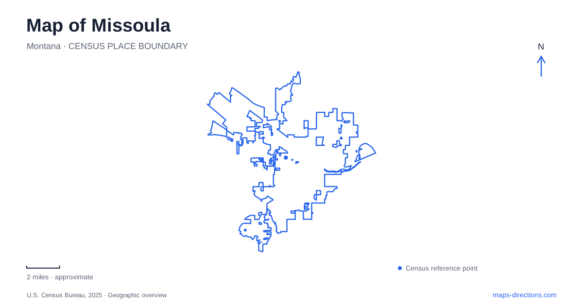
Street tiles load from OpenStreetMap when opened. The blue line shows the 2025 Census boundary.
- State
- Montana
- Population · July 2025
- 78,903
- Land area
- 35.0 sq mi
- Water area
- 0.2 sq mi
Missoula's downtown meets the Clark Fork River at a sequence of parks, bridges, and trails. That riverfront offers a useful starting point for understanding the city, but the surrounding terrain quickly adds other dimensions. Mount Sentinel rises beside the university campus, Rattlesnake Creek supports a wooded neighborhood park, and the historic fort preserves a broad landscape of buildings and open parade grounds. Each setting gives the map a different scale and a different kind of local history.
Caras Park and the downtown river edge
Caras Park gathers several public attractions along the downtown bank of the Clark Fork. The pavilion, carousel, Dragon Hollow playground, and terrace at Brennan's Wave occupy a connected riverfront setting. Trails provide a linear route through the area, while the pavilion and play spaces create places to stop and gather.
The city's facility listing identifies the Ron MacDonald Riverfront Trail System as part of Caras Park's setting. This matters because the park is both a destination and a passage along the river. A visit centered on the carousel stays within a compact area; a walk following the river trail uses the same public space as one part of a longer route.
Beartracks Bridge carries Higgins Avenue across the water. Older maps and plans may call it the Higgins Avenue Bridge. The newer name honors a prominent Salish family and was selected through collaboration involving tribal elders and local government. Knowing both names connects older descriptions with the present crossing without treating them as separate bridges.
The space beneath the bridge has also become part of the public landscape. Painted surfaces, seating, bicycle racks, table tennis, and other activities have transformed an area previously dominated by parking. This gives downtown Missoula an example of a bridge doing more than moving traffic above the river: its sheltered space also supports activity at the park level.
Mount Sentinel and the campus edge
Mount Sentinel rises on the east side of the University of Montana campus. The white M first took shape in 1908, when forestry students carried whitewashed rocks onto the hillside. The familiar landmark now connects the university's identity with a mountain visible far beyond the campus grounds.
The M Trail's switchbacks climb through the grassy face, but the letter is only one feature of a much larger natural area. The university describes approximately 1,000 acres of native prairie on the mountain's front, with forest on the top and back slopes. Ponderosa pine and Douglas fir occur in those wooded areas, giving the mountain a different character beyond the exposed face seen from town.
This terrain explains why a short-looking line on a city map can represent a substantial uphill walk. The campus, hillside letter, and upper mountain occupy different elevations and landscapes. Viewing them together makes the transition from urban streets to prairie slope and forest more apparent than a map focused solely on road distances.
Rattlesnake Creek and Greenough's forest
Greenough Park, listed at 1001 Monroe Street, preserves approximately 42 acres along Rattlesnake Creek. The Greenough family deeded the land to the city in 1902 with the intention that it remain in a natural state. Old black cottonwoods survive within the riparian forest, and restoration work has sought to protect that setting.
The creek corridor offers a different outdoor experience from the exposed mountain slope. Paved and unpaved paths follow the wooded landscape, while the Arnold Bolle interpretive birding trail adds a way to understand the habitat. The picnic shelter and playground occupy the eastern edge, leaving much of the park's identity tied to the creek and trees.
For a map of Missoula, this is an important contrast: outdoor space close to urban neighborhoods can be a preserved forest as well as a developed recreation park. McCormick Park's Currents Aquatics Center, at 600 Cregg Lane, provides an example of the latter, with indoor swimming facilities embedded in a larger public park.
Buildings and open ground at the fort
The Historical Museum at Fort Missoula is reached at 3400 Captain Rawn Way. Its 32-acre grounds include more than 20 historic structures, some surviving in their original setting and others relocated for preservation. The site therefore combines the history of the military post with a broader collection of regional buildings.
The parade grounds help explain the fort's layout. The first open ground dates to the post's founding in 1877; a second developed with new barracks and officers' quarters in the early twentieth century. Buildings arranged around these spaces reflect the practical needs of drills, formations, and ceremonies.
The fort, creek forest, campus mountain, and downtown riverfront reveal distinct ways people have occupied the valley. Reading a map of Missoula through those landscapes brings the street network into a larger physical and historical context, with the Clark Fork providing a central reference and the surrounding slopes and tributaries extending the story outward.
Map and statistics: U.S. Census Bureau, 2025 Gazetteer, January 2025 generalized place boundaries and Vintage 2025 population estimates. Local references: Destination Missoula; City of Missoula; Missoula County; Downtown Missoula Partnership; University of Montana; Montana tourism / park operator listing; Historical Museum at Fort Missoula. Article prepared by Maps & Directions.