Map of Mission
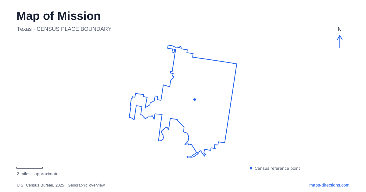
Street tiles load from OpenStreetMap when opened. The blue line shows the 2025 Census boundary.
- State
- Texas
- Population · July 2025
- 88,992
- Land area
- 36.3 sq mi
- Water area
- 0.1 sq mi
Mission lies within the Lower Rio Grande Valley, where the river shaped landownership, agriculture, settlement and wildlife habitat long before the modern road network. Its name recalls La Lomita Chapel, while the later commercial community developed farther north around a railway stop. That separation between the older riverside settlement and the railway town provides a useful starting point for understanding the map. Historic places and nature destinations occupy different parts of a landscape connected by water and movement.
Riverfront land grants and a small chapel
Spanish colonial land divisions known as porciones extended inland from the Rio Grande. Their narrow river frontage and long inland reach reflected the importance of access to water. These were not square parcels arranged around a modern road grid. The town's history identifies Porciones 55 and 57 with Rancho La Lomita, while the nearby state park occupies part of a different grant.
La Lomita means little hill, referring to a modest rise in the otherwise low-lying valley. Oblate clergy built a chapel and living quarters there in 1865 as a stop along horseback circuits between Brownsville and Roma. The location belonged to a network of ranches and religious activity extending along the river, rather than an isolated building without a surrounding community.
The chapel has been rebuilt or restored more than once. Its significance therefore lies in the continuing place and history as well as the surviving structure. The historical park preserves the chapel setting and provides a recognizable southern anchor on a map of Mission.
The town moves toward the railway
In the early twentieth century, land development and railway access shifted activity northward from La Lomita. A new station and siding attracted settlement, and the post office moved to the railway site in December 1908. That change explains why the present urban center is separated from the chapel that supplied its name.
The movement also reflects a broader change in the valley economy. Access to a river had shaped earlier land grants; access to markets by rail became increasingly important to agricultural development. The city grew around the newer transportation connection while retaining a name associated with the older settlement.
Citrus became a prominent part of the area's identity, commemorated through the Texas Citrus Fiesta. The local historical museum documents this wider story through objects, records, exhibitions and research concerning western Hidalgo County. Mission's history is consequently best understood at both the municipal and regional scale, with farming communities, transport routes and cultural traditions extending beyond one boundary.
Ebony woodland preserved at Bentsen
Bentsen–Rio Grande Valley State Park occupies land southwest of the urban center. Its history reaches back to Porcion 50, granted to José Antonio Zamora in the eighteenth century. After the Bentsen family acquired a much larger tract in the late 1930s, they developed land to the north while retaining an area of ebony woodland.
In 1944, the family transferred 586.9 acres to the state for one dollar with conditions requiring public park use. The park opened in 1962. Those dates distinguish the decision to preserve the land from the later creation of a functioning public destination.
The retained woodland gives the park a landscape different from surrounding developed or cultivated parcels. It is a reminder that the valley's agricultural history also involved decisions about which areas would remain wooded. For Mission, this protected tract provides a close connection with the ecological setting that preceded much of the city's expansion.
The state park directs visitors to leave cars at headquarters and continue on foot, by bicycle or by tram. Internal routes therefore function differently from ordinary public streets. The approach road leads to a transition in how the landscape is explored, with quieter movement supporting observation of birds and other wildlife.
Butterfly habitat and the wider outdoor landscape
The National Butterfly Center, in the southern part of the city, focuses attention on a different group of animals. Its native planting and butterfly gardens demonstrate relationships between plants and the insects that use them. The center's garden material emphasizes native species, making the landscape a place for ecological learning as well as observation.
Butterfly habitat is not interchangeable with a lawn or ornamental flower display. Nectar sources and caterpillar food plants support different stages of an insect's life, so plant selection affects what the garden can sustain. This gives the center a distinct purpose alongside the state park's broader woodland and birding setting.
The city's own hike-and-bike trails add another public outdoor network, managed through the parks department. Together with the chapel, museum and protected natural areas, they reveal several ways of using the valley landscape. A map of Mission becomes more informative when the river-oriented land grants, northward railway settlement and surviving habitat are read as connected parts of one changing place.
Map and statistics: U.S. Census Bureau, 2025 Gazetteer, January 2025 generalized place boundaries and Vintage 2025 population estimates. Local references: City of Mission; Oblates of Mary Immaculate; Texas Historical Commission; Texas State Historical Association; Texas Parks and Wildlife Department; National Butterfly Center; North American Butterfly Association. Article prepared by Maps & Directions.