Map of Minnetonka
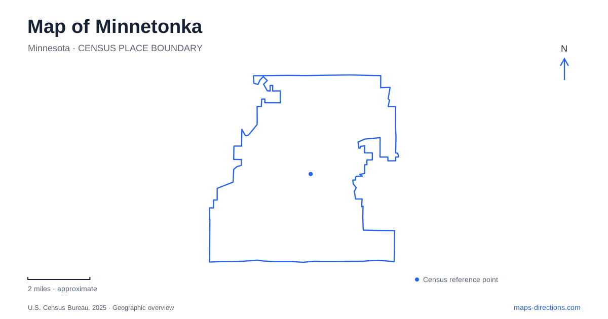
Street tiles load from OpenStreetMap when opened. The blue line shows the 2025 Census boundary.
- State
- Minnesota
- Population · July 2025
- 53,969
- Land area
- 26.9 sq mi
- Water area
- 1.0 sq mi
Minnetonka's map is shaped by creeks, wetlands, and several distinct centers of activity rather than a single downtown square. The old mill settlement beside Minnehaha Creek, the Gray's Bay headwaters, and parks in the southern part of the city each reveal a different relationship with water. The regional lake landscape extends beyond municipal boundaries, while major trails connect several neighboring communities. A useful reading begins with those waterways and historical places before adding shopping destinations or through roads.
The creek explains the early mill settlement
Minnetonka Mills developed around waterpower. A sawmill began operating in 1852, and subsequent production included furniture and flour. The creek supplied the energy that made this settlement practical before the area became a modern suburb. That industrial origin gives the old mill neighborhood a different historical focus from districts that grew around later highways and commercial development.
The Burwell House survives as a particularly clear landmark from that period. Charles Burwell, a mill manager, built the home in 1883. Its address is 13209 McGinty Road East. The city purchased it in 1970 and restored it to an appearance representing 1894, so the house functions as an interpreted historical property rather than an untouched room-by-room record of one moment. Public tours follow a seasonal schedule, so confirm the city's tour calendar before planning an interior visit.
The house gives the former industrial district a human scale. A mill site can be difficult to visualize after machinery and working structures disappear, but a manager's residence places domestic life alongside the productive landscape. The creek, neighborhood, and preserved house are therefore most informative when considered together, instead of treating the building as an isolated architectural attraction.
Where the lake becomes a creek
At Gray's Bay, Lake Minnetonka drains into Minnehaha Creek through a small adjustable dam. The watershed district operates that structure to balance conditions upstream and downstream. Holding back runoff from the upper basin can allow the more urbanized lower watershed to drain first; during drier periods, operations may also seek to maintain creek flow when possible.
The current structure dates to 1979, although earlier outlet controls preceded it. This is a managed transition between two parts of a watershed, not simply a picturesque point where water happens to narrow. The city's Headwaters Park is on the eastern side of Gray's Bay, north of Libbs Lake Beach. Those two named places help locate the outlet within the larger shoreline geography without confusing the dam setting with every other lake-access site.
A regional trail travels through several communities
The Lake Minnetonka Regional Trail connects Hopkins with Carver Park Reserve over an aggregate-surfaced route. It passes through Deephaven, Greenwood, Excelsior, Shorewood, and Victoria as well as this city. Its lake-related name describes a regional corridor; it does not mean the trail continuously follows the water's edge or stays within one municipality.
That distinction helps when choosing a ride. A segment near home can form part of a longer intercity outing, while the western destination at Carver Park Reserve introduces another park system and landscape. The aggregate surface is also relevant to the character of the trip. The route should be understood as a recreational connection across communities, rather than as a city street renamed for cyclists.
Southern parks preserve different environments
Purgatory Park occupies the southwestern part of the city and follows the landscape of Purgatory Creek. Its open space includes wetlands, woods, and prairie, with a loop beginning at the parking area. The municipal comprehensive plan identifies preservation and relatively quiet recreation as its principal roles. This makes the park a useful choice for experiencing a mixture of habitats rather than seeking a concentrated collection of sports facilities.
Lone Lake Park, in the southeast, combines natural land with a more active recreational setting. Its facilities include playing fields and courts alongside trails and lakeside access. Nearby Shady Oak Beach adds another water-oriented destination in that part of the city. The two parks consequently illustrate different ways open land has been retained amid residential development: one emphasizes the creek landscape, while the other combines natural space with organized recreation.
Older routes remain beneath newer development
The local historical society traces an Indigenous travel corridor along the vicinity of present-day Baker and Plymouth roads, connecting wider Dakota and Ojibwe travel networks. Later changes included streetcars, suburban housing, and commercial centers such as Ridgedale, which opened in 1974. These layers explain why present-day Minnetonka cannot be reduced to its freeway-era shopping landscape. Its roads and public spaces also preserve relationships with earlier travel, waterpower, and the land's waterways.
Map and statistics: U.S. Census Bureau, 2025 Gazetteer, January 2025 generalized place boundaries and Vintage 2025 population estimates. Local references: City of Minnetonka Historical Society; Minnehaha Creek Watershed District; City of Minnetonka; Three Rivers Park District. Article prepared by Maps & Directions.