Map of Milwaukee
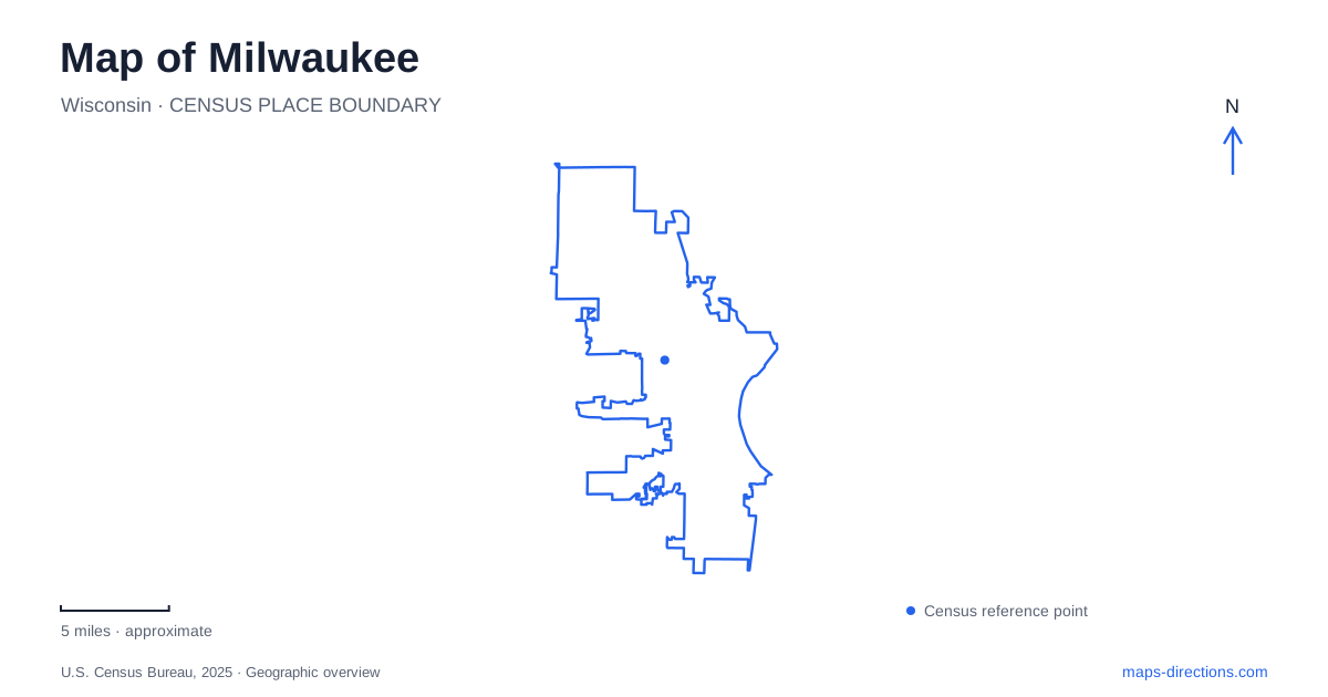
Street tiles load from OpenStreetMap when opened. The blue line shows the 2025 Census boundary.
- State
- Wisconsin
- Population · July 2025
- 562,407
- Land area
- 96.2 sq mi
- Water area
- 0.6 sq mi
Milwaukee's central geography is shaped by a meeting of rivers beside Lake Michigan. The water creates several different kinds of urban edge: a downtown river corridor, a harbor, an open lakefront, and a valley extending inland. These features are connected, but they are not interchangeable. A route along the river can lead through closely built commercial blocks, while a lakefront journey follows a much more open landscape. Reading those differences first gives the city map a useful structure.
Start where the rivers meet
The Milwaukee, Menomonee, and Kinnickinnic rivers join in the harbor system before their water enters Lake Michigan. The city's water-tour information identifies Confluence Point at 106 West Seeboth Street as a place to observe the meeting of the first two rivers. This is a specific geographic reference rather than simply another waterfront viewpoint.
The confluence helps explain why bridges and river bends matter so much near the center. A destination can sit close across a channel while its street approach comes from a different direction. Following the water upstream also leads into distinct parts of the city: the central RiverWalk follows one corridor, while the Menomonee Valley creates a westward connection. Keeping the river names visible prevents the harbor from becoming an undifferentiated blue shape on the map.
The RiverWalk joins different districts
The RiverWalk links the downtown corridor with the Historic Third Ward to the south and Beerline B to the north. Its route uses pedestrian spaces along both sides of the river. These segments have different built surroundings even though they belong to one larger walking network.
Beerline B retains visible connections to the brewing industry, including former Schlitz Brewery buildings. The central segment passes through the business district, and the Third Ward adds a warehouse neighborhood toward the south. That sequence gives a walk an urban narrative without requiring every stop to be a museum: the buildings and street patterns themselves show changes in the city's commercial history.
The visitor bureau's account also connects the river to the nineteenth-century divisions between the original settlements and the 1845 disputes over bridges. The unified city charter followed in 1846. This background makes the crossings more than functional links; they occupy a landscape where the river once reinforced rival local identities.
The Third Ward keeps a warehouse scale
South of downtown, the Historic Third Ward is characterized by nineteenth-century warehouses adapted to shops, galleries, restaurants, and other uses. The public market provides a recognizable destination, while the RiverWalk supplies a connection along the neighborhood's water edge.
The district also sits near lakefront destinations such as Henry Maier Festival Park and Lakeshore State Park. That relationship can be easy to overlook when searching only by neighborhood name. The Third Ward belongs to both an inland street-and-warehouse pattern and a transition toward the lake. A Milwaukee itinerary can use it as a connecting area, but a map should still distinguish the river edge from the Lake Michigan shoreline.
The lakefront leads into a westward trail corridor
The Hank Aaron State Trail reaches Lakeshore State Park from both north and south, forming a connection around the park and Third Ward before heading west into the Menomonee River Valley. The trail organization identifies Discovery World and the art museum among the lakefront destinations associated with this network.
A suggested lakefront route starts at Discovery World, passes through Lakeshore State Park, and reaches the lighthouse where the harbor meets the lake. This explains the local shoreline geometry more clearly than a generic instruction to walk toward the water. The harbor opening, park paths, and open lake are separate features encountered along the route.
The Milwaukee Art Museum adds a major cultural landmark to this lakefront setting. Its visitor information identifies the lakefront entrance on the north side of its campus. The museum location is useful for orienting the shoreline, while the broader trail map explains how that destination relates to parks and the inland valley.
Three Bridges Park reveals a changed industrial landscape
Three Bridges Park occupies a former rail yard in the Menomonee Valley. The restoration created a 24-acre park with revived riverbank habitat, and new bicycle and pedestrian bridges connected the valley with nearby neighborhoods. The Urban Ecology Center's valley branch forms part of the same project.
The park's sculpted hills, paths, and river views sit within a landscape that previously served a very different purpose. This is why a valley map needs to show bridges and neighborhood connections alongside the park boundary. The bridges do not merely decorate the recreational route; they explain how surrounding communities reach the valley.
The nearby ecology center is at 3700 West Pierce Street and lies along the Hank Aaron State Trail. Its address gives a specific landward reference for a larger trail landscape. A map of Milwaukee becomes more revealing when these scales are combined: the river confluence explains the center, the RiverWalk explains adjoining districts, and the valley's restored connections show how an industrial corridor has become part of the city's public outdoor network.
Map and statistics: U.S. Census Bureau, 2025 Gazetteer, January 2025 generalized place boundaries and Vintage 2025 population estimates. Local references: City of Milwaukee; Visit Milwaukee; Friends of Hank Aaron State Trail; Milwaukee Art Museum; Menomonee Valley Partners; Urban Ecology Center. Article prepared by Maps & Directions.