Map of Milton
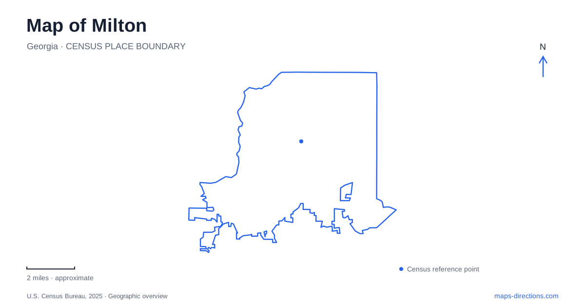
Street tiles load from OpenStreetMap when opened. The blue line shows the 2025 Census boundary.
- State
- Georgia
- Population · July 2025
- 41,266
- Land area
- 38.6 sq mi
- Water area
- 0.6 sq mi
Milton combines an incorporated municipal government with communities and landscapes that are much older. The city began on December 1, 2006, in northern Fulton County, but that date does not describe the beginning of Crabapple, the surrounding farms, or the rural road network. A useful map separates the compact downtown setting from the larger woodland parks and former agricultural properties spread across the city.
Crabapple's crossroads and civic spaces
Crabapple developed around the meeting of Crabapple Road and Mayfield Road with Birmingham Highway and Broadwell Road. The city's transportation study identifies this historic crossroads as a setting containing older homes and businesses alongside newer mixed-use development and civic spaces. The road names preserve the crossroads structure even as the surrounding development changes.
City Hall is at 2006 Heritage Walk, placing municipal activity in the Crabapple area. Nearby Broadwell Pavilion, at 12615 Broadwell Road, offers a covered gathering space, picnic tables, restrooms, a small green, and a playground. These are useful landmarks for understanding the district at a walking scale: public life occupies several places rather than a single building.
The Broadwell Building at 755 Mid Broadwell Road adds another historical detail. In 2021, University of Georgia artists restored crabapple-themed murals originally painted in the 1960s. An antique shop once operated upstairs, and the grounds hosted the Crabapple Antique Fair beginning in 1967. The later Crabapple Fest grew from that tradition. This connects a small building and its artwork with the district's identity as a place for gathering and trade.
Birmingham's larger trail landscape
Birmingham Park offers a different view of Milton. Access is from 750 Hickory Flat Road, and the park contains more than 200 acres of woods, meadows, creeks, and natural-surface routes. Equestrians and hikers both use the landscape, making it an especially direct expression of the area's association with horses and rural land.
The difference in scale from Crabapple matters. The downtown setting is organized around streets, buildings, and civic destinations; Birmingham Park is experienced through terrain and trails. Its woods and open areas create changing surroundings within a single property rather than a sequence of urban blocks.
The city has discussed conservation protections for the park, but a proposal for legal protection should not be confused with a new trail or public facility. The established attraction is the landscape itself. Reading the park map as a system of natural routes provides more useful orientation than expecting the density of signs and paved circulation found around a town center.
Providence Lake and accessible woodland routes
Providence Park lies at 13440 Providence Park Drive. Its 42 wooded acres include views of Providence Lake, a public fishing pier, and trails. A paved accessible route gives visitors a way to reach the lake within a park otherwise strongly associated with woodland walking.
Milton acquired the property from Fulton County in 2015 after a lengthy closure. An initial reopening followed in 2016, and a further round of improvements opened in November 2021. Those later works included a paved route from the parking area and a wooden pier with a shaded pavilion on the north side of the lake.
The city owns only part of the lake, an important qualification when interpreting its water outline on a map. The public park and pier identify the recreational setting; the whole shoreline should not be assumed to have the same ownership or access. This is a case where the boundary of a blue shape and the boundary of public land tell different stories.
A golf course becomes public green space
Milton City Park and Preserve, reached at 1785 Dinsmore Road, occupies a former country-club property purchased by the city in February 2018. Its 137 acres are divided between a large natural preserve and a smaller recreation area containing the pool, tennis facilities, and a renovated clubhouse used as a community center.
The preserve has two distinct landscape sections. North Woods forms a narrow U-shaped area with two lakes and a closer relationship to surrounding neighborhoods. South Woods is more wooded and hilly, with bottomland hardwood forest and Chicken Creek along its eastern side. These differences give a trail outing more structure than the former golf-course label alone would suggest.
Across Milton, the public landscape therefore ranges from historic commercial corners to horse trails, lake access, and land acquired for conservation after private recreational use. Locating those different settings first makes the roads and park names easier to interpret, while keeping the city's incorporation history separate from the much longer history of the places within it.
Map and statistics: U.S. Census Bureau, 2025 Gazetteer, January 2025 generalized place boundaries and Vintage 2025 population estimates. Local references: City of Milton. Article prepared by Maps & Directions.