Map of Millcreek
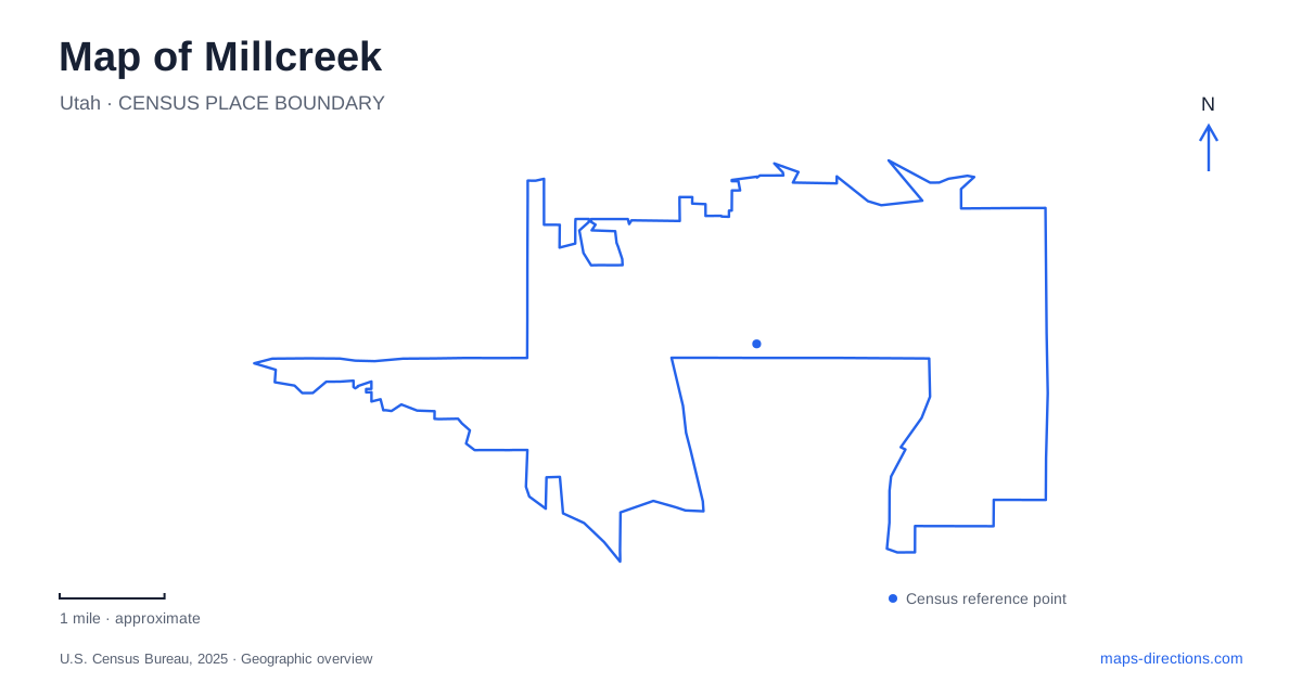
Street tiles load from OpenStreetMap when opened. The blue line shows the 2025 Census boundary.
- State
- Utah
- Population · July 2025
- 63,926
- Land area
- 12.9 sq mi
- Water area
- 0.0 sq mi
Millcreek occupies a meeting place between the Salt Lake Valley's developed neighborhoods and the Wasatch mountain landscape. Its map records several stages of settlement rather than a single town growing around one old square. Creekside farms and mills, suburban subdivisions, highway-oriented employment areas and a newer civic gathering place all contribute to the present pattern. Reading those layers together explains why an urban errand on Chambers Avenue and an outing into the canyon belong to very different geographic settings, even though their names share the same origin.
Water came before the suburban street pattern
The city's history traces nineteenth-century settlement to the areas now called Canyon Rim and East Mill Creek. Orchards, farms and mills depended on the creek and irrigation systems. This was an inhabited landscape before suburban development: the municipal account identifies the Goshute, Ute and Shoshone peoples in the valley's earlier history. A modern street map captures only the latest arrangement of a much older place.
Evergreen Avenue supplies a particularly useful historical reference. The municipal history associates that corridor with manufacturing and summer residences during the early twentieth century. Later subdivisions filled more of the surrounding land, while the area near Interstate 15 developed a stronger industrial and commercial role linked to highway and railway access. These different origins help explain why neighboring blocks can have very different building forms and parcel sizes.
For Millcreek, the creek is therefore more than a recreation label. It provides a connection between the farming landscape, early industry and subsequent development. A watercourse layer adds context that the numbered road grid alone cannot supply.
Neighborhood identities precede the city government
Canyon Rim, East Mill Creek and Mount Olympus remain useful local names. The Unified Fire Authority's community history describes an area largely built out by the 1980s under these neighborhood identities. The municipality itself is much newer than these established neighborhoods. The age of the government should not be confused with the age of its streets and houses.
The municipal neighborhood framework also recognizes agricultural, orchard, canyon and hillside influences. Those categories describe the landscape's variety rather than a promise of neatly separated districts on the ground. Canyon Rim and the mountain-facing neighborhoods place the eastern foothills in the reader's frame; the highway and rail references explain a different western setting. A useful overview retains that contrast instead of treating the entire boundary as a uniform suburb.
Chambers Avenue anchors the newer civic center
Millcreek Common introduces a deliberate gathering place into this inherited pattern. The plaza is on Chambers Avenue, within the city-center area associated with Highland Drive, 1300 East and 3300 South. Its skating loop, splash pad and climbing wall make it an activity space as well as a landmark. The adjacent City Hall uses 1330 East Chambers Avenue, while the plaza's published location is 1354 East Chambers Avenue.
The Public Market occupies the first floor of City Hall, bringing indoor activity into the same civic cluster. This arrangement differs from an older courthouse square: municipal functions, public space and recreation have been assembled as a contemporary center among existing streets. On a close map, the relationship between the plaza, City Hall and Chambers Avenue is more informative than a citywide center marker.
For a Millcreek civic-center visit, the operator identifies a parking garage entered from Chambers Avenue, west of City Hall, as well as lots north and east of the plaza. Those separate locations explain the site's internal arrangement without assuming that every event uses one identical arrival point.
The canyon is a separate mountain setting
The nearby mountain destination is officially written Mill Creek Canyon, with the creek name separated into two words. Salt Lake County works with the Forest Service on recreation there, including group picnic areas and a winter yurt. Its route network belongs to a canyon landscape rather than the valley's suburban grid. The Pipeline, Big Water and Little Water trail names identify different parts of that wider recreation setting.
Season also changes what a canyon-road line means. The county explains that winter gates restrict vehicle access while allowing travel on foot, with reopening dependent on weather and road conditions. The Forest Service describes winter grooming for cross-country skiing. A road shown continuously on an overview can therefore serve a different kind of movement in winter. Current construction and access notices remain relevant when choosing a particular trailhead.
A map of Millcreek works best when these layers remain distinct: the creek's settlement history, established neighborhood identities, the Chambers Avenue civic cluster and the mountain recreation corridor. Together they explain the area's form, while a closer street or trail view supplies the detail appropriate to the particular journey.
Map and statistics: U.S. Census Bureau, 2025 Gazetteer, January 2025 generalized place boundaries and Vintage 2025 population estimates. Local references: City of Millcreek; Unified Fire Authority; Millcreek Common; Salt Lake County; US Forest Service. Article prepared by Maps & Directions.