Map of Midwest City
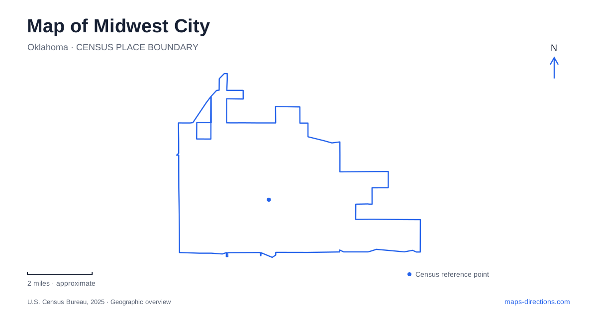
Street tiles load from OpenStreetMap when opened. The blue line shows the 2025 Census boundary.
- State
- Oklahoma
- Population · July 2025
- 58,799
- Land area
- 24.4 sq mi
- Water area
- 0.0 sq mi
Midwest City grew alongside a wartime air depot, and that origin remains unusually clear in its street map. The Original Mile neighborhood, the commercial frontage near Interstate 40, and Tinker Air Force Base form a connected historical geography. Farther north, Reno Avenue and Douglas Boulevard organize a substantial recreation landscape. These places show how housing, aviation, shopping, and public parks developed around a community planned during the 1940s.
The founding square between four roads
The Original Mile has precise boundaries: SE 15th Street on the north, SE 29th Street on the south, Air Depot Boulevard on the west, and Midwest Boulevard on the east. That square is a useful starting frame for examining Midwest City because its name refers to an actual neighborhood extent rather than a loosely defined historic district.
The city describes it as a wartime housing development, created to serve the military installation and its workforce. Its internal streets preserve a different pattern from the large roads around the perimeter. Aircraft-associated names visible on the neighborhood plan include Lockheed, Boeing, Grumman, and Kittyhawk. The names reinforce the relationship between residential development and the aviation work that prompted it.
The 2011 revitalization plan records the survival of much of the original street layout and housing. It also places Town Center Plaza immediately south of the residential neighborhood. Reading the square from north to south therefore reveals a transition from the founding residential fabric toward a later commercial frontage facing the base and interstate.
SE 29th Street and the hospitality district
Town Center Plaza is part of the redevelopment that followed the destructive tornadoes of 1999 and 2003. The city's historical account connects those rebuilding efforts with the renewal of SE 29th Street. A present-day map consequently contains layers of different periods: the wartime neighborhood remains legible, while the shopping corridor reflects later reconstruction.
The area around Sooner Road and Tinker Diagonal forms the hospitality district, with hotels and the Reed Conference Center. This gives travelers another recognizable cluster beyond the Original Mile. Someone arriving for a conference may initially experience Midwest City through that road junction, whereas a visit focused on local history would begin with the founding neighborhood and aviation setting.
Founder W. P. “Bill” Atkinson established the community in 1942. The city's account describes his aim as a self-contained place with homes, schools, parks, shopping, and entertainment for military personnel and civilian workers. That origin helps explain why the residential square, shopping frontage, and recreation grounds all matter to the city's identity; the place was conceived as more than accommodation beside an airfield.
Reno Avenue opens onto a broad park landscape
Joe B. Barnes Regional Park is listed at 8700 East Reno Avenue. Its facilities include ball fields, tennis and basketball courts, playgrounds, picnic areas, and trails. The official park map gives these activities a geographic arrangement, locating the Doug Hunt Softball Complex, garden and picnic pavilions, Fred Quinn Happy Tails Dog Park, and adjoining golf landscape.
South Douglas Boulevard supplies another important reference. Reno Swim & Slide is listed at 101 South Douglas, while John Conrad Regional Golf Course is at 711 South Douglas. Those addresses make the boulevard a practical spine for comparing the different recreation destinations. The swimming facility, golf course, and large park share an area without offering the same activity or occupying one compact building complex.
For an outdoor visit to Midwest City, the range of facilities allows a day to be organized around a particular interest. The park's trails and open ground support a different outing from a scheduled ball game or a round of golf. Looking at the park map also reveals how pavilions and playing areas are distributed across the grounds, helping explain the scale that a simple green park label conceals.
Aviation history at the interstate edge
Charles B. Hall Airpark is a nearby public aviation-history destination at the Air Depot Boulevard exit from Interstate 40. The Air Force identifies it as an Oklahoma City location, an important municipal distinction within the adjoining urban area. Its paved walkways lead through a self-guided display landscape associated with Tinker.
The airpark was renamed in 2002 for Major Charles B. Hall, a Tuskegee Airman who later worked at the base. Public access to this park does not imply unrestricted access to the military installation; the Air Force also notes that heightened security can require closure. For visitors studying Midwest City, the airpark complements the residential story of the Original Mile by placing the aviation history behind the neighborhood's street names and founding purpose into a visible setting.
Map and statistics: U.S. Census Bureau, 2025 Gazetteer, January 2025 generalized place boundaries and Vintage 2025 population estimates. Local references: City of Midwest City; Tinker Air Force Base. Article prepared by Maps & Directions.