Map of Midlothian
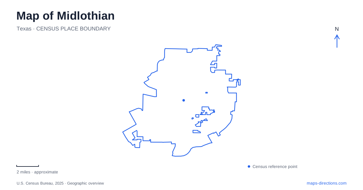
Street tiles load from OpenStreetMap when opened. The blue line shows the 2025 Census boundary.
- State
- Texas
- Population · July 2025
- 46,683
- Land area
- 63.7 sq mi
- Water area
- 0.7 sq mi
A map of Midlothian makes more sense when its modern highway junction is read alongside its railway beginnings. US 67 and US 287 establish the regional framework, but the older numbered streets and the depot tell a different story about how the settlement took shape. Beyond that core, a nature park, neighborhood recreation grounds, and sports facilities represent different kinds of open space. Treating these places as separate geographic layers produces a more useful picture than following the largest road labels alone.
The crossroads began before the highways
The municipal transportation history places an early military road through the high ground connecting the area with Cedar Hill and Duncanville. It later served movements of settlers, goods, and cattle. That older route is useful historical context: transportation through this part of northern Texas did not begin with freeway interchanges. Terrain and connections between settlements mattered before modern road numbering standardized the journey.
Railways then gave the town a more definite center. The Gulf, Colorado and Santa Fe line arrived in 1882, followed by the dedication of a depot and the sale of town lots in 1883. Another railway arrived in 1886 on its way toward Waxahachie. Those events explain why rail corridors deserve attention when reading the central street pattern. They were formative features, rather than infrastructure added to an already mature suburban grid.
The city records that a replacement depot was later relocated beside the tracks on 5th Street. This is a historic landmark reference, not a claim that the building provides a passenger service. Locating it helps connect the street map with the physical history of the town.
Two highway numbers, a different scale
For regional orientation, Midlothian sits where US 67 and US 287 cross. These route numbers identify corridors with much longer journeys beyond the city, so their prominence on a map is understandable. They are useful for establishing an approach, while the numbered streets supply the finer detail needed to understand the older center.
There is a scale change between identifying a highway junction and locating a particular downtown block. A small regional map emphasizes the former and can make the surrounding town appear like a single interchange destination. Zooming closer reveals the street network and the relationship between the railway, civic addresses, and public spaces. Keeping both scales in view avoids reducing the place to a highway stop.
The heritage area around North 8th Street
Heritage Park is identified at 234 North 8th Street in municipal material. Its historic association includes the Larkin Newton log cabin, giving the numbered-street core a destination tied to settlement history rather than road transport alone. North 8th Street is therefore a helpful reference when comparing the historic park area with the depot's 5th Street location.
This part of Midlothian also illustrates why a map of heritage places is not necessarily a map of unchanging spaces. Heritage Plaza planning forms another layer in the park's development history. The established address remains useful, but older photographs or park descriptions may represent a different stage of the site's development. For an outing centered on the cabin or plaza, use the city's visitor information rather than assuming every feature in an older park guide remains arranged in the same way.
Onward Road leads to a different landscape
Mockingbird Nature Park, at 1361 Onward Road, provides a contrasting map reference. Municipal descriptions identify trails, a butterfly garden, a pond, native grasses, and a boardwalk. These features make the property a place for observing habitat at a slower pace, rather than simply a green parcel containing athletic fields.
Most of its trails have natural surfaces. That distinction matters when comparing a proposed walk here with a paved neighborhood circuit: two paths drawn with similar lines can offer quite different ground conditions. The Texas Master Naturalists' local chapter supports nature programming and interpretive material, reinforcing the park's role as an outdoor learning setting. On a map of Midlothian, the Onward Road address identifies the destination, while the trail layout explains the experience within it.
Recreation grounds have different purposes
The sports complex at 1000 South 14th Street was developed through cooperation between the city and school district. Ridgeview Park, on Walter Stephenson Road, combines neighborhood recreation with a walking trail. Mountain Peak Community Park, at 6411 Hill Drive, has its own walking track, playground, and pavilion. These names should not be treated as interchangeable alternatives merely because all appear under a parks filter.
A useful personal map of Midlothian can therefore distinguish three kinds of outing: the railway and heritage core, a nature-focused visit on Onward Road, and recreation at a particular sports or neighborhood park. Each has a different organizing feature. The first follows historic streets and landmarks; the second follows habitat and trails; the third depends on the specific facility needed. That distinction preserves the character of the places while making the map more useful for an actual day out.
Map and statistics: U.S. Census Bureau, 2025 Gazetteer, January 2025 generalized place boundaries and Vintage 2025 population estimates. Local references: City of Midlothian. Article prepared by Maps & Directions.