Map of Michigan
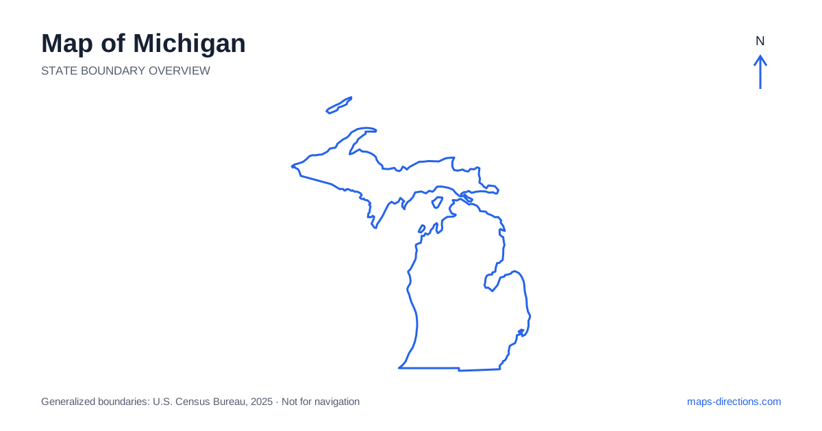
Michigan is divided into two large peninsulas surrounded by the Great Lakes. The Lower Peninsula contains Detroit, Grand Rapids and Lansing, while the Upper Peninsula stretches westward between major lake shores. The Mackinac Bridge joins the two road networks at the Straits of Mackinac, making that crossing a central feature of any statewide driving plan. Begin by identifying the correct peninsula and coastline. A destination on a lake can be in a completely different region from another place described by the same state name or broad northern-travel label.
Understand the water around the two land areas
Lake Michigan lies west of the Lower Peninsula, Lake Huron to its east, and Lake Erie farther southeast near the Detroit region. Lake Superior borders the north of the Upper Peninsula. These large bodies of water shape the outline and separate nearby-looking shores that cannot be connected by an ordinary direct road journey.
A Great Lakes overview may show cities on opposite sides of a lake within the same frame, but a driving route must follow land connections and appropriate bridges. Any ferry segment is a distinct transport choice that needs its own arrangements. Keep this difference explicit when comparing routes into the state. The outline is excellent for identifying shorelines, but it does not establish a short road connection across the blue space between them.
Place the southeastern cities and the capital
Detroit sits along the river corridor connecting the lower Great Lakes and forms part of a large metropolitan area. Ann Arbor lies farther west, while Lansing, the state capital, sits inland toward the center of the Lower Peninsula. These are separate urban destinations, each with its own approaches and local road network. A general southeastern-region label does not identify the final arrival point.
Interstate 94 connects the Detroit area with Ann Arbor and the southwestern corridor, while Interstate 96 links the southeastern region with Lansing and Grand Rapids. Interstate 75 provides another major route northward. Choose the corridor according to the actual destination sequence. A hotel near an airport or interchange may serve a transfer well while being poorly positioned for a visit to a different part of the metropolitan area.
Read the western shore as a chain of local regions
Along western Michigan, towns and cities face a long shoreline broken by river mouths, dunes and smaller inland lakes. Grand Rapids is an inland urban anchor, while places such as Holland and Muskegon relate more directly to the lakeshore. A destination described as being near the beach may still require a separate drive from the city associated with its address.
US 31 is an important route for understanding parts of this western corridor, but it does not trace every waterfront street. Mark the actual beach entrance, harbor or accommodation before choosing the approach. Rivers and local lakes can divide nearby neighborhoods, and a road ending near the water may require backtracking. A northbound coastal itinerary works best as a sequence of specific town clusters rather than an assumed continuous scenic drive beside the lake.
Give the northern Lower Peninsula its own scale
Traverse City and the surrounding bay country occupy the northwestern part of the Lower Peninsula, while other northern destinations sit toward the Lake Huron side. The inland forests, lakes and smaller towns between these coasts create their own travel pattern. A map that uses one broad northern label can conceal how far apart the two shores and their main access corridors are.
For a lakeside stay, identify the particular bay, peninsula or shore. A short water crossing on the overview may become a longer drive around an inlet. This is also relevant near the straits, where the mainland towns, bridge approaches and island departure points have different roles. Select the exact terminal or road destination instead of treating every place near the crossing as the same arrival area.
Treat the Upper Peninsula as a substantial region
The Upper Peninsula of Michigan is not a small appendage to a Lower Peninsula road trip. Sault Ste. Marie anchors the eastern end, Marquette lies along the northern shore farther west, and the Keweenaw Peninsula extends into Lake Superior beyond the central region. Escanaba occupies a southern-shore position, illustrating how destinations within the same peninsula can face different lakes and corridors.
Road routes across this region deserve their own overnight plan. A scenic destination along the northern coast may require leaving the main east-to-west connection for a separate approach. Islands, including remote park destinations, need transport planning beyond the road map. Choose the actual visitor area or harbor rather than a pin in the center of a broad protected landscape, and distinguish the regional transfer from the final local access.
Build the itinerary around peninsulas and shores
A southeastern city visit, a western-shore journey, a northern Lower Peninsula stay and an Upper Peninsula circuit each form a coherent starting plan. Combining them can create an extensive route, especially when the bridge crossing and travel beyond it are included honestly. Avoid arranging distant lakefront stops merely because they share a similar description.
For a Michigan map to guide a practical journey, keep the named lake, peninsula and arrival point attached to every stop. Use the statewide outline to establish the correct region, then a closer view to locate the bridge, bay road or terminal. That preserves the distinctive two-peninsula geography and prevents the surrounding water from making distant road destinations appear misleadingly close.