Map of Miami Gardens
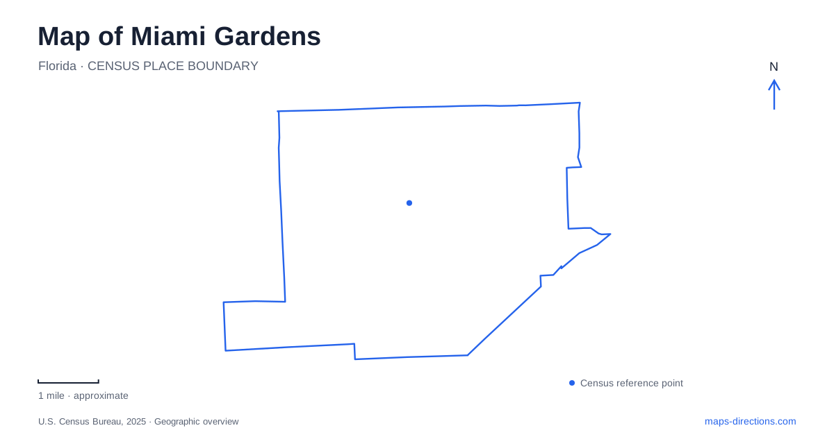
Street tiles load from OpenStreetMap when opened. The blue line shows the 2025 Census boundary.
- State
- Florida
- Population · July 2025
- 113,579
- Land area
- 18.5 sq mi
- Water area
- 0.8 sq mi
Miami Gardens occupies an inland part of north-central Miami-Dade County, between the broader urban centers of Miami and Fort Lauderdale. Its numbered streets connect university campuses, civic offices, residential parks, and the large Hard Rock Stadium grounds. The city incorporated on May 13, 2003, but several institutions within it have much longer histories. A useful map therefore shows both the modern municipal area and the individual destinations that established themselves before incorporation.
Finding the city's frame
The municipality's published boundary description uses 151st Street on the south and Countyline Road on the north. Its eastern limits follow North Miami Avenue and Northeast 2nd Avenue in different sections, while Northwest 47th and Northwest 57th avenues help describe the western side. These are broad orientation references; the boundary is more irregular than a simple rectangle between four roads.
Regional access comes through Interstate 95, the Palmetto Expressway, and Florida's Turnpike. The city identifies the Palmetto corridor with furniture businesses and US 441 with the automobile trade. That commercial geography helps explain why a shopping trip may lead toward a highway corridor instead of a traditional downtown square. For municipal business, City Hall is at 18605 NW 27th Avenue, giving the map a separate civic anchor among those larger roads.
Reading the stadium at the scale of its grounds
Hard Rock Stadium is a major destination within Miami Gardens, but its grounds contain a network of lots, gates, and pedestrian approaches. The stadium's official parking map asks visitors to choose whether they are entering or leaving and to select a gate number. This is more specific than simply routing to the stadium name.
The map distinguishes Orange, Yellow, and Gray parking areas, along with accessible parking, rideshare, taxi, and shuttle arrangements. Those categories explain why two parties attending the same event may need different approaches. The practical unit of navigation is the assigned parking or drop-off area, followed by the relevant pedestrian gate. A broad city map is useful for choosing the regional approach, while the event's own map supplies the final circulation pattern within this unusually large destination.
This stadium landscape is also distinct from municipal recreation facilities. A field, pool, or community program elsewhere in the city does not share the stadium's event access system. Locating those everyday facilities separately reveals more of Miami Gardens than its best-known venue alone.
Recreation along NW 199th and NW 183rd streets
The Betty T. Ferguson Recreational Complex stands at 3000 NW 199th Street. Its facilities combine indoor and outdoor uses: an auditorium, dance studio, basketball gym, indoor swimming pool, track, stadium, and outdoor fitness court. That combination makes the complex a substantial community destination with several activities on one property. The pool and track are components of the same complex, even when a program listing emphasizes only one of them.
Farther east and south on the numbered grid, State Senator Oscar Braynon II Park at Rolling Oaks is listed at 1317 NW 183rd Street. Its longer official name and the familiar Rolling Oaks name refer to the same park. The current city directory identifies a community garden, walking trail, outdoor fitness area, putting green, pickleball and tennis courts, playgrounds, and a welcome center.
These two sites show different approaches to public recreation. The Ferguson complex groups large indoor facilities with athletic spaces, while Rolling Oaks combines outdoor courts, garden space, and a walking circuit. On a map of Miami Gardens, their street and avenue numbers provide a useful way to distinguish the destinations before examining their individual facility layouts.
Two universities on different avenues
Florida Memorial University occupies 15800 NW 42nd Avenue. Its history reaches back to an institution founded in Live Oak in 1879 and includes a period in St. Augustine. Trustees acquired a former airstrip near Opa-locka in 1965, and the new campus opened in 1968. The university's present setting consequently belongs to a longer history of relocation and Black higher education in Florida, rather than beginning with the municipality's creation.
St. Thomas University is at 16401 NW 37th Avenue. This Catholic institution maintains a separate campus with colleges devoted to fields including law, business, nursing, and the liberal arts. The two university addresses place them on different north–south avenues, a helpful distinction when arranging a campus visit or attending an academic event.
Together, these campuses add an educational dimension to Miami Gardens' map. The university avenues, the NW 27th Avenue civic address, the recreation sites on NW 183rd and NW 199th streets, and the stadium's internal circulation form a set of concrete reference points for understanding the city beyond the regional expressways.
Map and statistics: U.S. Census Bureau, 2025 Gazetteer, January 2025 generalized place boundaries and Vintage 2025 population estimates. Local references: City of Miami Gardens; Hard Rock Stadium; Florida Memorial University; St. Thomas University. Article prepared by Maps & Directions.