Map of Miami Beach
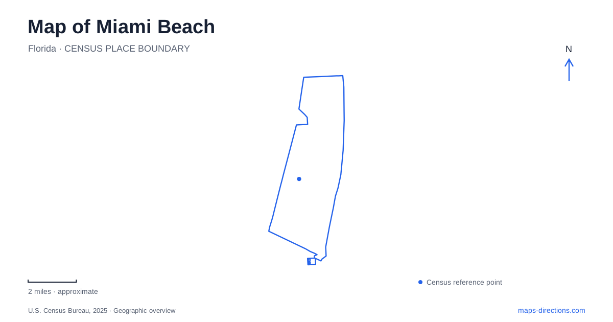
Street tiles load from OpenStreetMap when opened. The blue line shows the 2025 Census boundary.
- State
- Florida
- Population · July 2025
- 81,594
- Land area
- 7.7 sq mi
- Water area
- 7.5 sq mi
Miami Beach has a long coastal shape, and its north–south sequence is more useful than treating every address as part of South Beach. The city distinguishes South Beach, Mid Beach, and North Beach. The oceanfront Beachwalk connects their coastal edges, while numbered cross streets identify particular sections of the shoreline. A good first reading places South Pointe at the southern end, the Ocean Drive park district farther north, and the northern oceanside park near the upper end of the city.
South Pointe and the shipping-channel edge
South Pointe Park is at 1 Washington Avenue. Its setting combines Atlantic beach access with views toward Government Cut, giving this southern park a relationship to both the open ocean and the channel used by vessels. That is a different waterfront experience from simply continuing along the middle of a long beachfront.
The municipal park directory lists a playground, seating, water features, and beach access. The park's location and amenities explain why it serves as a starting point for several kinds of outing. A visitor can focus on the open space, the shoreline, or the beginning of the coastal walking route without confusing those activities with a drive along Ocean Drive.
For a map of Miami Beach, South Pointe is a strong southern reference because it marks a recognizable end of the coastal sequence. Washington Avenue gives the street approach; the channel and ocean give the landscape orientation. Using both makes the place easier to understand than a general South Beach label.
Ocean Drive and the architectural district
Lummus Park occupies the strip between Ocean Drive and the Atlantic from 5th Street to 14th Place. The park therefore has considerable length and several cross-street references. A meeting near 6th Street is not the same as a gathering near 14th Street, even though both can accurately be described as being in the park.
The Art Deco Welcome Center stands at 1001 Ocean Drive, at the 10th Street area. Operated by the Miami Design Preservation League, it provides a concrete starting location for exploring the architectural district. The address places architectural interpretation alongside the beachfront park rather than in a distant museum district.
This pairing is a useful way to read Miami Beach at a smaller scale. Ocean Drive supplies the built frontage, while Lummus Park supplies the open coastal strip. Cross streets connect the two in short, identifiable sections. The park's municipal listing also places public restrooms around 6th, 10th, and 14th streets, reinforcing those numbers as practical orientation points rather than arbitrary labels.
The garden beside the convention district
The botanical garden is at 2000 Convention Center Drive. Its own visitor guide identifies an entry plaza at 19th Street and Convention Center Drive, while municipal planning material places Collins Canal and Dade Boulevard along the northern side of the garden setting. The convention center stands to the east and the Holocaust Memorial to the west.
Those relationships create a different kind of district from Ocean Drive. Here, a canal, civic-scale buildings, a memorial, and a planted garden form a compact cultural landscape inland from the beach. The garden's visitor entrance is also distinct from its loading gates, which its guide lists separately for 19th Street and the canal side.
A Miami Beach itinerary that includes the garden should therefore shift attention away from the oceanfront strip and toward Convention Center Drive. The location is part of a recognizable cluster with its own edges and neighboring landmarks. Keeping the canal visible helps explain the northern boundary of that cluster.
Following the coast toward North Beach
The city describes the Beachwalk as a nine-mile oceanfront promenade extending from South Pointe Park to 87th Street. Its modern paved form was completed in 2022, replacing and extending a route once associated with a wooden boardwalk between 23rd and 45th streets. The older boardwalk description covers only part of today's coastal connection.
At the northern end, North Beach Oceanside Park lies between Collins Avenue and the beach, with its main stretch extending from the upper 70s into the 80s streets. Municipal project mapping uses 79th and 87th streets as the outer reference lines. The park directory identifies pavilions, beach access, an interior walking path, and outdoor fitness stations around 82nd through 85th streets.
The interior park path and the Beachwalk are related but distinct routes. One threads through park facilities; the other continues along the coastal edge. Their parallel relationship is useful when deciding whether a walk is intended to remain within the park or continue along the wider shoreline.
Miami Beach becomes more legible through this sequence of distinct places: the channel-side southern park, the Ocean Drive and Lummus pairing, the canal-edge garden district, and the northern park beside the continuous Beachwalk. The named places explain the setting, while the numbered streets identify the specific section to explore.
Map and statistics: U.S. Census Bureau, 2025 Gazetteer, January 2025 generalized place boundaries and Vintage 2025 population estimates. Local references: City of Miami Beach; Miami Design Preservation League; Miami Beach Botanical Garden. Article prepared by Maps & Directions.