Map of Methuen
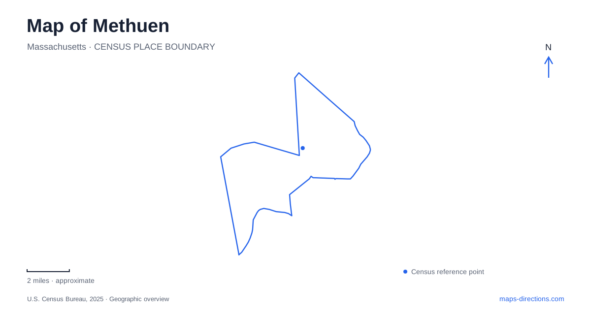
Street tiles load from OpenStreetMap when opened. The blue line shows the 2025 Census boundary.
- State
- Massachusetts
- Population · July 2025
- 54,584
- Land area
- 22.2 sq mi
- Water area
- 0.8 sq mi
Methuen's older center grew around the Spicket River rather than a perfectly regular downtown grid. Waterpower brought mills to the falls, and manufacturing concentrated activity near Osgood, Broadway, Hampshire, and Pleasant streets. Later gifts from the Nevins, Searles, and Tenney families added conspicuous cultural buildings and estate landscapes. A map of these streets consequently reveals both an industrial community and the architectural ambitions of its wealthiest residents, with public parks and trails providing another way to follow the river today.
Waterpower and the older center
The municipal history places the development of cotton mills at the falls in the 1820s, alongside hat and shoe manufacturing in smaller factories. This concentration helped draw economic and residential activity toward the river. The surviving street pattern is therefore tied to the locations of waterpower and industry, not simply to later automobile routes through the region.
The Spicket flows south from New Hampshire through the city and Lawrence before joining the Merrimack. At Lowell Street, the falls and dam mark an important industrial location. The municipal open-space plan distinguishes that feature from the ornamental dam beside the Broadway Searles Bridge. Both involve the same river, but they have different historical purposes. Identifying the particular bridge or street helps make sense of photographs and descriptions that otherwise refer only to a waterfall or riverside landmark.
Broadway's cultural landmarks
The Nevins Memorial Library at 305 Broadway is a major architectural reference in Methuen. Its construction began in 1883 as a memorial to David Nevins, commissioned by his family to fulfill his wish for a public library and hall. Architect Samuel J. F. Thayer designed it in the Romanesque Revival style. The building opened in 1885, with book circulation beginning later, in 1887.
The library's history connects directly with the textile economy: Nevins had purchased the manufacturing company on Osgood Street in 1864. That relationship helps explain why a substantial cultural institution stands within the older industrial center. The building is both a working library and a record of how private fortunes supported public facilities. Its Broadway address makes it a distinct stop from the former mills themselves, even though their histories are closely linked.
Farther along the same street, the Memorial Music Hall stands at 192 Broadway. It opened in 1909 as Serlo Organ Hall, built by Edward F. Searles to house the Great Organ. The instrument had originally been installed in Boston in 1863. The hall's identity is therefore inseparable from an object brought from another city, creating a specialized musical destination within the local street network.
Pleasant Street and the Tenney landscape
Pleasant Street adds another layer to Methuen's public architecture. The Searles building at 41 Pleasant began as a high school in 1904 and now accommodates City Hall. Its change of use is a clear example of a prominent educational building continuing to serve civic life. The historic survey records subsequent school and office uses before the municipality repurchased it in 1992.
Greycourt Park is also associated with Pleasant Street. It occupies part of the former Tenney estate, where the large Grey Court mansion no longer survives intact. The house burned in 1978 and was demolished in 1985; the gatehouse survived. This distinction is essential to understanding the landscape. A historic estate name on a map may lead to parkland and remnants rather than a complete mansion available for an interior visit.
Rail and river corridors for walking
The rail trail gives Methuen another route through its river landscape. The city's open-space plan records completion of the local trail in 2019 and describes improved access to the Spicket watershed, including the Nevins Bird Sanctuary and conservation viewing areas. The former railway corridor now serves a different purpose from the trains that once supported the industrial town.
Riverwalk Park on Osgood Street and Bicentennial Park on Broadway add smaller public spaces within the developed center. Their locations allow a visit focused on buildings to include the surrounding water and open space. The trail, riverside parks, library, and music hall are related by geography, but each offers a different encounter with the area: movement through the watershed, a neighborhood pause, public learning, or a scheduled performance.
Reading the historical layers together
A map of Methuen is most revealing when the river and the named streets remain visible together. Osgood and Lowell explain the industrial setting; Broadway connects substantial cultural landmarks; and Pleasant Street brings civic reuse and the former Tenney grounds into view. Following those relationships turns a collection of impressive buildings into a coherent account of how the community developed, while showing where today's public spaces fit within that inherited landscape.
Map and statistics: U.S. Census Bureau, 2025 Gazetteer, January 2025 generalized place boundaries and Vintage 2025 population estimates. Local references: City of Methuen; Nevins Memorial Library; Methuen Memorial Music Hall; Essex Heritage Trails and Sails; Methuen History. Article prepared by Maps & Directions.