Map of Mesquite
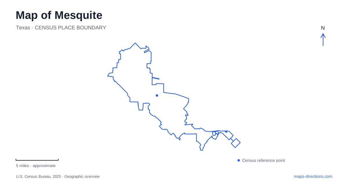
Street tiles load from OpenStreetMap when opened. The blue line shows the 2025 Census boundary.
- State
- Texas
- Population · July 2025
- 150,693
- Land area
- 49.1 sq mi
- Water area
- 0.2 sq mi
Mesquite's older center began as a railway town, but two surviving farmsteads show that its history also belongs to the agricultural landscape around the tracks. The relationship between Front Street and Main Street records changes in commercial life, while the Lawrence and Florence properties preserve different parts of domestic and farming history. A newer butterfly habitat at Paschall Park adds an ecological layer, using native prairie plants within an urban recreation setting. These places offer several distinct ways to understand the city.
Why the commercial streets face different directions
In May 1873, Texas and Pacific Railroad engineer A. R. Alcott platted a depot town here. Businesses initially faced Front Street, orienting themselves toward the railway economy. As the settlement grew, proprietors turned their entrances toward Main Street to help create a town square. That change gives the two streets a historical relationship that is easy to overlook on a basic road map.
Front Street Station, completed in 2021, returned attention to the earlier commercial edge through a public improvement project. Located north of Main Street, the project introduced a performance pavilion, space for vendors and events, lighting, landscaping and parking. Below ground, new infrastructure supported restaurant development. Its name belongs to a public gathering space and streetscape project, rather than identifying a passenger train station.
The downtown landscape of Mesquite therefore reflects both the original railway orientation and a later effort to make the district useful for community gatherings. Reading Front and Main streets together reveals that progression more clearly than viewing the square as an isolated landmark.
A farmstead assembled over several generations
Opal Lawrence Historical Park occupies thirteen acres at 711 East Kearney Street, near the historic downtown. Construction of the Lawrence house began with three rooms in 1874. Fourteen additional rooms followed in 1882, with the kitchen and belvedere tower added during subsequent years. Its size and form emerged through expansion rather than a single completed design.
The surrounding structures explain how the property functioned. A smokehouse, brick-lined root cellar, washhouse, livestock barn, mule barn and chicken coops supported food storage, household work and animal husbandry. These buildings make the park a farmstead complex, not simply a large historic residence with decorative grounds.
Family members lived there continuously until 1995. Opal Lawrence left the house and two acres to the city, which acquired eleven more acres to include the barns and other outbuildings. Preserving those surroundings retained the practical relationships between the house and the activities that sustained it. This is an important part of the agricultural history of Mesquite that the commercial streets alone cannot convey.
A separate ranch on Barnes Bridge Road
Florence Ranch Homestead, at 1424 Barnes Bridge Road, tells another family story. David and Julia Florence built the first portion of the house in 1871–1872, before the railway township was platted. The surviving museum occupies four acres, a small remnant of the much larger farming operation once associated with the family.
The frame house has a central chimney, a front gallery and rooms added behind the original structure. Later dining and kitchen rooms were connected by a dogtrot, and the kitchen included an indoor well. These features show how a rural household adapted its building to work, climate and changing needs.
The next generation operated the property as Meadow View Farm, raising livestock and feed crops. Family descendants donated the homestead to the city in 1987. Unlike the Lawrence property's prominent tower and extensive outbuildings, this house presents a more compact expression of rural domestic architecture. Both sites enrich a map of Mesquite, but their separate addresses and histories deserve individual attention.
Prairie plants within a neighborhood park
Paschall Park's Butterfly Trail lies at 1001 New Market Road, across from the Travis Williams softball complex. A restoration unveiled in June 2025 added native Texas Blackland Prairie plants, educational signs, sculpture, butterfly benches, a mural and a refreshed pollinator garden. The project connects environmental education with an established public park rather than recreating a large rural farm.
The trail's planting explains relationships between nectar sources, host plants and butterfly habitat. Its Monarch Waystation certification recognizes that conservation purpose. New Market Road also locates the pavilion and broader park facilities, so the butterfly area can be understood as one component of a larger recreation destination.
These landscapes reveal how Mesquite developed through railway commerce, farm households and later public investment. The surviving street relationships, agricultural buildings and prairie planting provide concrete evidence of that evolution, giving each part of the map a different story to tell.
Map and statistics: U.S. Census Bureau, 2025 Gazetteer, January 2025 generalized place boundaries and Vintage 2025 population estimates. Local references: City of Mesquite / Historic Mesquite Inc.; City of Mesquite. Article prepared by Maps & Directions.