Map of Mesa
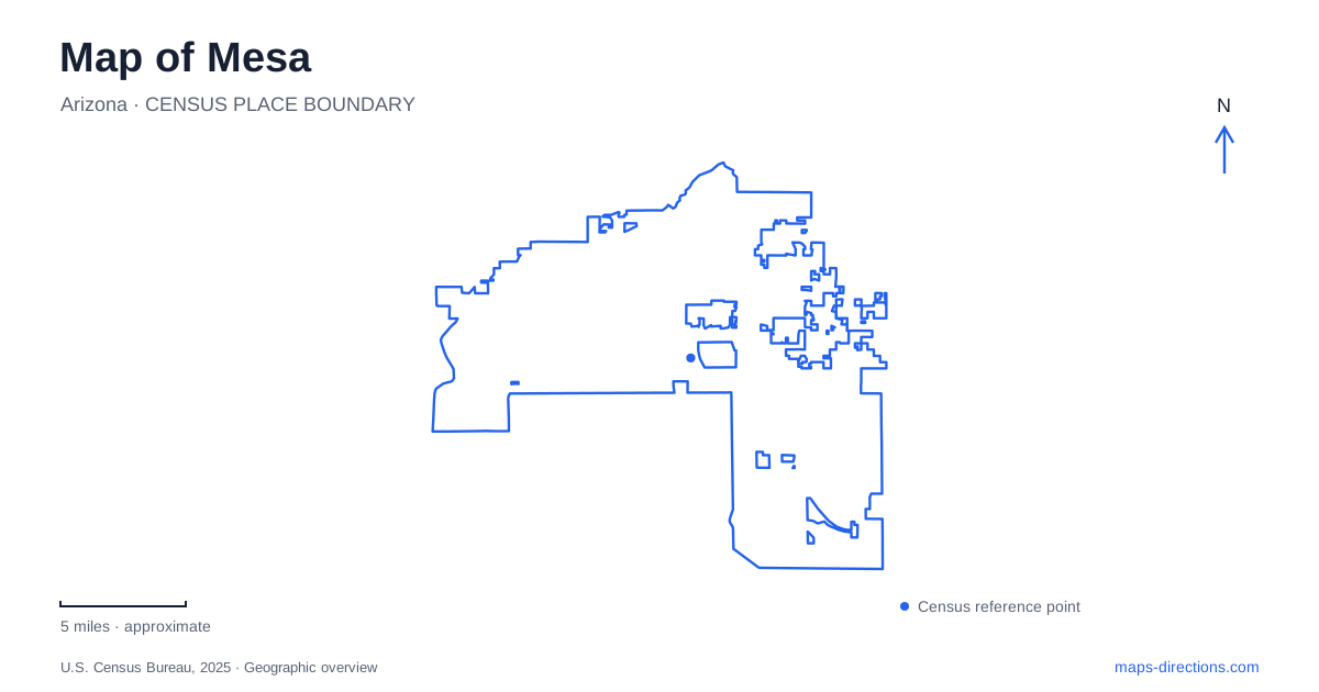
Street tiles load from OpenStreetMap when opened. The blue line shows the 2025 Census boundary.
- State
- Arizona
- Population · July 2025
- 513,656
- Land area
- 142.0 sq mi
- Water area
- 0.6 sq mi
Mesa's geography connects a planned urban center with a much older irrigation landscape and the desert mountains to the east. Main Street supplies a useful downtown reference, while canals reveal another network that does not always follow the surrounding roads. Beyond the developed blocks, Usery Mountain Regional Park introduces trails, washes, and mountain slopes. Reading these features together explains the city more clearly than treating it as an undifferentiated part of the metropolitan area.
Main and Center form a concrete downtown reference
Mesa Arts Center stands at the southeast corner of Main Street and Center Street. Its site map shows Main to the north, Center to the west, Sirrine Street to the east, and First Avenue to the south. These four streets create a useful frame for understanding the campus and its place in the downtown blocks.
Within that frame are separate theaters, studios, museum spaces, lobbies, and the Shadow Walk. The Ikeda Theater, Piper Theater, Farnsworth Studio, and Nesbitt-Elliott Playhouse are different performance spaces within the same complex. A ticket naming one of them identifies a more precise destination than the campus name alone.
The city treats Central Main Street as a corridor for development around light rail. Its area plan connects the transit investment with a more concentrated mix of uses while also addressing the adjoining neighborhoods. This relationship is visible on a map: a linear transportation corridor runs through a broader residential and commercial area, rather than replacing that area's street network.
Irrigation is part of the settlement pattern
The city's history records that settlers arriving in 1878 reused part of an abandoned Hohokam canal for their first irrigation project, the Mesa Canal. Land allocations were related to the labor families contributed to building the irrigation system. Water infrastructure was therefore fundamental to settlement, not a feature added after the streets and homes were established.
That history gives canal lines on a modern map particular significance. They show a working landscape shaped by the need to move water through an arid region. The city's canal mapping identifies separate owners and maintenance providers, including the Salt River Project and Roosevelt Water Conservation District. A visible water corridor is not automatically one continuous public trail or a city street.
The useful map distinction is between the canal itself, nearby roads, and any designated path. Each can follow a different alignment or have a different access arrangement. Keeping those layers separate preserves the connection between the city's irrigation history and its present geography.
Park of the Canals makes the earlier landscape visible
Park of the Canals is at 1710 North Horne. The city lists a botanical garden, shaded garden areas, picnic facilities, and an unpaved walking path within the 31-acre park. Its location gives visitors a specific place to explore the landscape associated with the historic canal system.
The park's preservation history is also part of the city's own account: it became a municipal park in 1977 after work by the local historical society. On a Mesa itinerary, this creates a different experience from the Main Street cultural campus. One setting concentrates contemporary performance and art facilities; the other interprets the land and water systems that supported settlement.
A detailed park map is useful here because the garden, paths, and historic features belong to different parts of the grounds. The street address identifies the park, while its internal layout explains how to move through the site.
Usery changes the map from blocks to terrain
Usery Mountain Regional Park lies at the western end of the Goldfield Mountains, adjacent to Tonto National Forest. Its main address is on North Usery Pass Road. The county map distinguishes the entrance road, nature center, campgrounds, picnic areas, and trailhead staging area from the surrounding trail network.
The trails offer different relationships to the terrain. Merkle Trail circles a small mountain, while Wind Cave Trail climbs toward an alcove on Pass Mountain. The county describes the cave as forming at the boundary between volcanic tuff and granite, with seepage supporting plants beneath its roof. That geological detail explains the destination more accurately than imagining an underground cavern.
Pass Mountain, Wind Cave, and the lower trails are therefore separate route choices within one park. A terrain map reveals their shapes and connections; the city road map explains only the approach. For Mesa, that shift in scale is central to understanding the eastern outdoor destinations: the familiar street network gives way to washes, slopes, and named trail junctions.
Map and statistics: U.S. Census Bureau, 2025 Gazetteer, January 2025 generalized place boundaries and Vintage 2025 population estimates. Local references: Mesa Arts Center; City of Mesa; Maricopa County Parks. Article prepared by Maps & Directions.