Map of Memphis
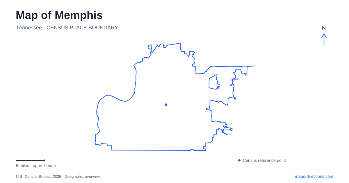
Street tiles load from OpenStreetMap when opened. The blue line shows the 2025 Census boundary.
- State
- Tennessee
- Population · July 2025
- 609,647
- Land area
- 289.8 sq mi
- Water area
- 8.9 sq mi
Memphis has several distinct geographic centers of interest rather than one continuous visitor district. The Mississippi River establishes the western edge of the downtown landscape. South Main extends the historic urban experience inland from that waterfront, while Midtown contains its own sequence of neighborhoods and parks. Reading these areas as connected but separate places helps explain a route before individual attractions are added. It also prevents a riverfront visit from becoming confused with a journey across the broader city.
The bluff and the river are different levels
Tom Lee Park occupies a 31-acre riverfront landscape. Its paths connect gardens, a playground, public art, and the large Sunset Canopy gathering space. The park's name commemorates Tom Lee's rescue of 32 people after the steamer M.E. Norman capsized in 1925. That historical association ties the park directly to the river rather than simply supplying a decorative name.
The Carlisle Cutbank Bluff connection is especially useful for understanding the park's setting. It joins downtown with the riverfront across the change in elevation. On a flat map, the park and nearby streets may appear to be side by side; the bluff explains why the designed connection matters. A route down to the water is also a route between levels of the urban landscape.
The wider river-park network includes River Garden, Fourth Bluff, Martyrs Park, and other public spaces linked by the Riverline walking and cycling route. A Memphis waterfront map should retain the names of those individual parks. They represent different settings along the same larger corridor, with separate landmarks useful for meeting points or for choosing a shorter segment.
Mud Island introduces another kind of river map
Mud Island River Park contains a scale model of the Mississippi, a large Southfield, and a grove of trees. The model offers an unusual geographic experience: the river becomes something that can be followed at a smaller scale while the actual waterway remains nearby. It makes the distinction between a map representation and the landscape itself particularly tangible.
The park's visitor information identifies a pedestrian walk bridge and parking both on the island and in the garage at Poplar and Front streets. These are different approaches to the same destination. For a map-based itinerary, it is useful to decide whether the visit begins on the downtown side or already on the island. That decision changes the first part of the route even when the final park destination remains identical.
Fourth Bluff Park, by comparison, provides views of Wolf River Harbor and the Hernando de Soto Bridge. Its outlook belongs to the mainland waterfront landscape. Keeping the harbor, the island park, and the main river visible together gives this part of Memphis a clearer shape than a single broad “riverfront” label.
South Main links a district to a specific historic site
The South Main Arts District begins just south of Beale Street. Its neighborhood scale is important: it is an area of streets, architecture, businesses, and historic places, rather than one arts building. The National Civil Rights Museum provides a precise reference within it at 450 Mulberry Street.
The museum incorporates the Lorraine Motel, where Martin Luther King Jr. was assassinated in 1968. The motel also has an earlier history as lodging for Black travelers during segregation. Its physical location therefore matters to the interpretation of the site; the museum is not simply displaying that history in an unrelated building.
Mulberry Street and G.E. Patterson Avenue give the visit a practical street framework. The museum directs drivers to its visitor lot from G.E. Patterson by turning north on Mulberry. For Memphis visitors combining the district with the waterfront, those named streets help connect a broad neighborhood itinerary to a specific historic address.
Cooper Street ties together Midtown destinations
Midtown encompasses several separate districts, including Cooper-Young, Overton Square, Broad Avenue, and Crosstown. Overton Square is a multi-block performing arts and entertainment area around Madison Avenue. Cooper Street provides a useful north–south reference: Cooper-Young lies south of the square, and Overton Park lies to its north.
This sequence makes the similar Overton names easier to distinguish. The square is an urban entertainment district; the park is a much larger green landscape. A theater address on Madison and a trail destination in the park require different local maps even though they belong to the same general part of the city.
The Old Forest has its own internal geography
Within Overton Park, the Old Forest preserves an ecosystem that predates the surrounding development. The conservancy describes a remaining 142-acre forest, with 126 acres protected as a state natural area in 2011. Its interpretive loop uses numbered markers to connect the trail with information about the woodland.
Those markers give a forest walk a different organizing system from the street names used in South Main or Midtown. A map of Memphis can show all these places together, but each becomes clearer at the right level of detail: river-park connections, named urban blocks, or a marked woodland loop. The city's variety is geographic as well as cultural, and its maps are most useful when that variety remains visible.
Map and statistics: U.S. Census Bureau, 2025 Gazetteer, January 2025 generalized place boundaries and Vintage 2025 population estimates. Local references: Memphis River Parks; Memphis Tourism; National Civil Rights Museum; Overton Park Conservancy. Article prepared by Maps & Directions.