Map of Melbourne
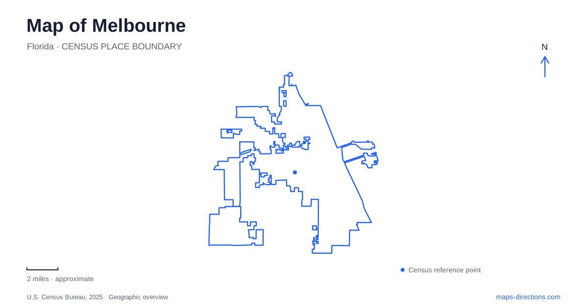
Street tiles load from OpenStreetMap when opened. The blue line shows the 2025 Census boundary.
- State
- Florida
- Population · July 2025
- 87,097
- Land area
- 44.2 sq mi
- Water area
- 5.8 sq mi
Melbourne, Florida has two historic downtown landscapes because its present boundaries brought together two formerly separate cities. Eau Gallie retained its name and recognizable riverfront district after the 1969 merger, while the older downtown farther south remains closely associated with Crane Creek. Both face the broader Indian River Lagoon setting, but they have different histories, buildings and public spaces. A map that preserves these two centers explains the city more clearly than one that treats every historic attraction as part of a single downtown.
Eau Gallie's identity survived the merger
The city's account of the Olde Eau Gallie Riverfront redevelopment area records the voter-approved merger in 1969. The district's later improvements include Eau Gallie Square, a parking area on Highland Avenue, pier reconstruction, sidewalks and building-front grants. The Eau Gallie Arts District Main Street organization works within this setting, connecting cultural activity with the older commercial area.
Eau Gallie is therefore both a historical place-name and a continuing neighborhood identity within Melbourne. Its preservation does not mean that it remains a separate municipality. Reading the name at neighborhood scale helps resolve that apparent contradiction. The square, riverfront and commercial streets belong to a district with its own inherited center, while citywide services and boundaries reflect the later consolidation. This is one reason the area feels geographically distinct from the southern downtown even on a simple street map.
The Rossetter complex spans more than one property
The Rossetter House Museum comprises several historical components: the 1908 James Wadsworth Rossetter House and gardens, the 1901 Roesch House, and the Houston family cemetery established in 1865. The Rossetter family arrived in Eau Gallie in 1902. Their house is interpreted as it stood in 1908, preserving a particular period rather than presenting an undifferentiated collection of old buildings.
The cemetery is about half a block south of the main house. That short separation is useful to notice because the museum's historical story extends beyond one roof or garden boundary. The houses and burial ground represent overlapping family and community histories across a small part of Eau Gallie. A neighborhood map can make those relationships visible, while a single attraction pin tends to compress them. The dates also distinguish the older cemetery from the later domestic buildings associated with the museum.
Crane Creek links campus and downtown
Crane Creek runs through the southern part of the city and empties into the Indian River Lagoon. The city's coastal-resiliency plan identifies its passage through the Florida Institute of Technology campus and its relationship with public places near the lower creek. The Crane Creek Promenade is a downtown observation area beside the water, offering a different setting from the wider lagoon frontage.
Following the creek upstream provides a useful way to understand this part of Melbourne. The same waterway passes through a campus landscape before reaching the downtown waterfront. That does not establish a continuous public walking route along its entire length, but it does reveal an environmental connection between places otherwise encountered through separate street addresses. The creek's course helps explain why planted gardens, developed blocks and waterfront recreation can appear within a relatively compact southern district.
A botanical garden occupies a natural hammock
Florida Tech's Joy and Gordon Patterson Botanical Garden covers 15 acres within the campus. Its purpose includes preserving a natural hammock while supporting observation, education and quiet use. The university's walking-tour guide describes the descent into the floodplain of Crane Creek, giving the garden a clear topographic setting rather than treating it solely as a collection of plants.
The Little Red Schoolhouse stands at the garden entrance after relocation to the campus in 1970. That move gives the garden a second kind of historical interest. The natural landscape remains associated with the creek, while the schoolhouse arrived through a preservation decision. It should not be used as evidence that the present campus was the building's original setting. Together, the garden and relocated school show two different ways of preserving local heritage: protecting an environment and moving a threatened structure into a new public context.
Green Gables faces the lagoon
Green Gables stands at 1501 South Harbor City Boulevard, beside the Indian River Lagoon and just south of Hibiscus Boulevard. The preservation organization dates the house to 1896 and connects it with the Wells family. Its grounds and historic building add a domestic waterfront landscape to Melbourne's map, distinct from both the Rossetter complex and the creek-side campus garden.
The site also demonstrates why street frontage and waterfront orientation are different pieces of information. Harbor City Boulevard identifies the road approach, while the lagoon explains the house's broader setting. When the two historic downtowns, Crane Creek and the separate house museums are read together, Melbourne emerges as a city assembled from connected but distinct places. The most useful map keeps those inherited identities visible while showing how they now fit within one municipality.
Map and statistics: U.S. Census Bureau, 2025 Gazetteer, January 2025 generalized place boundaries and Vintage 2025 population estimates. Local references: City of Melbourne; Rossetter House Museum; Space Coast Office of Tourism; Florida Institute of Technology; Green Gables at Historic Riverview Village. Article prepared by Maps & Directions.