Map of Marysville
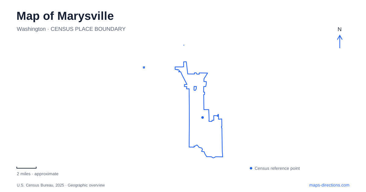
Street tiles load from OpenStreetMap when opened. The blue line shows the 2025 Census boundary.
- State
- Washington
- Population · July 2025
- 77,686
- Land area
- 20.8 sq mi
- Water area
- 0.3 sq mi
Marysville's waterfront belongs to a delta landscape of sloughs, tidal wetlands, and river channels. That setting is easy to overlook when approaching through the commercial roads farther inland. Downtown, the Ebey shoreline, the Allen Creek parks, and the northern athletic grounds each reveal a different part of the city. A useful map keeps these water systems and neighborhood destinations visible alongside the roads, rather than treating all green areas as interchangeable parks.
Downtown's streets and surviving water tower
Third Street and State Avenue form important references for the older shopping area. The Opera House at 1225 Third Street supplies a recognizable cultural destination within those blocks, while Comeford Park combines recreation and civic space nearby. Its historic water tower makes the park particularly easy to identify in photographs and on the ground.
The historical society records that the tower's 50,000-gallon tank first filled in 1921 as part of a new municipal water system. A later tower served the growing southern area but was removed in 1987. The surviving Comeford structure no longer functions in the water network; community preservation retained it as a landmark. That distinction turns a familiar skyline feature into evidence of how Marysville's infrastructure developed.
Around the tower, Comeford Park includes a playground, picnic space, spray park, and Delta Plaza event seating beside the Civic Center grounds. The combination creates a public gathering place within the downtown street pattern. It is a different environment from the broader wetland views found only a short distance away along the slough.
Ebey Slough and the restored estuary
Ebey Waterfront Park provides access to the Snohomish River Delta through its boat launch and shoreline trail. The city's cycling guide describes the route from the launch near State Avenue and First Street as an out-and-back journey of about 2.9 miles. It follows the waterfront toward an overlook, with interpretation explaining the Qwuloolt restoration along the way.
Qwuloolt is central to understanding this side of Marysville. The Tulalip Tribes and project partners restored tidal processes to land that had been separated from the estuary. The restoration work included opening the Ebey Slough levee, reshaping channels, and reconnecting stream habitat. The city dates the restored tidal landscape to 2015. What appears on a map as an expanse of water and vegetation is therefore also the result of a substantial ecological restoration effort.
The trail gives a land-based view of this changing environment, while the launch serves people entering the waterways. Those are different ways of experiencing the same delta. The broad channels, wetland margins, and mountain views distinguish the waterfront from a conventional inland lake park. Herons and other wildlife are part of the habitat, and the interpretive signs help relate what is visible to the restoration process.
Allen Creek and the Jennings parks
Jennings Memorial Park and Jennings Nature Park introduce a second water-centered landscape within Marysville. Their trails and green spaces follow the Allen Creek environment, combining wooded and wetland areas with more developed recreation grounds. The Gehl House Museum, barn, fishing pond, gardens, and playgrounds add several layers of activity to the park setting.
The red barn at 6915 Armar Road is a useful landmark for the memorial park. Nearby picnic shelters include the Lions Pavilion beside the pond and a barbecue shelter by the sports courts. These named features help explain the layout more clearly than a single park marker: the pond, event building, play areas, and nature trails each occupy their own setting.
The city's attraction guide identifies a 3.4-mile Jennings Loop Walk as another way of exploring the area. A visitor can therefore focus on the developed park grounds or choose a broader walk linking the surrounding landscape. The gardens and museum introduce cultivated and historical elements, while the creek corridor provides the natural continuity between them.
Northern fields and quieter eastern woods
Strawberry Fields Athletic Complex at 6100 152nd Street Northeast serves the northern part of the city. The 72-acre facility adjoins the Quilceda Creek system and combines soccer grounds with trails and picnic areas. The adjacent off-leash dog area, Strawberry Fields for Rover, provides a separate use within the same larger recreation setting.
The fields have also changed over time. A synthetic surface on Field 3 opened in June 2026, joining the first turf field completed in 2023. This detail matters when interpreting older facility descriptions that imply all the playing surfaces are natural grass. The numbered field and current site layout are more useful to a team visit than the complex name alone.
For a quieter landscape, Deering Wildflower Acres at 4708 79th Avenue Northeast preserves forest, ponds, and wetlands with walking trails. The city describes preservation in a natural state as a condition of the property's use. Together with the delta, Allen Creek grounds, and athletic complex, it shows how Marysville's parks reflect several different water systems and community needs across the city.
Map and statistics: U.S. Census Bureau, 2025 Gazetteer, January 2025 generalized place boundaries and Vintage 2025 population estimates. Local references: City of Marysville; Marysville Historical Society; Washington Recreation and Conservation Office / Tulalip Tribes. Article prepared by Maps & Directions.