Map of Maryland
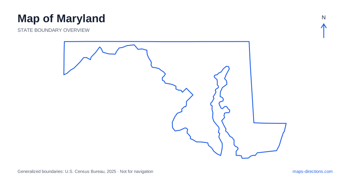
Maryland has a shape that demands more than one map scale. A narrow western section reaches into mountain country, a heavily connected central region surrounds major cities, and the Eastern Shore lies across Chesapeake Bay. Baltimore, Annapolis, Frederick, Cumberland and Salisbury orient these different areas. The bay is the central organizing feature: it separates places that may look close on an outline while concentrating road travel onto particular crossings. Begin by deciding which side of the water or which inland region contains the destination before choosing a route.
Put Chesapeake Bay at the center of the picture
Chesapeake Bay divides Maryland into broad western and eastern travel areas. Its tidal rivers and inlets create further local divisions on both sides. A waterfront destination may be up a tributary rather than beside the open bay, and two towns described as being on the same shore can still require a substantial drive around intervening water.
The Chesapeake Bay Bridge carries an important road connection between the Annapolis area and the Eastern Shore. Locate that crossing when the itinerary moves between the two sides rather than drawing a direct line across the bay elsewhere. The wider Chesapeake region also extends beyond the state, so a regional view may be needed for journeys involving the lower bay. Keep the actual crossing and approach road explicit in the plan.
Distinguish Baltimore from Annapolis
Baltimore is the largest city and occupies a harbor setting connected to the Patapsco River and the upper bay. Its metropolitan area spreads well beyond the waterfront, meaning that an airport arrival, central-city visit and suburban destination may involve different sides of the road network. Use the exact address rather than assuming every Baltimore-area stay serves the same local trips.
Annapolis is the state capital and lies farther south near the Severn River and the bay. It is a separate city with its own approaches, waterfront streets and parking destinations. A visit to both cities can form a coherent regional plan, but the connecting drive should remain visible. Neither city's center is a substitute for a precise marina, event venue or accommodation entrance located elsewhere in the surrounding area.
Read the national-capital region beyond the boundary line
Central Maryland includes communities closely connected with Washington, D.C., such as Bethesda, Silver Spring and College Park. The district boundary is politically important but does not mark an abrupt end to the metropolitan landscape. A destination described by the wider capital region may lie on a different road corridor from the one suggested by a city-center pin.
The Capital Beltway and radial highways organize much of this area, while the Potomac River shapes connections toward Virginia. Identify the correct side of the region and any necessary crossing before choosing an approach. For a trip that later continues toward Frederick or the bay, an overnight location should support that next direction as well as the initial visit. Metropolitan proximity on a statewide map can conceal substantial local travel.
Follow the narrow western extension
Frederick marks a useful transition from the central urban corridor toward the western interior. Interstate 70 connects through this part of the state, while Interstate 68 serves the mountain corridor farther west through the Cumberland area. The outline narrows dramatically near Hancock, a feature that is easy to recognize on a boundary map but tells little about the surrounding ridges and valleys.
Western destinations such as Deep Creek Lake belong to a different landscape and travel pattern from the bay. Elevation and terrain influence the approach, and a lakeside address should be located on the correct shore or access road. Treat a western stay as a separate regional stage rather than an incidental detour from Baltimore or Annapolis. A terrain view helps explain why the roads do not simply follow the shortest line between labels.
Give the Eastern Shore its own road network
The Eastern Shore of Maryland occupies part of the Delmarva Peninsula, with towns and waterways organized differently from the central metropolitan region. Easton and Cambridge help locate the middle shore, while Salisbury is a major inland reference point farther south. Ocean City lies on the Atlantic side and should not be confused with a destination facing Chesapeake Bay.
A trip from the bay bridge toward an Atlantic beach crosses a regional landscape, not a single compact coastal district. Tidal rivers and inlets influence the final approaches to many shore towns. Mark the actual hotel, harbor or beach entrance before comparing routes. If the journey continues into Delaware or Virginia, keep the wider peninsula visible so that the state boundary does not hide the most relevant road connections.
Match overnight bases to the side of the water
The most useful first decision is whether the trip centers on the western mountains, the national-capital suburbs, Baltimore and Annapolis, or the Eastern Shore. Each can support a coherent set of nearby visits. Combining them requires deliberate transfers, especially when the route crosses the bay or passes through a large metropolitan area.
For a Maryland itinerary, locate the water crossing before the optional detour. Then keep a detailed arrival map for the correct riverbank, shoreline or urban district. A broad outline explains why the state has such a distinctive shape; a practical route depends on the bridges, valley corridors and local access roads inside it. Reading those two scales together prevents visually close destinations from being mistaken for straightforward neighbors.