Map of Marion
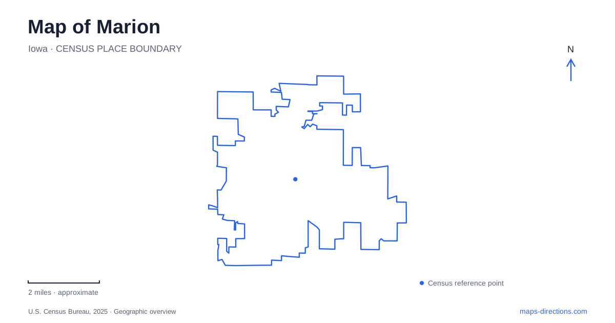
Street tiles load from OpenStreetMap when opened. The blue line shows the 2025 Census boundary.
- State
- Iowa
- Population · July 2025
- 42,732
- Land area
- 18.1 sq mi
- Water area
- 0.0 sq mi
Marion's map is shaped by the reuse of railway land as much as by the familiar numbered streets. Uptown surrounds City Square Park, while former rail alignments have become streets, trails, and pedestrian bridges. Indian Creek supplies another organizing line, linking parkland with the trail system. Farther north, Lowe Park expands the outdoor map into gardens, art, performance space, and sports fields. These places offer several ways to see how older infrastructure has been adapted for present-day community life.
Uptown's square and railway memory
City Square Park remains a useful anchor for the central district. The railway depot once stood near what are now 11th Street and Sixth Avenue, historically described as Broad and Meridian streets. Its distinctive roof was salvaged in 1988 and moved across to the park. The structure seen there is consequently a preserved piece of the railway story in a new setting, rather than evidence that trains once stopped at its exact present position.
That distinction makes the surrounding blocks easier to interpret. The railroad helped organize business and movement around Uptown Marion, while the park became a place to retain a visible reminder after railway functions changed. The numbered street grid still provides a straightforward reference system, but the old names explain historical descriptions that otherwise appear to point somewhere different. Sixth Avenue and 11th Street connect the modern map with the former depot location.
A rail corridor becomes a street
The Central Corridor project gave former railroad right-of-way another purpose. The city celebrated a major portion of Sixth Avenue's reconstruction in 2021, describing it as a way to balance traffic between Sixth and Seventh avenues. Land once associated with warehouses and industry was repositioned for a broader mix of uses. This change is central to understanding why an old transport corridor now reads as part of the everyday street network.
For a walk through the center, the two avenues frame different experiences. Seventh Avenue connects with the commercial and public-art setting of Uptown, while Sixth reflects the conversion of a former rail space into a civic street. The point is not simply that the tracks disappeared. Their former alignment continued to influence how new development and movement were arranged around the older blocks.
Art in the space behind the storefronts
The Uptown Artway turns an alley between Seventh and Eighth avenues, in the block between 10th and 11th streets, into a pedestrian destination. Permanent art installations, a small performance setting, and access to patios give the backs of commercial buildings a public role. The original project opened in 2017, adding a route through the interior of the block rather than another attraction on its outer street frontage.
This is a particularly useful detail on a map of Marion because the most interesting walking route need not follow only the main sidewalks. The Artway's location explains how public space can occupy a narrow service corridor and still connect several destinations. Nearby, the Heritage Center and Museum at 590 10th Street supplies a place to investigate the area's history through collections, photographs, and archival material.
Bridges across the creek and boulevard
The reconstructed former Milwaukee Road bridge over Indian Creek reopened as part of the trail network in 2021. Originally built in 1915, it retained its girders while receiving new piers and paving. Its new use allows walkers and cyclists to experience a piece of railway infrastructure from the deck itself. Thomas Park, at 343 Marion Boulevard, was identified by the city as an approach for people reaching the bridge on foot or by bicycle.
A separate trail bridge crosses the boulevard. Opened in 2022 and subsequently completed with illuminated artistic columns, it provides a crossing separated from road traffic. These are two different structures: one spans Indian Creek, while the other crosses a busy road. Together they help connect the Grant Wood and CeMar trail systems. The distinction clarifies both the creek geography and the sequence of former railway features entering Uptown.
Lowe Park's arts and sports landscapes
Lowe Park covers 180 acres, with its eastern arts-and-gardens area reached from 4500 North 10th Street. The Arts and Environment Center, demonstration gardens, community garden plots, and Klopfenstein Amphitheater cluster on this side. The amphitheater's sculptured Corten-steel canopy resembles an oak leaf, giving a performance venue a form tied to the park landscape.
The western portion, approached from 4901 Alburnett Road, contains the baseball and softball diamonds. Irish Drive provides another entrance, with access to an inclusive playground and walking trails joining the park's sections. This layout gives Marion a large park with complementary uses rather than one central activity zone. It also extends the local story of connections: the square preserves railway memory, the Artway links interior blocks, and the trail bridges and park paths create new ways through formerly separate spaces.
Map and statistics: U.S. Census Bureau, 2025 Gazetteer, January 2025 generalized place boundaries and Vintage 2025 population estimates. Local references: City of Marion; Marion Historical Society. Article prepared by Maps & Directions.