Map of Marietta
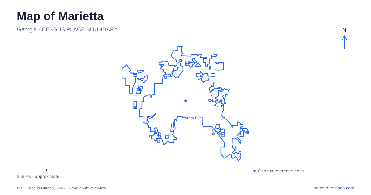
Street tiles load from OpenStreetMap when opened. The blue line shows the 2025 Census boundary.
- State
- Georgia
- Population · July 2025
- 63,574
- Land area
- 23.8 sq mi
- Water area
- 0.1 sq mi
Marietta has a recognizable center in its historic square, but the wider map also follows a railway legacy, several preserved street districts and a trail corridor toward Kennesaw Mountain. These features create a more useful geographic picture than the general label of an Atlanta-area suburb. Start with Glover Park and the surrounding downtown blocks, then follow the named streets and trail connections outward. The square, the historic neighborhoods and the national battlefield belong to related local stories, while remaining distinct places on the ground.
Glover Park gives the square its focus
Glover Park occupies the center of Marietta Square. The city describes a public setting with a gazebo, stage, three-tier fountain and a playground train, surrounded by restaurants, shops, museums and theatres. The arrangement places a landscaped gathering space inside the commercial center. It is both a landmark for orientation and a destination where markets, concerts and other community events take place.
That central open space helps organize a downtown walk. The park supplies a recognizable reference while the surrounding business frontages identify individual blocks. A route that circles the square experiences a different scale from one continuing toward the mountain or a residential historic district. Keeping the park visible in a close map makes it easier to understand how several downtown stops relate without reducing the whole center to one business address.
The railroad helped shape the commercial town
The city's historical account places an early courthouse square in the 1833 town plan and describes the Western and Atlantic Railroad's subsequent role in local growth. Stores, lodging and industry developed around the transport economy. This sequence matters when interpreting the center: the railway was part of the town's development, rather than an unrelated line added to an already complete suburban landscape.
The Marietta History Center occupies the historic Kennesaw House, connecting a present-day cultural destination with that earlier commercial setting. The city's account links the building, formerly the Fletcher House, to lodging and the events surrounding the Great Locomotive Chase. A history-focused map can therefore connect the square with a particular surviving building instead of treating local history as a list of events with no physical locations.
The broader history also includes the Cherokee communities and land from which Cobb County was formed. The modern street pattern should be understood as one layer of a landscape whose history predates the courthouse and railroad.
Historic districts extend the map beyond the square
The city's preservation directory distinguishes the downtown district, Church Cherokee Streets, Forest Hills and Kennesaw Avenue. These are separate mapped areas, not interchangeable names for the blocks surrounding Glover Park. Kennesaw Avenue was the first locally designated district, while Church Cherokee Streets received local designation in 2016. Their individual maps provide a finer view of the city's preserved fabric.
For a neighborhood walk, the street name is often a more useful organizing reference than a broad search for the historic district. Church and Cherokee identify one set of streets; Kennesaw Avenue identifies another corridor. The distinction allows the commercial square and surrounding residential settings to remain legible as different parts of the same town. Preservation boundaries describe specific mapped areas and should not be assumed to match every informal neighborhood label.
The Mountain to River Trail links several local settings
The municipality describes a three-and-a-half-mile portion of the Mountain to River Trail within Marietta, running from the mountain area toward Kennestone Hospital, the historic square, Brown Park and the City Cemetery. That sequence turns the trail into a useful local geography lesson. It links a mountain-facing setting, a major medical area, the commercial center and quieter public grounds.
The broader M2R identity reaches beyond the city and connects with regional trail planning. For a local outing, the named city segment is the clearest starting frame. It shows how downtown can be part of a longer walking or cycling route rather than the endpoint of every visit. Use the current trail map to identify the segment and crossings relevant to the intended journey, particularly when extending the trip into another jurisdiction.
The battlefield has several distinct destinations
Kennesaw Mountain National Battlefield Park is a separate landscape with its own visitor center, road system and trail map. The National Park Service lists the visitor center at 900 Kennesaw Mountain Drive and uses Barrett Parkway, Old Highway 41 and Stilesboro Road as approach references from Interstate 75. Those roads locate the visitor facilities more precisely than a broad mountain marker.
The park also distinguishes Pigeon Hill and Cheatham Hill from the visitor-center area. Their separate parking and interpretive locations show why a battlefield visit is not necessarily a single stop at the mountain's summit. The historic terrain extends across several places, and the route chosen depends on which part of that landscape a visitor wants to understand. Current mountain-road access arrangements should be checked with the park before planning to drive uphill.
A map of Marietta is most informative when it keeps these relationships visible: Glover Park within the square, the railway-era center, separately mapped historic streets, the M2R corridor and the wider battlefield landscape. Each adds a different scale and historical layer to the same regional setting.
Map and statistics: U.S. Census Bureau, 2025 Gazetteer, January 2025 generalized place boundaries and Vintage 2025 population estimates. Local references: City of Marietta; National Park Service. Article prepared by Maps & Directions.