Map of Marana
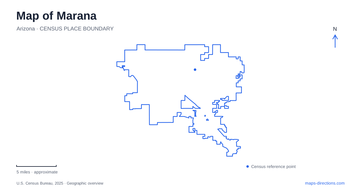
Street tiles load from OpenStreetMap when opened. The blue line shows the 2025 Census boundary.
- State
- Arizona
- Population · July 2025
- 65,523
- Land area
- 121.7 sq mi
- Water area
- 0.7 sq mi
Marana spans landscapes that call for different map scales. The Santa Cruz River corridor contains evidence of long-established settlement and farming, while the Tortolita foothills lead into a network of desert trails. Conservation projects protect both archaeological remains and habitat. Aviation adds another layer, with similarly associated airfields that began as separate parts of a wartime training system. These relationships give the town a geography more complex than a single suburban center.
Los Morteros preserves a settlement landscape
Los Morteros Conservation Area contains the remains of a Hohokam village, including a ballcourt, dwelling traces and communal features. Its name refers to mortar holes in rock used for processing plant foods. These features record everyday work and social activity as well as the larger organization of a settled community.
Pima County's interpretation describes farmers and artisans who developed irrigation and traded beyond the immediate region. The site also became a later stopping place associated with the Anza expedition and the Butterfield stage route. Those successive uses show why the Santa Cruz corridor remained important across different periods.
For a map of Marana, Los Morteros is therefore more than an isolated archaeological point. It helps explain a landscape of water, cultivation and movement. Interpretive paths provide a way to read the surviving features without mistaking the open ground for an empty area awaiting development.
El Rio combines engineering and habitat restoration
El Rio Preserve lies north of the county's Los Morteros property. Pima County identifies it as a 104-acre preserve, while town projects focus on restoring native vegetation and removing invasive plants. The conservation area occupies ground that previously included a gravel excavation associated with construction of Interstate 10.
That origin is important because the wetland setting did not remain untouched throughout the twentieth century. Its present ecological role developed through a sequence of disturbance, changing water conditions and deliberate restoration. The town's work with Tucson Audubon connects bird habitat with practical land management.
The preserve and the archaeological area form a useful pair on Marana's map, but they have distinct purposes. One protects and interprets evidence of earlier settlement; the other combines riparian habitat with restoration and bank-protection work. Their proximity reveals how cultural and environmental conservation can address neighboring parts of the same river corridor.
Heritage River Park keeps cultivation visible
Heritage River Park contains a community garden beside the Gladden Farms neighborhood. The town lists 40 garden plots, a display garden, a covered barn and access to the Santa Cruz shared-use path and the Anza national historic trail. Its address is 12375 North Heritage Park Drive.
The garden makes agricultural heritage tangible through continuing cultivation. Residents use small plots in a setting that also accommodates events and interpretation. This differs from both commercial farming and a museum where agriculture is represented only by stored equipment.
The park's trail connections also give it a role beyond its own grounds. A local recreation site intersects with a river route and a nationally recognized historical corridor. Marana's agricultural story can thus be read through both the planted spaces within the park and the broader network extending away from it.
Distinguishing the preserve from the mountain trails
Tortolita Preserve occupies about 2,400 acres on the gently sloping fan below the mountains. Its main loop is approximately nine miles, passing through Sonoran Desert vegetation that includes saguaros and ironwood trees. The preserve trailhead is at Moore Road and Wild Burro Road.
The Wild Burro Trailhead is a different access point, at 14810 North Secret Springs Drive. It serves the mountain trail system, where routes branch through canyons and higher terrain. The shared Tortolita name can obscure this distinction: the lower preserve and the mountain network offer different topographic settings.
On a trail map, contour lines and the chosen trailhead provide more useful information than the regional name alone. A loop across the foothill fan should not be interpreted as equivalent to a route climbing into the mountains. Both belong to the area's desert landscape, but elevation and route structure change the character of the ground.
Two airfields share a military connection
Marana Regional Airport began as an auxiliary Army airfield serving the larger wartime base that is now Pinal Airpark. It later became known as Avra Valley Airport. Town ownership began in 1999, followed by the present name in 2002.
This history explains why old references to the air base, the auxiliary field and the civilian airports can be confusing. They belong to a connected aviation story, but the regional airport and Pinal Airpark are separate sites. Reading their names alongside their physical locations prevents an old institutional label from collapsing two airfields into one.
Together, the river sites, garden park, desert preserves and airfields show successive decisions about where to settle, cultivate, travel and conserve. The town's map preserves those decisions at several scales, from mortar holes in bedrock to a mountain trail network and the long geometry of a runway.
Map and statistics: U.S. Census Bureau, 2025 Gazetteer, January 2025 generalized place boundaries and Vintage 2025 population estimates. Local references: Discover Marana; Pima County; Coalition for Sonoran Desert Protection; Town of Marana. Article prepared by Maps & Directions.