Map of Manteca
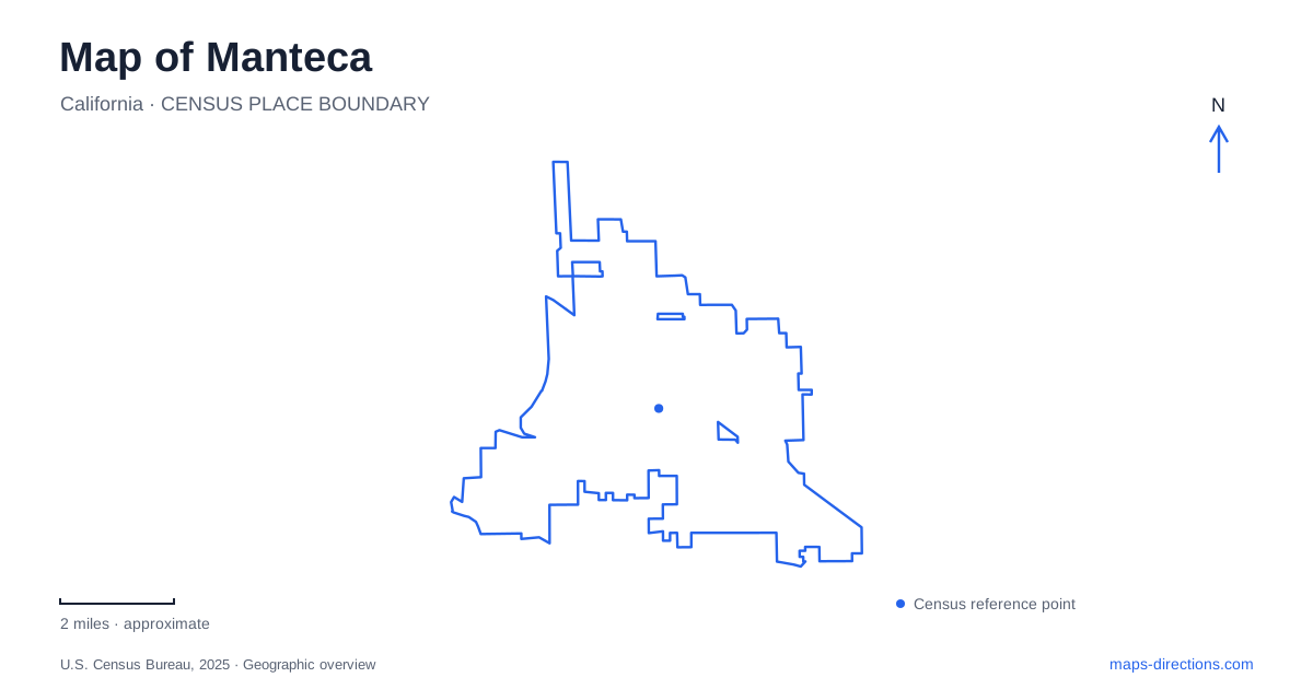
Street tiles load from OpenStreetMap when opened. The blue line shows the 2025 Census boundary.
- State
- California
- Population · July 2025
- 96,693
- Land area
- 22.1 sq mi
- Water area
- 0.0 sq mi
Manteca can be read through two kinds of routes: the streets that gather local history and the paths that reveal its outdoor spaces. Yosemite Avenue carries a museum and several major murals, while the Tidewater Bikeway passes through downtown and residential neighborhoods. Farther south, Woodward Park provides large recreation grounds, and Austin Road continues toward the Stanislaus River landscape outside the city. Together, these places offer a more specific introduction than the freeway junctions alone.
A painted intersection introduces downtown
At Yosemite Avenue and Main Street, D.S. Gordon's Crossroads mural depicts the same intersection around the city's incorporation in 1918. Located on the building at 110 West Yosemite Avenue, it was dedicated in 2003. The subject makes the artwork unusually useful for orientation: visitors can compare a painted historical street scene with the intersection where they are standing.
Other works along the corridor develop different themes. Cow-munity Mural at 234 West Yosemite Avenue recalls dairy farming, while Sierra's Crown at 226 East Yosemite Avenue presents a Yosemite Valley scene. The latter belongs to a mural-and-plaza setting associated with the American Legion property. The street therefore brings together local agricultural history, regional landscape imagery, and civic remembrance.
For a walking visit to Manteca, these named works provide natural stopping points rather than a requirement to cover every mural in one circuit. Library Park adds another cluster of paintings, including a history sequence and Last at Bat, which recalls a former baseball sandlot. Art here is distributed through ordinary streets and public spaces, making the neighborhood itself part of the experience.
The museum gives objects a place beside the paintings
The historical museum at 600 West Yosemite Avenue complements the outdoor murals with artifacts, documents, and photographs. Its exhibits include railroading, agriculture, a 1927 La France fire engine, a Caterpillar tractor, and the Goodwin Ranch blacksmith shop. These subjects make the local economy and everyday work tangible at the scale of individual objects.
The historical society was chartered in 1990. Its collection also includes material connected with the Delicato winery and the sugar industry, showing that the agricultural story extends beyond crops in fields. Processing, transport, tools, and community services all appear in the museum's interpretation.
A museum visit can therefore deepen a mural walk without repeating it. Painted scenes establish broad themes in the streetscape; the indoor collection gives those themes material detail. West Yosemite Avenue is the common geographic thread between the two experiences.
The Tidewater route crosses the urban map
The Tidewater Bikeway supplies a different way to move through Manteca. City planning documents describe a separated bicycle and pedestrian route running from the Moffat Boulevard area toward Lathrop Road, passing downtown, Library Park, and residential neighborhoods. Its alignment links everyday destinations rather than circling a single recreation property.
The regional bikeway map distinguishes this off-road path from painted street lanes and routes shared with traffic. That distinction matters when extending a ride beyond the main corridor. Main Street, Union Road, Yosemite Avenue, and the freeway network provide larger orientation lines, but a cycling itinerary depends on the type of facility along each segment.
The trail's relationship with Library Park is particularly useful for combining movement and local history. A short downtown stop can sit within a longer walk or ride, while the surrounding neighborhood sections show another side of the city beyond the central commercial blocks.
Recreation grounds and river woodland have different settings
Woodward Community Park at 710 East Woodward Avenue is a major recreation destination in southern Manteca. The city's park inventory identifies lighted multi-use fields, youth soccer space, playgrounds, fitness equipment, picnic facilities, and open space. Its scale and collection of sports areas make it more suited to an organized game or broad family gathering than a quiet woodland walk.
For the latter, Caswell Memorial State Park lies outside the city near Ripon, at the southern end of Austin Road. The park protects riparian oak woodland along the Stanislaus River. Old valley oaks and habitat for the endangered riparian brush rabbit preserve a landscape that once covered a much larger portion of the Central Valley's river corridors.
The state describes a compacted-soil Loop Nature Trail connecting portions of several named paths, while riverbank access introduces steeper ground. Flood damage and debris can affect individual paths, so check the state park's trail guidance before relying on the mapped network as a continuous walk.
These outdoor destinations complete the map of Manteca with a useful contrast: the Tidewater route connects urban places, Woodward Park concentrates active recreation, and Caswell preserves river woodland beyond the city. Each supports a different kind of outing and deserves its own place in the plan.
Map and statistics: U.S. Census Bureau, 2025 Gazetteer, January 2025 generalized place boundaries and Vintage 2025 population estimates. Local references: Manteca Mural Society; Manteca Historical Society; City of Manteca; San Joaquin Council of Governments; California State Parks. Article prepared by Maps & Directions.